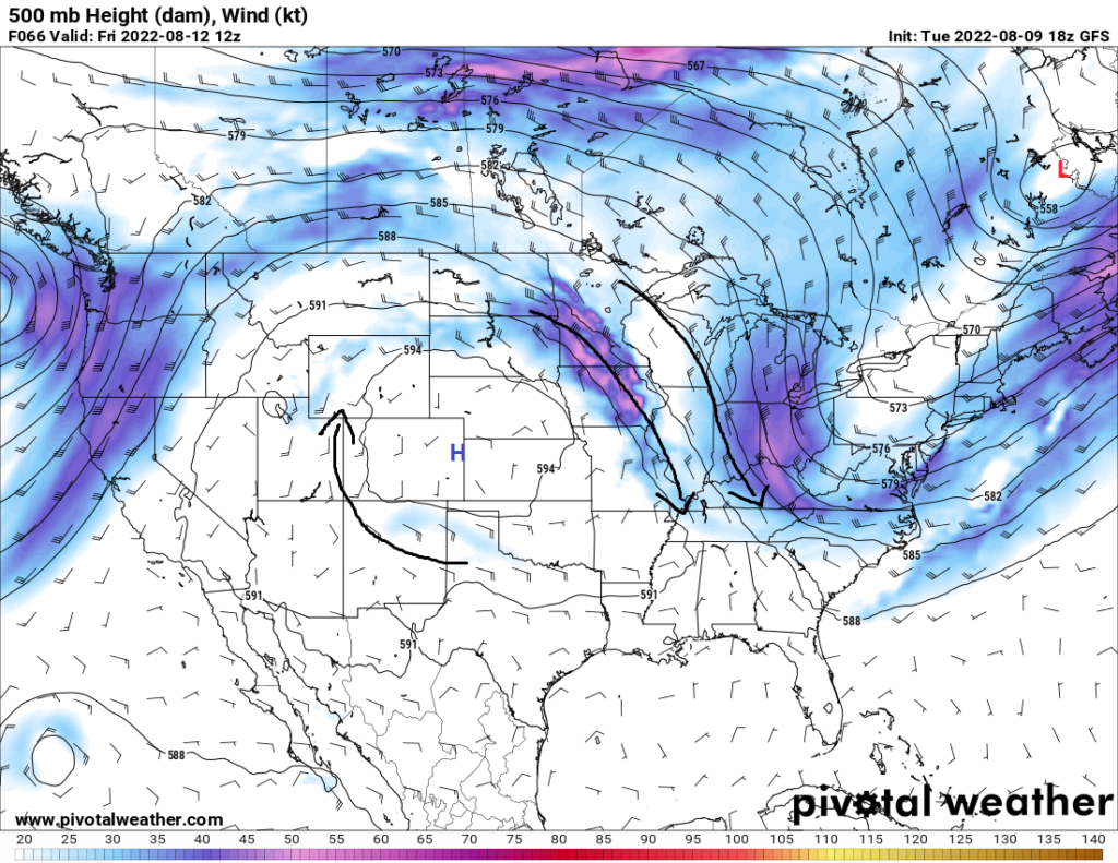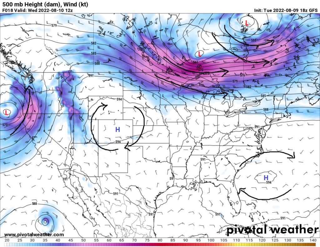
Finally, for what seems like forever up to this point, we don’t have high pressure dominating over much of the Southeast US (well, except for Texas. Sorry Texas.). The high pressure ridge will be moving off to the central and western US, leaving us under the influence of north-northwesterly flow aloft. What this means for us from a weather standpoint is an increased opportunity for weather systems to sweep in from the north and give us greater chances of rain and some relief from the summertime heat.
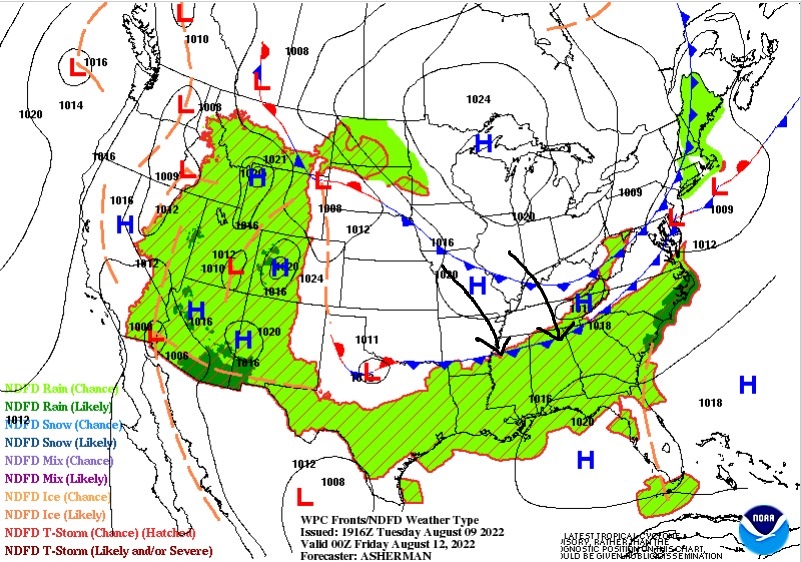
We should see the dome of high pressure begin to move off more to the west as early as today as a trough ejects eastward across the eastern seaboard. This will help to introduce northwesterly flow aloft and push in our next frontal system. Currently, a stationary front is situated across portions of Missouri, Arkansas, and Kentucky, which paired with gulf moisture advecting towards the front, has allowed and will continue to allow for scattered showers and thunderstorms across the northern southeast US. By Thursday evening, this front looks to transition to a cold front and begin to push its way south towards the coast. We can expect rain chances to increase for much of the southeast Thursday and Friday as the front advances. By Saturday, the eastern periphery of the cold front will stall over the gulf coast, while the western side of the front will transition into a warm front and lift back through Texas, Arkansas, and Louisiana.
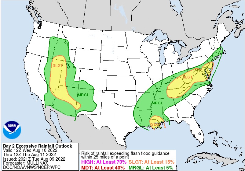
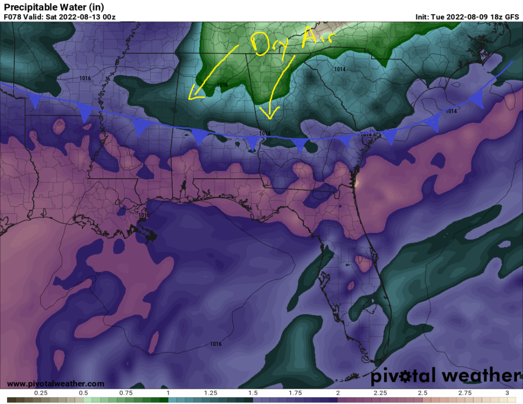
Heavy rainfall will be a concern in the near term for the Mississippi River Valley on up through the Ohio River Valley. Precipitable water values will hover around the vicinity of 1.75 inches to 2.5 inches for much of the southeast, which will allow for very efficient, if not torrential, rainfall with any strong thunderstorm in the area. As the cold front approaches later in the week, the threat for localized flash flooding will have to be monitored in front of the cold front with any storms that do form. Behind the front, dry air will fill in and bring down those chances for rain by this weekend. Further out west, we can expect continued tropical air to flow in over the area and help to maintain rain chances through the weekend and into next week. Region-wide, we can expect scattered thunderstorms to once again enter the picture as the front lifts back north by early next week.
Local 3 Day Weather Forecast (Courtesy: NWS)
| Dallas, TX | ||
| Wednesday | Thursday | Friday |
| High: 96°F | High: 97°F | High: 95°F |
| Low: 79°F | Low: 78°F | Low: 77°F |
| Precip: 30% | Precip: 30% | Precip: 20% |
| New Orleans, LA | ||
| Wednesday | Thursday | Friday |
| High: 88°F | High: 87°F | High: 87°F |
| Low: 77°F | Low: 76°F | Low: 75°F |
| Precip: 90% | Precip: 90% | Precip: 90% |
| Little Rock, AR | ||
| Wednesday | Thursday | Friday |
| High: 89°F | High: 87°F | High: 88°F |
| Low: 74°F | Low: 72°F | Low: 71°F |
| Precip: 50% | Precip: 30% | Precip: 20% |
| Memphis, TN | ||
| Wednesday | Thursday | Friday |
| High: 88°F | High: 88°F | High: 90°F |
| Low: 75°F | Low: 72°F | Low: 71°F |
| Precip: 70% | Precip: 20% | Precip: None |
| Birmingham, AL | ||
| Wednesday | Thursday | Friday |
| High: 88°F | High: 87°F | High: 88°F |
| Low: 72°F | Low: 72°F | Low: 70°F |
| Precip: 40% | Precip: 70% | Precip: 30% |
| Atlanta, GA | ||
| Wednesday | Thursday | Friday |
| High: 88°F | High: 85°F | High: 88°F |
| Low: 71°F | Low: 71°F | Low: 69°F |
| Precip: 60% | Precip: 70% | Precip: 30% |
