It looks like we will have another dry couple of days before the next shot for showers rolls into the area as we move through the weekend. The good news is, so far, it looks like the rain this weekend will be just that: Rain. No severe weather. No wintry weather, either.
Just regular rain.
That said, for all of you snow-lovers… this is exactly the scenario we like to see to get snow — it is just going to be about 15-degrees too warm this time. I’ll explain why in a second.
Looking at the model guidance, the Euro model shows a band of rain sliding this direction Saturday.
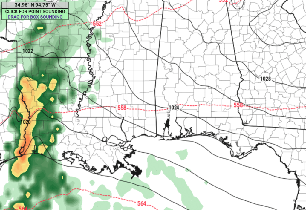
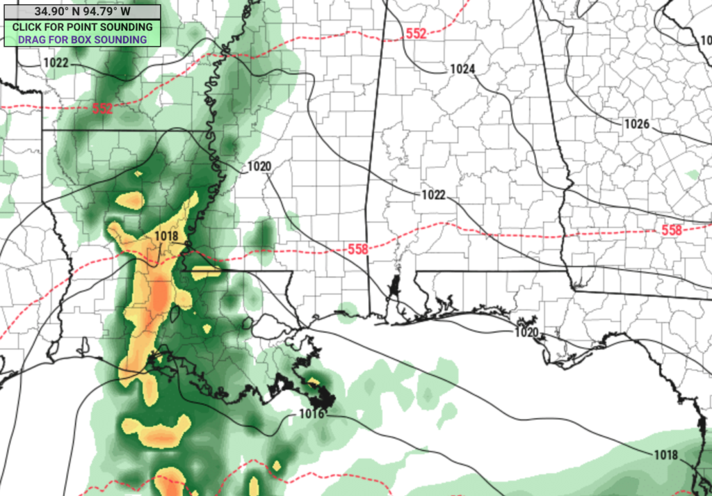
But it looks like it may struggle to stay together as it approaches the area as some drier air will be funneled in from the northeast as it arrives. The model guidance shows that some of the rain may not even make it into the eastern slice of counties in Mississippi nor into western Alabama.
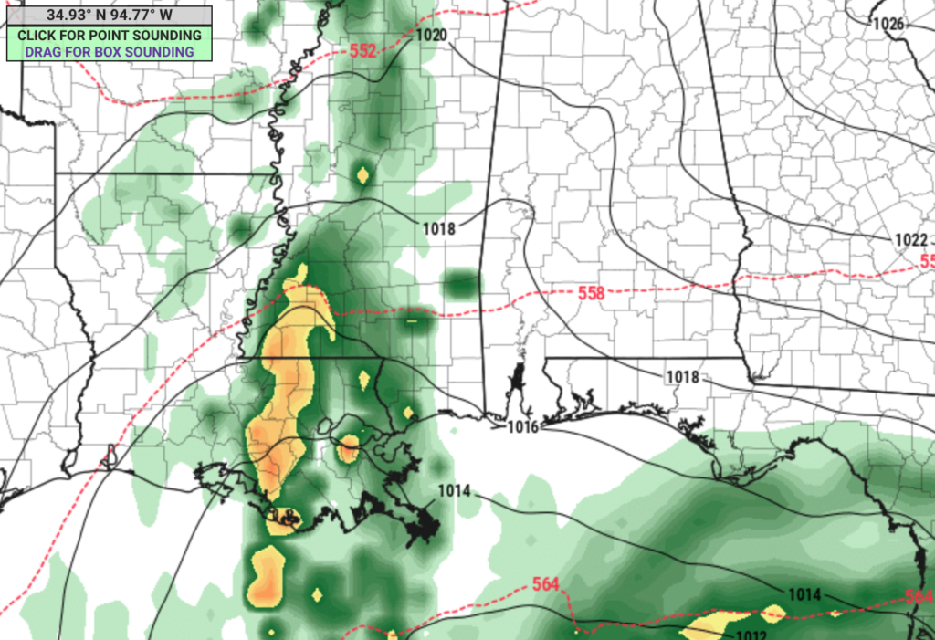
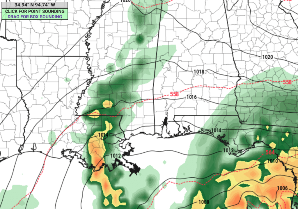
By Sunday morning, the rain has all but evaporated, according to the latest model guidance.
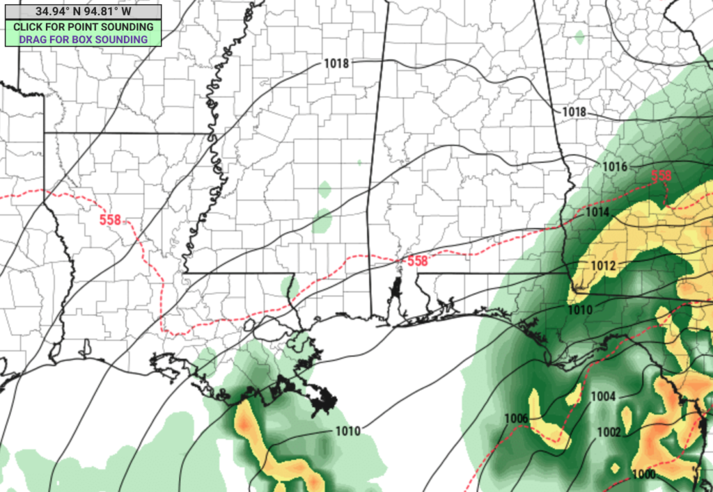
In fact, most of the precip is going to give the area a miss and go right into Florida. Leaving our neck of the woods cooler than normal and drier than normal through Sunday night.
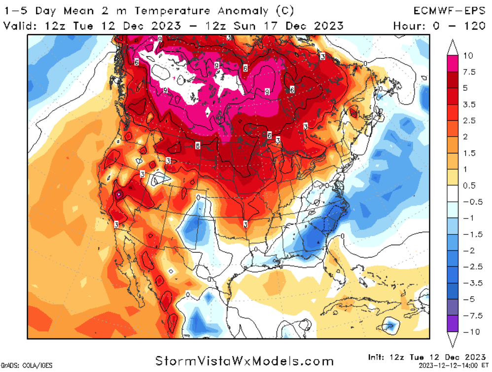
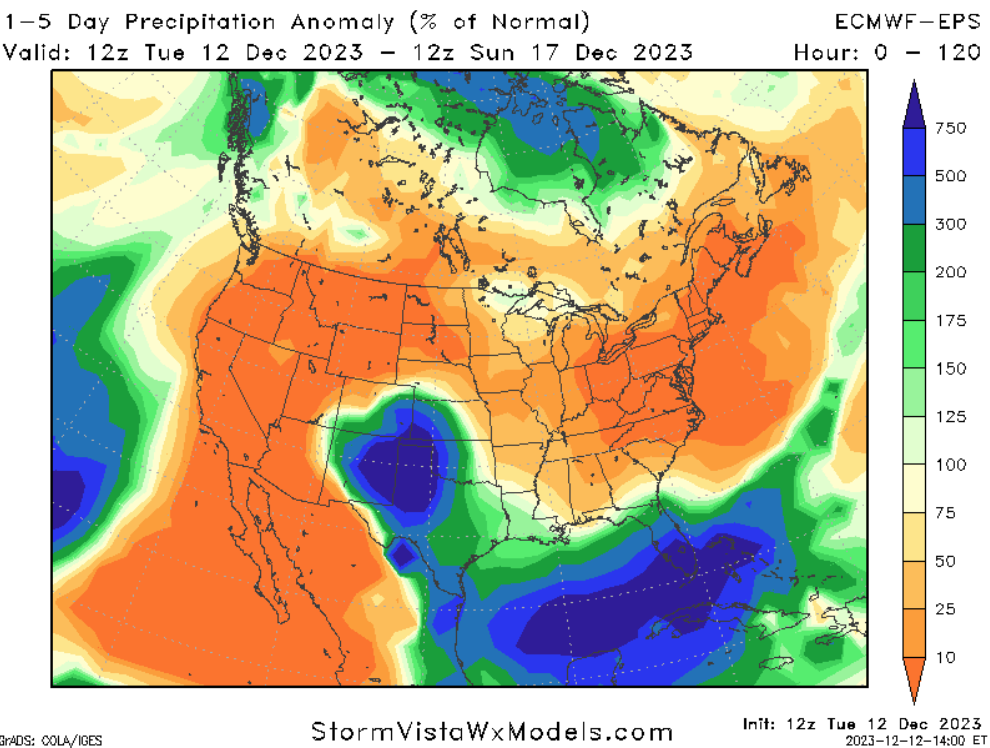
One interesting thing to note about the map above on the left. That is the temperature anomaly map averaged out over the next five days. Notice how warm it is across parts of Canada. For those who want snow down here, that is a very bad sign for you guys. Because in order for things to get cold enough for snow down here they need to be very cold up there. And if things will be running 5F to 15F above normal for them, there isn’t much of a way for our area to get cold enough for snow.
And, truly, on any other year, I’d argue that a setup like this with all of the other puzzle pieces in place, would’ve set us up for at least a shot for some wintry precip. But this time, no dice.
Which brings me to the forecast for next week. Originally (all the way back on November 3rd), I was thinking we may see some cooler weather sneak into the area around the 18th. Turns out, it is going to be here on the 19th instead. And I posted how that may some with the chance for some precip and it might not all be liquid. But given how warm it is up in Canada, things shouldn’t get icy at all.
Afternoon temperatures on the 19th look to top out around 45F to 55F across the region. Though, overnight lows may dip down to around 30F to 35F.
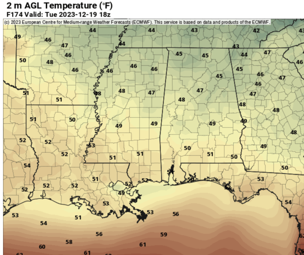
But it isn’t going to last too long. It looks like we get about three to four days of chilly weather at best, before things flip back around to warmth. The CIPS Analogs are showing temperature swing around back to warmer than normal with a shot for severe weather returning around 12/23.
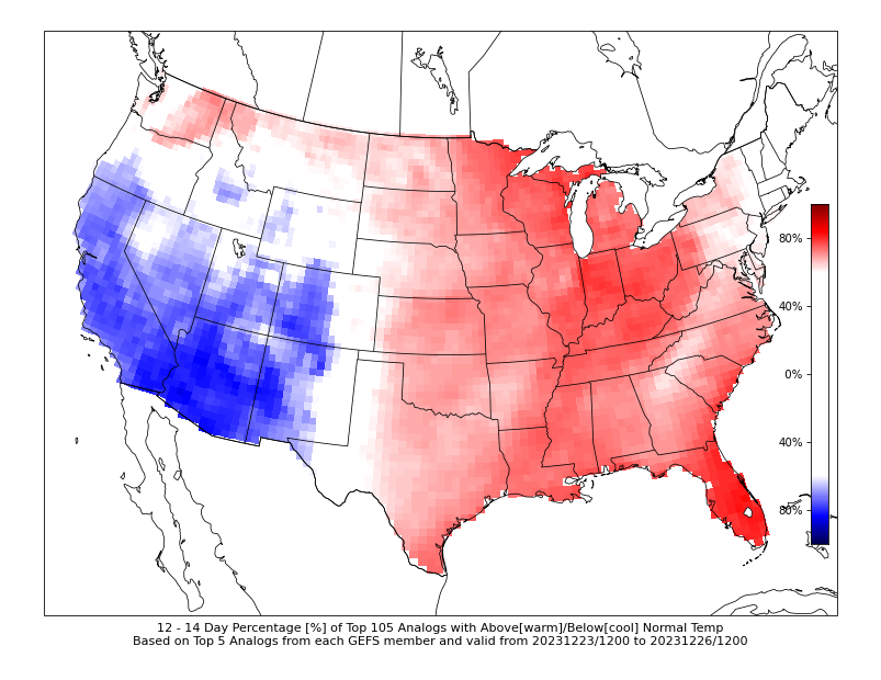
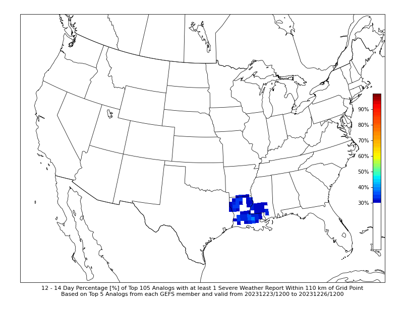
As a reminder, how these CIPS Analogs work: They look at the forecast parameters from the GEFS model and then pair about a dozen specific parameters with the closest analogous situations in the past. And then ask, “What happened?” and put the answer on a map.
In this case, about 80% of the time it was warmer than normal and 30% of the time, the region experienced severe weather.
Not exactly the way we want to welcome Santa into town.
The good news is this is still quite a ways off and things are bound to change, and they may change for the better. But I wanted to give everyone an early heads up, since we are going into the Holiday Season where everyone is more likely to be a little extra busy and may be traveling.
REGIONAL DAY TO DAY FORECAST
Wednesday: Partly sunny in the morning, then becoming mostly cloudy. Highs in the lower 60s. Northeast winds 5 to 10 mph.
Wednesday Night: Mostly cloudy. Lows in the mid 40s. Northeast winds 5 to 10 mph with gusts up to 20 mph.
Thursday: Mostly cloudy in the morning, then becoming partly sunny. Highs in the lower 60s.
Thursday Night: Partly cloudy. Lows in the mid 40s.
Friday: Mostly sunny. Highs in the lower 60s.
Friday Night: Partly cloudy in the evening, then becoming mostly cloudy. Lows in the upper 40s.
Saturday: Mostly cloudy. A slight chance of showers in the morning, then a chance of showers in the afternoon. Highs in the lower 60s. Chance of rain 30 percent.
Saturday Night: Mostly cloudy with a 50 percent chance of showers. Lows in the upper 40s.
Sunday: Mostly cloudy in the morning, then becoming partly sunny. A 40 percent chance of showers. Highs around 60.
Sunday Night: Mostly cloudy with a chance of showers in the evening, then partly cloudy with a slight chance of showers after midnight. Lows in the mid 40s. Chance of rain 30 percent.
Monday: Mostly sunny. Highs in the mid 60s.


What about Christmas in Tenn. Will there be snow?