More rain is expected for this evening after most of the area dealt with storms throughout the day. Don’t get excited, because the chance for rain does not quit. Storms are expected throughout the weekend and through the early part of next week. While not severe, these storms could bring strong winds and plenty of rain.
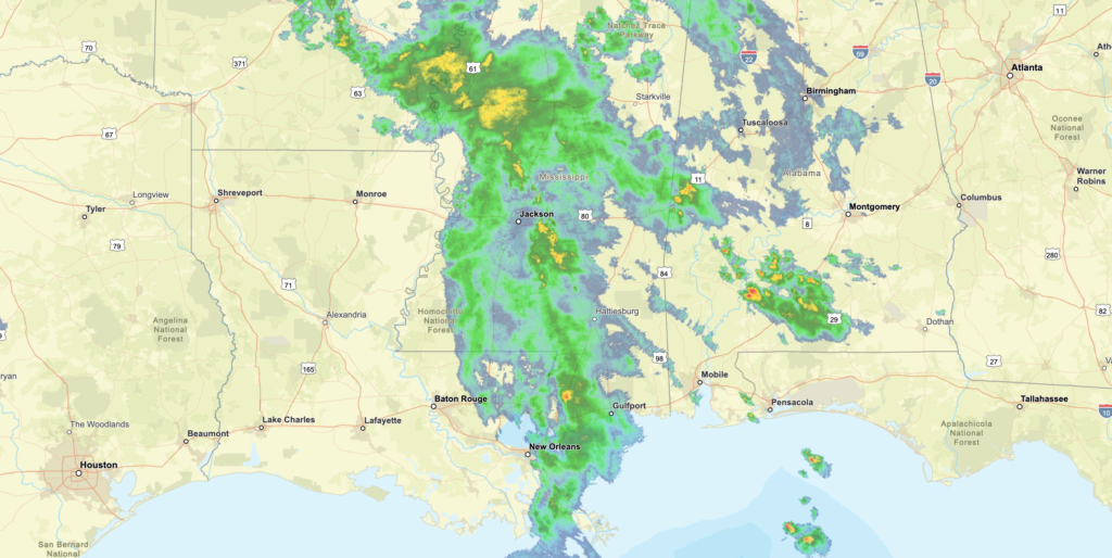
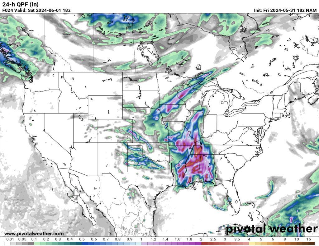
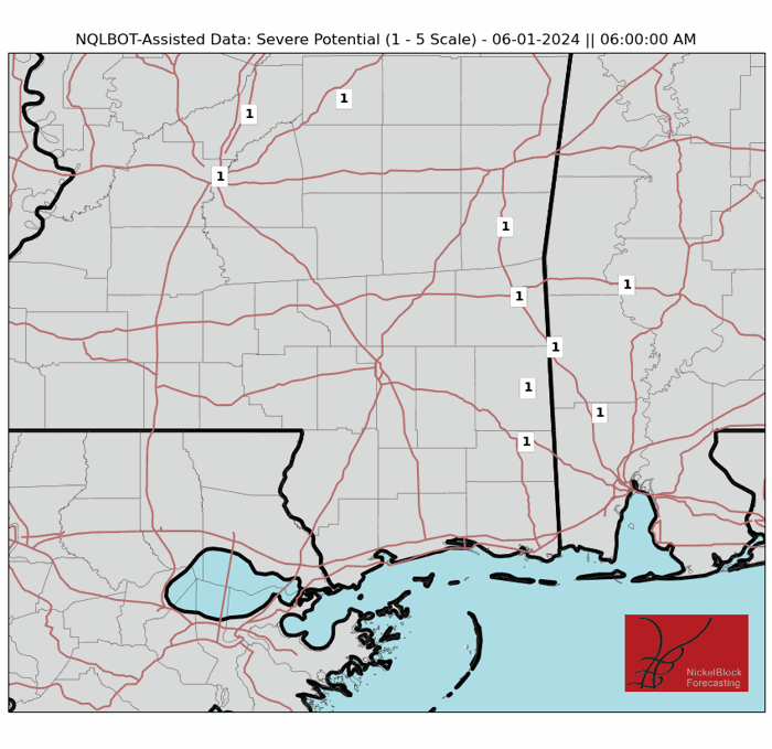
Moving into Saturday, the rain is here to stay along with a Marginal risk for severe weather according to the SPC Outlook (Marginal is the lowest of the 5 severe weather risks denoted by the SPC). The storms associated with the rain are unlikely to be severe with the strongest storms staying more to the west. However, the chance for flooding across the area may be a issue with the expected 2-4 inches of rain for most areas.
The storms are expected to last majority of the day, so prepare appropriately. The highs for Saturday range from upper 80s to low 90s, which will make for a hot and wet day for most of the region.
While the strongest of the storms will occur on Saturday, rain is expected to stay through Sunday. These storms/showers will be more scattered than the previous system. Rain chances stay present through the start of the week as well as the heat making a comeback with highs getting into the 90s. Be weather aware and get ready for more heat!
REGIONAL DAY TO DAY FORECAST:
Tonight: Partly cloudy in the evening, then mostly cloudy with a chance of showers and thunderstorms after midnight. Lows in the lower 70s. Southeast winds 5 to 10 mph. 40 percent chance of rain.
Saturday: Showers and thunderstorms. Highs in the mid 80s. South winds 5 to 10 mph. 90 percent chance of rain.
Saturday Night: Mostly cloudy with a chance of thunderstorms. A chance of showers. Lows in the upper 60s. South winds 5 to 10 mph. 50 percent chance of rain.
Sunday: Partly sunny. A chance of showers and thunderstorms in the morning, then showers and thunderstorms likely in the afternoon. Highs in the mid 80s. South winds 5 to 10 mph. 60 percent chance of rain
Sunday Night: Partly cloudy. A slight chance of showers and thunderstorms in the evening. Lows in the upper 60s. 20 percent chance of rain.
Monday: Mostly sunny. A slight chance of showers and thunderstorms in the morning, then a chance of showers and thunderstorms in the afternoon. Highs in the upper 80s. 30 percent chance of rain.
Monday Night: Partly cloudy. Lows around 70.
Tuesday: Sunny with a slight chance of showers and thunderstorms. Highs around 90. 20 percent chance of rain.
Tuesday Night: Mostly clear. Lows in the lower 70s.
Wednesday: Mostly sunny. A slight chance of showers and thunderstorms in the afternoon. Highs in the lower 90s. 20 percent chance of rain.
Wednesday Night: Partly cloudy. Lows in the lower 70s.
Thursday: Mostly sunny. A slight chance of showers and thunderstorms in the morning, then a chance of showers and thunderstorms in the afternoon. Highs in the lower 90s. 30 percent chance of rain.
Thursday Night: Partly cloudy. Lows in the lower 70s


