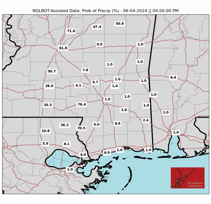
Over the last few days, the region has been experiencing rainfall and cooler temperatures. That trend is expected to continue through tomorrow, with scattered showers and thunderstorms expected to develop in the afternoon hours. Some of these storms could produce heavy rainfall, which may lead to localized flash flooding.
After tomorrow, an area of high pressure is expected to move into the region, bringing dryer weather and warmer temperatures.
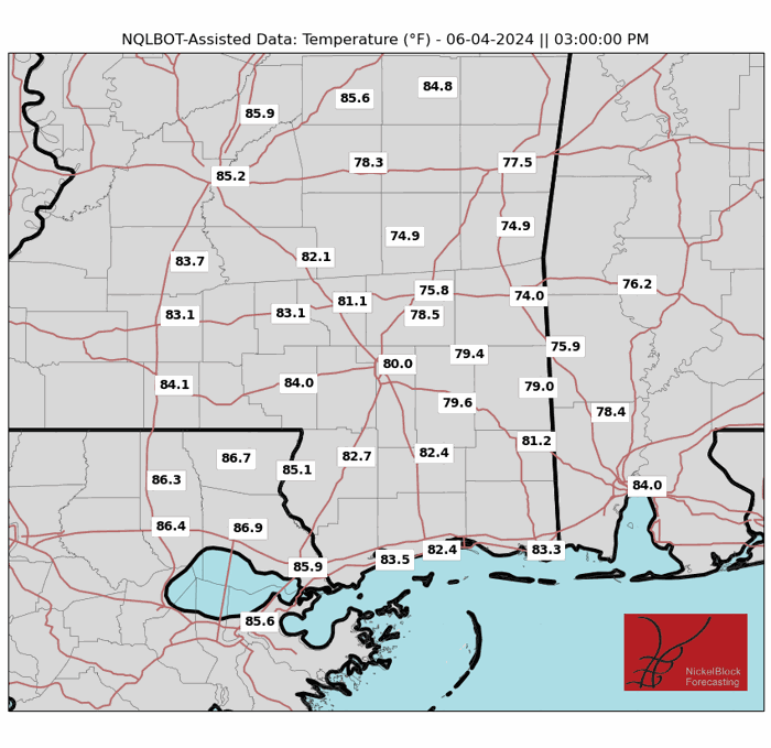
Scatterd Showers Continues Through Today and Tomorrow
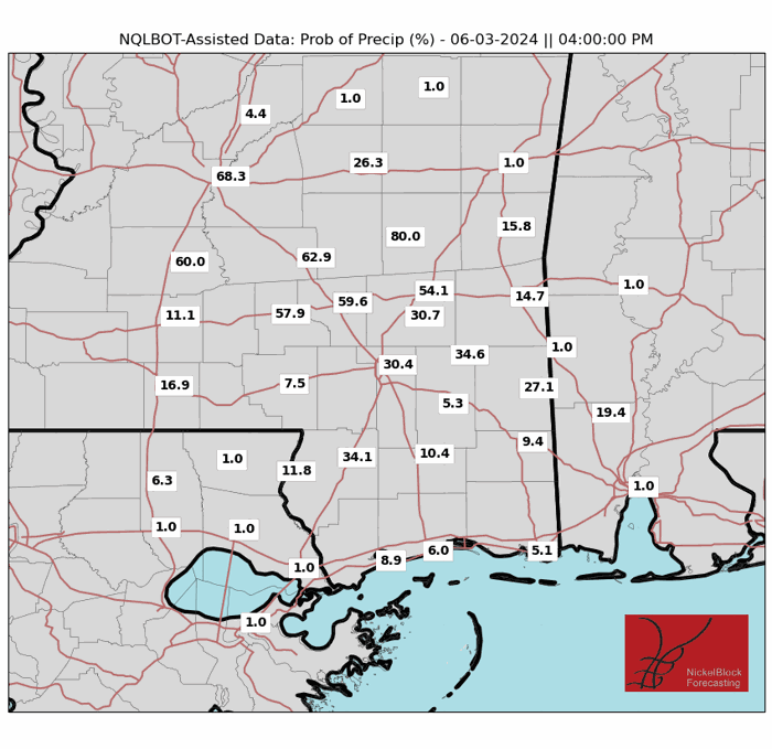
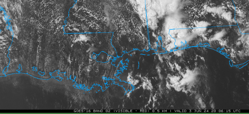
Over the last couple of days, the region has been experiencing scattered showers and thunderstorms in the afternoon and evening hours. I’m sorry to say that we will have two more days of this trend before there is a change in the weather pattern that will be talked about later. Today, most of the thunderstorm activity should take place between the hours of 5 and 9 PM Central Time. These storms will be mainly scattered, meaning that some of the region may not see rainfall while other areas see rainfall.
Tomorrow’s storm chances will be about the same as today’s, with the only difference being the chance of seeing heavier rain and higher winds. This has prompted the Storm Prediction Center to issue a marginal risk of severe weather for areas north of Baton Rouge, Louisiana, with the primary threat being heavy downpours and high wind gusts. Any outdoor plans for today and tomorrow should have a back up plan in case of rain.
High Pressure to build into the Region Later This Week
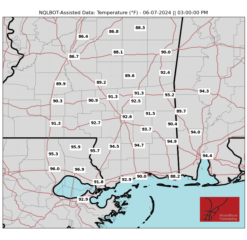
Looking to the next couple of days, a significant change in the weather is expected for the region. A ridge of high pressure is expected to set up over the region later this week. Temperatures are expected to climb as the week progresses, with high temperatures expected to be in the mid 90s by Friday The ridge of high pressure will also bring high humidity, causing heat index values to soar.
This will also allow for rain chances to decrease for the rest of the week into the weekend; although some rainfall is possible on Thursday. Anyone outside in the middle of the day should adhere to heat safety precautions to avoid heat related illnesses.
REGIONAL DAY TO DAY FORECAST
Today: Scattered thunderstorms, with highs around 88°F. Winds southeast at 5-10 MPH. Chance of rain, 50%.
Tonight: ScatterEd thunderstorms before 9 PM, with lows around 72°F. Winds south at 5 MPH. Chance of rain 30%.
Tomorrow: Scattered thunderstorms, with highs around 87°F. Winds south at 5-10 MPH. Chance of rain, 50%.
Tomorrow night: Partly cloudy, with lows around 77°F. Winds south at 5-10 MPH. Chance of rain, 20%
Wednesday: Mostly cloudy, with highs around 86°F. WInds south/southwest at 5-10 MPH. Chance of rain 20%.
Wednesday night: Mostly cloudy, with lows around 75°F. Winds south at 5 MPH. Chance of rain 20%
Thursday: Isolated showers and thunderstorms, with highs around 90°F. Winds west/northwest at 5 MPH. Chance of rain 30%.
Thursday night: Mostly clear, with lows around 73°F. Winds West at 5 MPH.
Friday: Sunny and hot, with highs around 93°F. Winds light and variable.
Friday Night: Mostly clear, with lows around 70°F. Winds light and variable.
Saturday: Sunny, with highs around 90°F. Winds northwest at 5 MPH.
Saturday night: Mostly clear, with lows around 70°F. Winds Southwest at 5 MPH.


