We went from pleasant and sunny to mostly cloudy and hot in the past week, and it won’t change anytime soon. Except rain, probably some of that too. We’re getting close to that season where we’ll get single cell thunderstorms popping up almost every day and right now, we’re on the verge of that. Part of that is due to the Atlantic high pressure system that will remain for the next several days and will halt some incoming surface lows. Because of that, we’ll see scattered chances for rain and thunderstorms for much of the week until a slightly stronger cold front moves in by Friday.
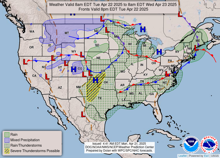
Tonight, we’ll have a few more storms rolling in from parts of Louisiana, but these look to dissipate as we move past midnight. Tuesday will have a mixed chance of thunderstorms as more move in from the Gulf from the early afternoon to the late evening. If you’re having anything outdoors, be prepared to move it indoors quickly if it rains. Locally heavy rain is possible with some of these thunderstorms. Overnight there will be a chance of patchy fog since the winds will die down, and this will be a continuing trend for the rest of the week, so be careful while driving in the morning.
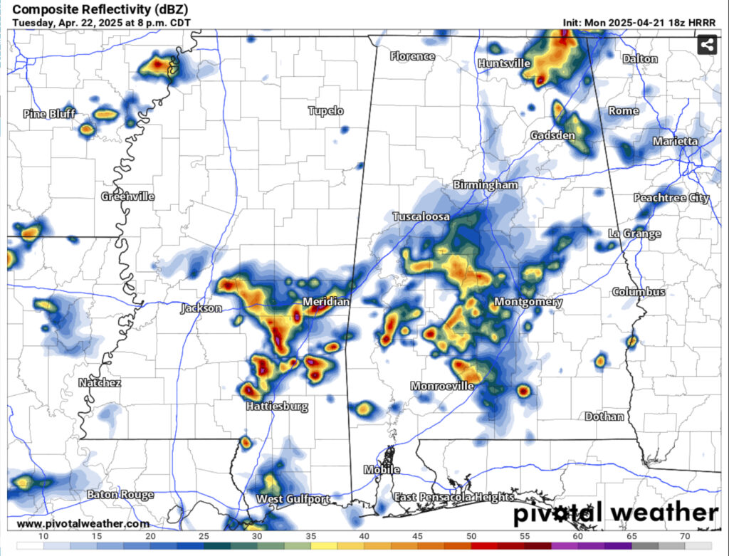
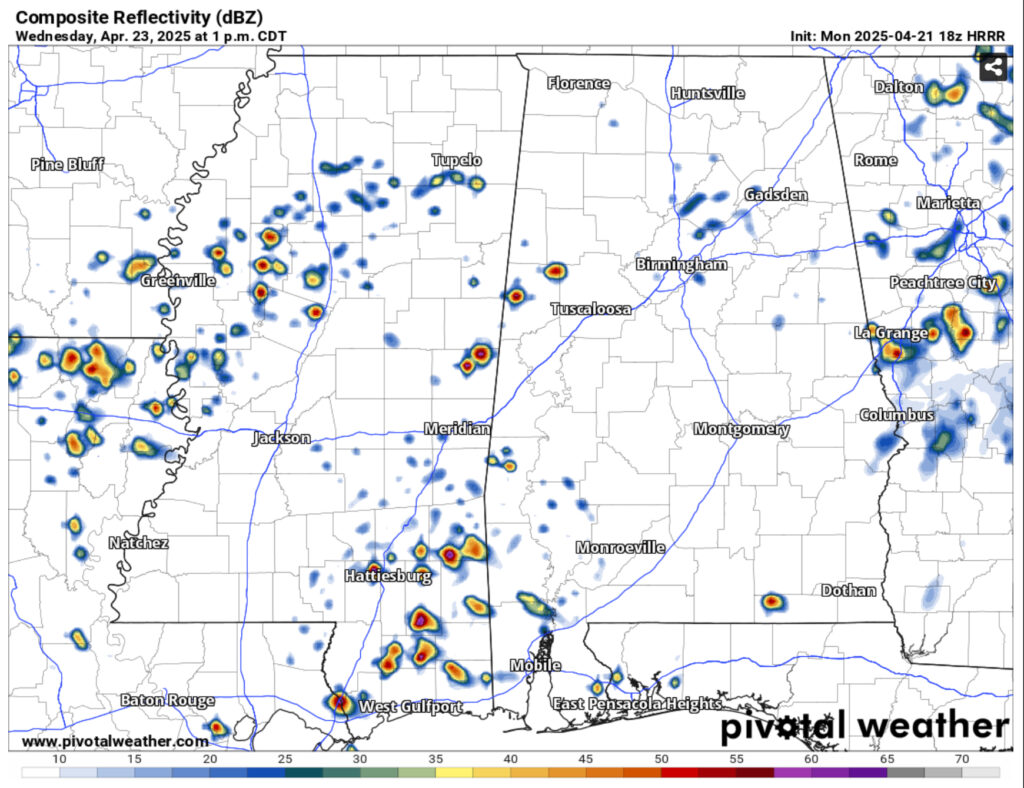
Wednesday will see another round of scattered storms move in with the stalling front in the early afternoon to mid afternoon. As this front dissolves over us, we’ll have a slight break from the storms on Thursday, however areas north of I-20 will still have some of the rain to deal with.
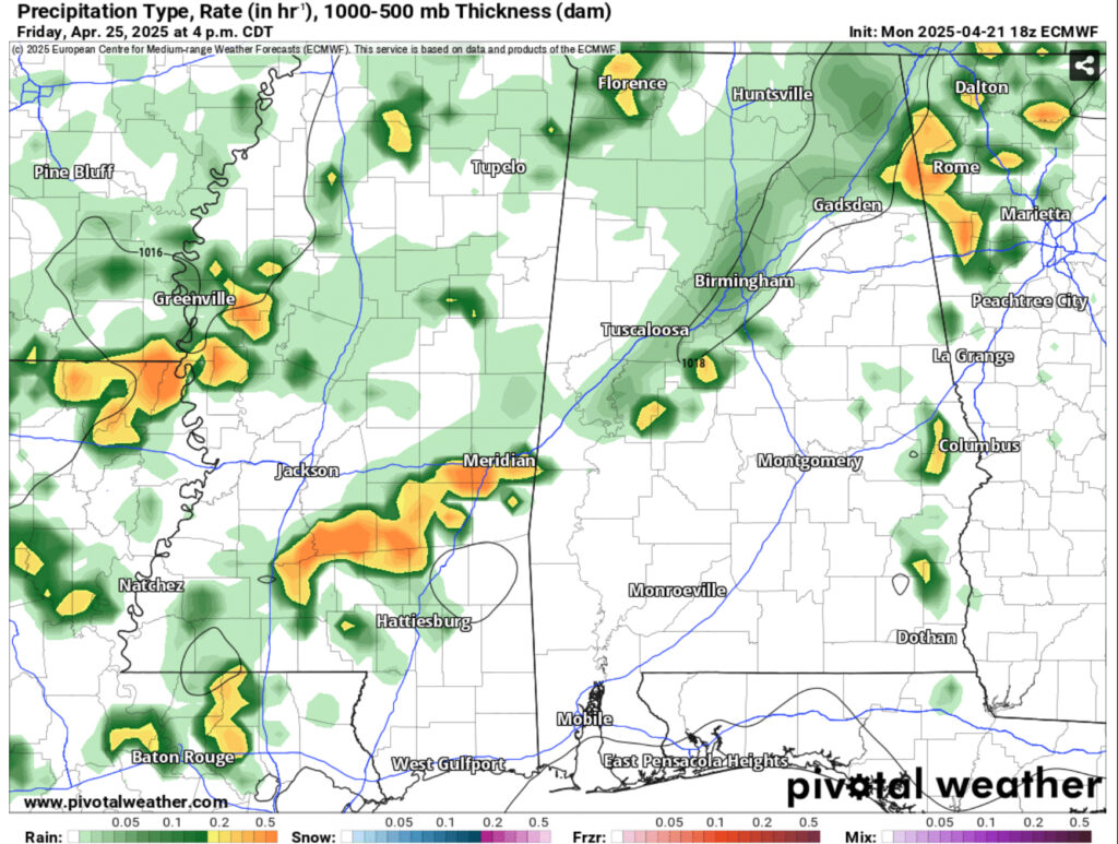
By Friday, another cold front will permeate the high pressure zone and move in bringing us one more chance of rain for the week. This looks to hit during the afternoon to the evening hours. Overall rain totals are a bit all over the place, however it looks to be an average of at least 3/4” across much of Mississippi with some areas reaching more than that. It may put a damper on the fire weather since we’ll have several days of rain.
Temperatures during the week will gradually warm up from the low to mid 80s and eventually the upper 80s by Friday. We may even see our first 90 by the weekend. Overnight lows will remain fairly consistent, however, remaining in the low to mid 60s. It’s going to be a pretty warm end to April this year, so keep your umbrella, and your sunscreen for that matter with you for the next week!
Regional Day-to-Day Forecast
Tonight – A chance of showers and thunderstorms. Mostly cloudy, with a low in the mid 60s. South southeast wind 5 to 10 mph. Chance of precipitation is 50%. New precipitation amounts of less than a tenth of an inch, except higher amounts possible in thunderstorms.
Tuesday – A chance of showers, then showers likely and possibly a thunderstorm after 1pm. Partly sunny, with a high in the mid 80s. Calm wind becoming south southwest around 5 mph in the morning. Chance of precipitation is 60%. New rainfall amounts between a tenth and quarter of an inch, except higher amounts possible in thunderstorms.
Tuesday Night – A chance of showers and thunderstorms before 8pm, then a slight chance of showers. Patchy fog after midnight. Otherwise, mostly cloudy, with a low in the low to mid 60s. Calm wind. Chance of precipitation is 30%.
Wednesday – A chance of showers and thunderstorms beginning in the late morning. Patchy fog before 8am. High in the low to mid 80s. Calm wind becoming south around 5 mph in the afternoon. Chance of precipitation is 80%. New rainfall amounts between a quarter and half of an inch possible.
Wednesday Night – Patchy fog after midnight. Otherwise, mostly cloudy, with a low in the low 60s. Calm wind.
Thursday – A 30 percent chance of showers and thunderstorms in the afternoon. Patchy fog before 8am. Otherwise, partly sunny, with a high in the mid 80s. Calm wind becoming south southeast around 5 mph in the afternoon.
Thursday Night – Patchy fog after 3am. Otherwise, mostly cloudy, with a low in the mid 60s. South wind around 5 mph becoming calm in the evening.
Friday – A 20 percent chance of showers and thunderstorms in the afternoon. Patchy fog before 8am. Otherwise, partly sunny, with a high in the mid to upper 80s. Calm wind becoming south around 5 mph in the afternoon.
Friday Night – Patchy fog after 2am. Otherwise, partly cloudy, with a low in the mid 60s. South wind around 5 mph becoming calm in the evening.
Saturday – A 20 percent chance of showers and thunderstorms in the afternoon. Areas of fog before 8am. Otherwise, mostly sunny, with a high in the upper 80s.
Saturday Night – Patchy fog. Otherwise, mostly clear, with a low in the mid 60s.
Sunday – Patchy fog. Otherwise, sunny, with a high near 90.
Sunday Night – Mostly clear, with a low in the mid 60s.
Monday – Mostly sunny, with a high near 90.


