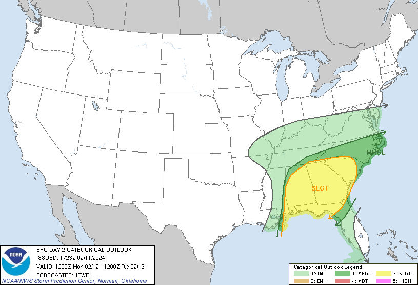
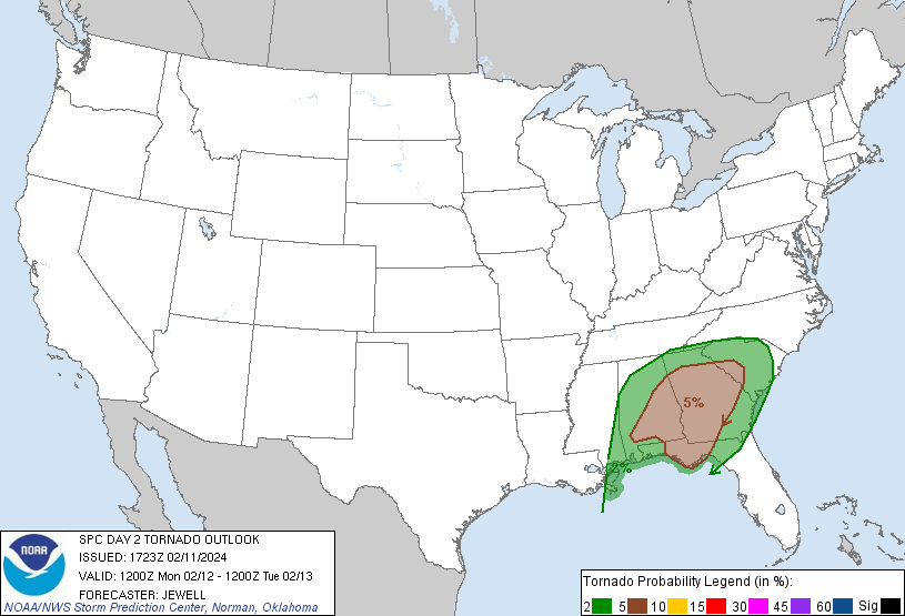
Looking to the week ahead, the most immediate concern is the severe threat Monday across the Southeast. Georgia, Alabama, South Carolina, and the Florida Panhandle will see the most significant severe threat.
CAPE values will be low to moderate, but very strong shear may be enough to compensate for that. It may end up being one of those low CAPE high shear severe days that we sometimes see in the Southeast during winter. One factor that could limit severe potential is morning convection ahead of the main line of storms, which might stabilize the atmosphere. However, given the strong shear, it will not take too much CAPE to produce a severe threat, so people in these areas should monitor their forecasts. The current model trends suggest the greatest severe threat will be in the morning in Alabama, the afternoon in Georgia, and the evening in South Carolina.
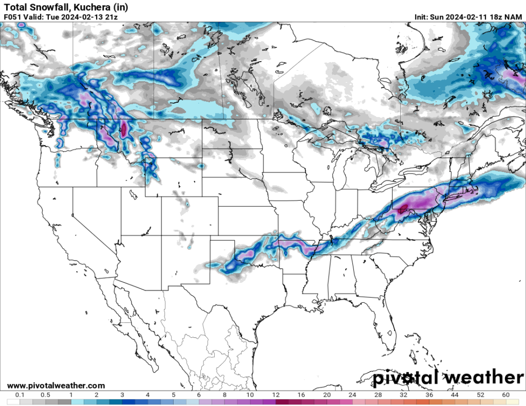
The system that is producing the severe weather will also produce snowfall on its north side. Snowfall may extend as far south as Tennessee on Monday and move towards the Northeast on Tuesday. The Northeast may see heavy snow, possibly up to a foot in some areas.
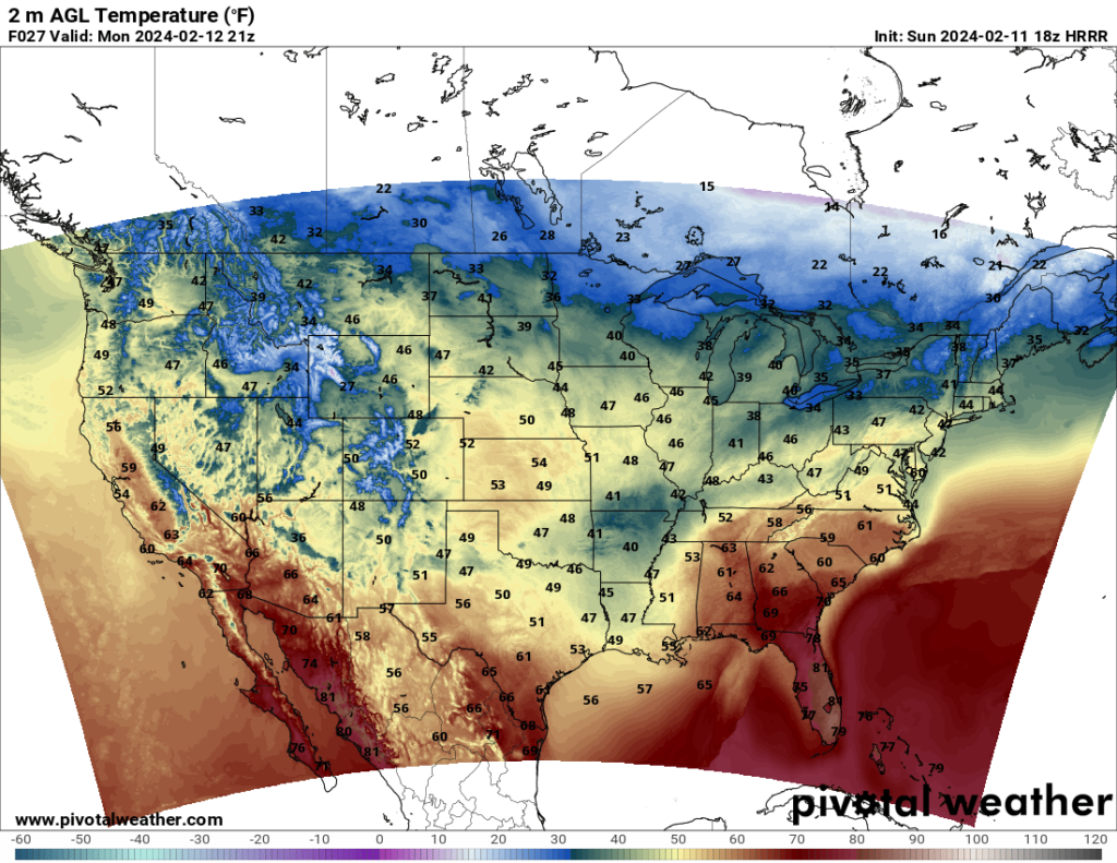
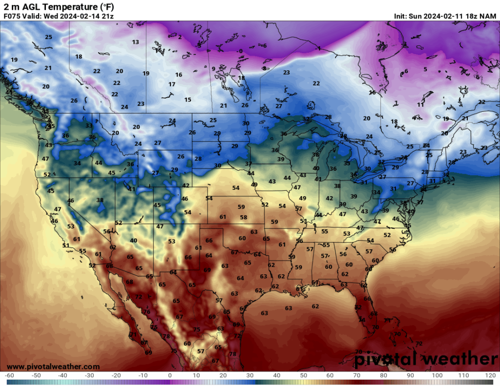
Looking at temperature, the cold front producing the severe weather will push through the South on Monday. However, the chilly temperatures will only last a day or so, and by Wednesday, temperatures will be warming up again in the South.
