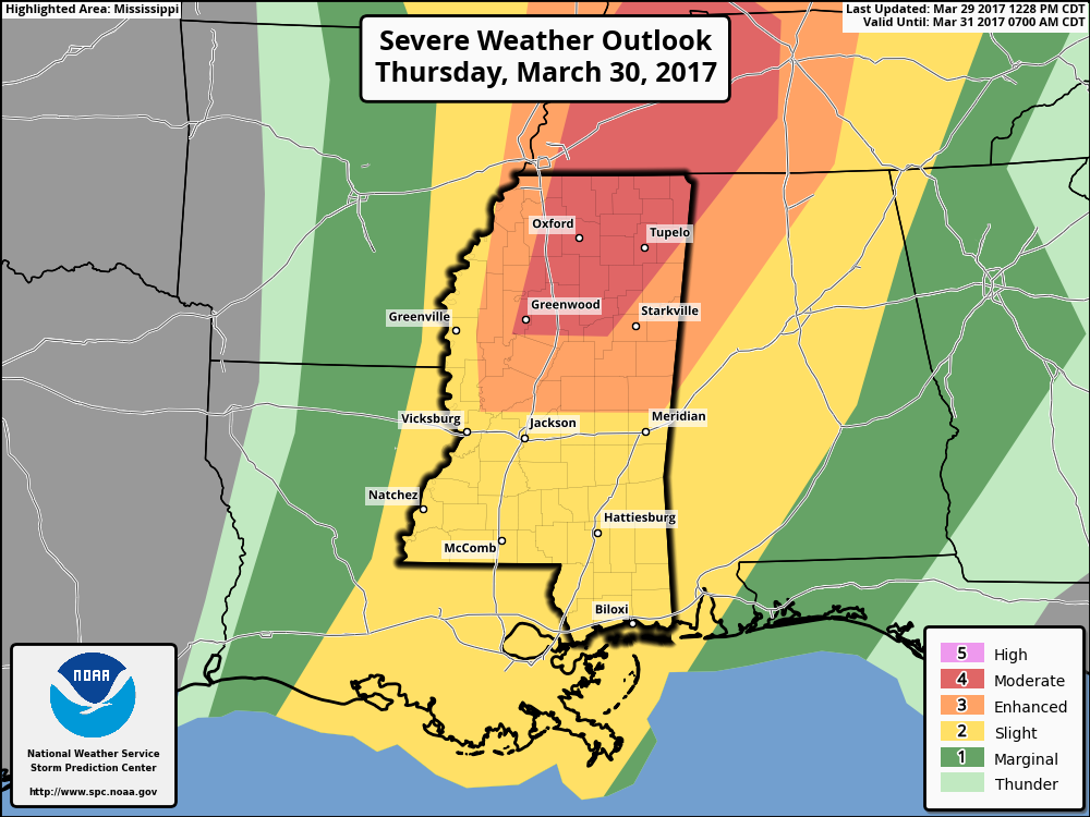
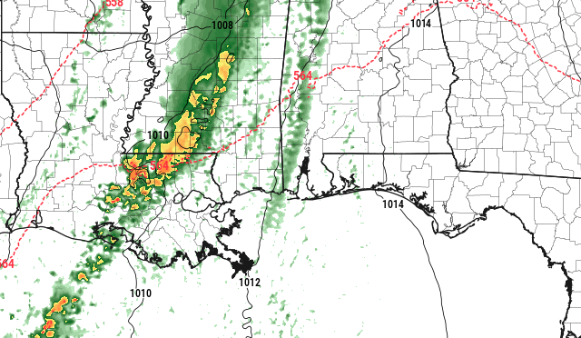
Looking at the latest model guidance, a lot of the thought is that a robust atmospheric setup may lead to two rounds of severe weather for parts of Tennessee, Mississippi and Alabama.
For southern Mississippi, this doesn’t look as likely.
The Setup
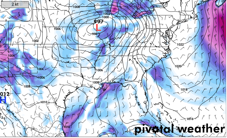
A big area of Low pressure is moving by from southwest to northeast across Texas, Oklahoma and Missouri. As it does so, it will open up the atmosphere for the development of showers and storms along and ahead of a cold front.
From the SPC
Complex forecast for Thursday with considerable uncertainty regarding specific details of the overall forecast scenario owing in part to prior thunderstorm activity on Wednesday and Wednesday night through early Thursday. Some model solutions exhibit favorable buoyancy/shear for the possible development of significant severe thunderstorms during peak heating while other solutions suggest a more mesoscale-dependent severe risk to develop within the area generally defined within the 30% severe probabilities (category 3 risk). Early-day clouds/thunderstorm activity will likely modulate both low-level moisture and 700-500mb lapse rates across the MS Valley. This is reflected in the variability of the most recent model guidance with the NAM implying intense storms redeveloping across the northern half of MS northward into the lower OH Valley.
 This is in contrast to the latest GFS and ECMWF models showing widespread thunderstorms in a band during the morning near the MS River moving east with little recovery/destabilization expected in its wake. Yet, some cooling aloft in association with the approaching mid-level low/cold pocket will contribute to destabilization, in addition to surface heating during the day in wake of early-day clouds/thunderstorms. A cold front is forecast to slowly progress across the MS Valley and serve as a focus for renewed thunderstorm development, perhaps as early as midday. As previously described, considerable variability in the magnitude of buoyancy is depicted in model guidance. Nonetheless, upwards of 500-1500 J/kg is forecast within an area of strong cyclonically curved 500-mb flow. Forecast soundings show strong effective shear (40-60 kt) which will likely result in storm organization and an attendant risk for wind damage. The strength of the low-level shear will conditionally augment a tornado risk for any mature supercells or mesovortices in a squall line. Hail will be possible both near the cold pocket with strong updrafts and in areas where mid-level lapse rates are less convectively contaminated. The broken bands of storms will move east in eastern parts of KY/TN and the eastern portions of the central Gulf Coast during the evening and overnight with a gradual weakening in storm intensity and expected severe coverage.
Local Thoughts
Locally, this doesn’t compare favorably with historical severe weather setups.

Model guidance shows that the area will be too dry at 850mb, low-level shear and helicity values will be too low, and general vertical velocity values will be too low.
However, localized storms that can overcome these deficiencies will still have the possibility to develop very robust severe characteristics. These storms – if any develop – would be few and far between.
What is most likely is that a line of showers and strong storms will move through the area between 5am and 2pm. The line will have very heavy rain, gusty wind, small hail and a ton of lightning. The threat for a tornado is low, but a brief spin-up will be possible. Any strong wind gust or weak tornado will damage fences, poorly-built structures, trees and similar objects. A long-track devastating, life-threatening-unless-you’re-underground-mile-wide tornado? Not likely. Not impossible, but there is no reason to stress about that.
The thought is that after this line moves through, it will stabilize the atmosphere behind it and put the lid on the further development of storms int he afternoon.
Timing
Storms will develop across Walthall, Lawrence, Simpson counties as early as 5am and move from west to east across southern Mississippi. The last of the storms should exit the area and move into Alabama by 6pm. Storms will be pretty hit and miss during this time, it wont rain, rain, rain all day.


