Happy Wednesday everyone! I hope the work week is going well as we reach midweek. Weather wise, we are watching the risk for severe weather on Thursday and higher temperatures into the weekend. For Wednesday however, a weak upper-level trough through the Southeast should support scattered showers and thunderstorms in the area. Rain chances will not be high for the region; however, southern counties will have a better chance to see these storms as they should start offshore and move inland. More storms will develop off of the sea breeze and other storms’ outflow boundaries.
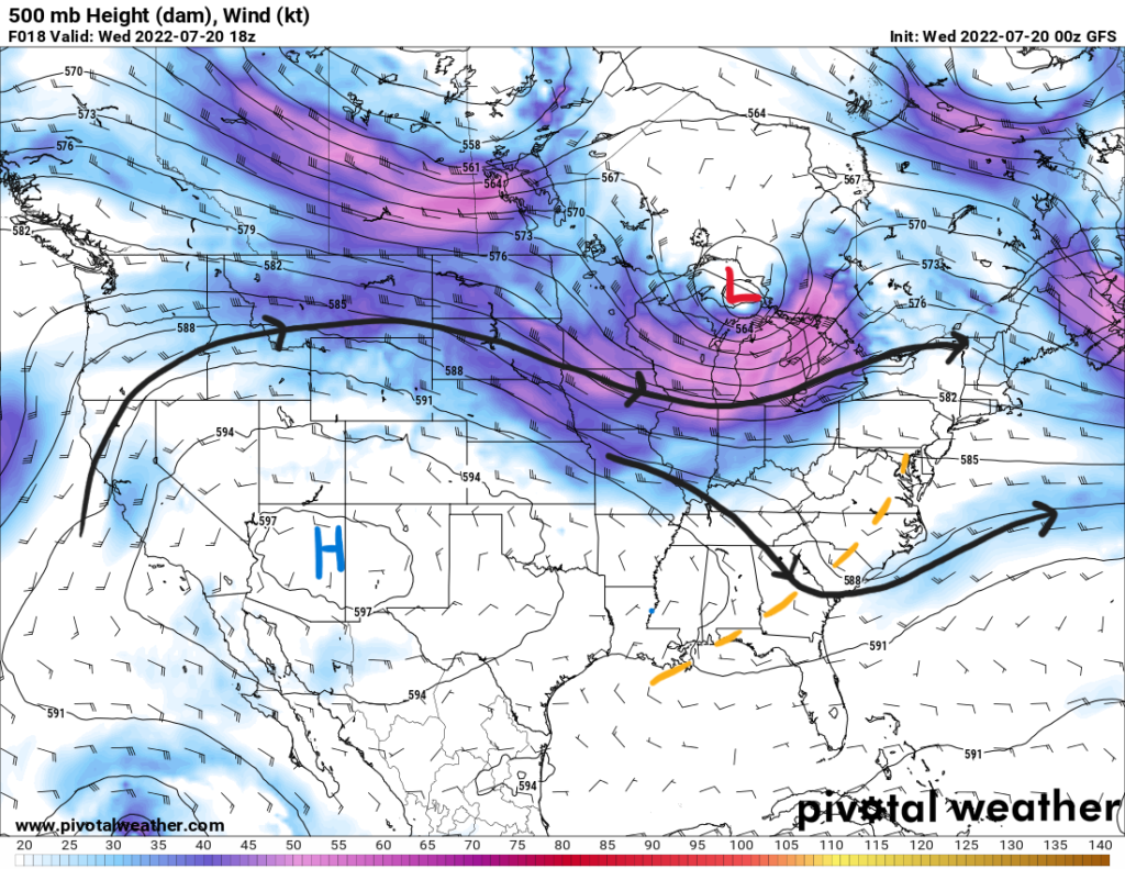
High temperatures Wednesday will reach the mid 90s. Dewpoints hitting the 70s will increase the heat indices to up to 105F. This will prompt a heat advisory for the eastern counties in the southeast portion of Mississippi. Any rainfall though will give some temporary relief from the heat.
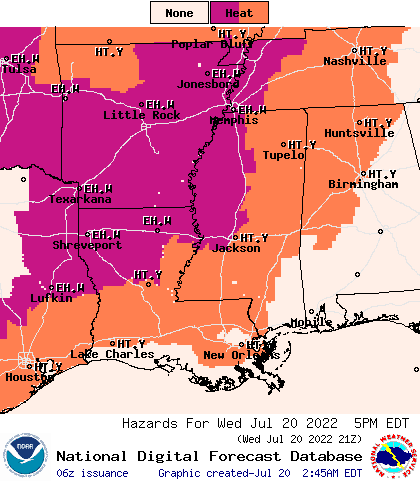
Thursday will see an increased chance of precipitation as a cold front moves in from the north. The surface frontal boundary will be aligned with an mid-level trough oriented from the northeast into the region.
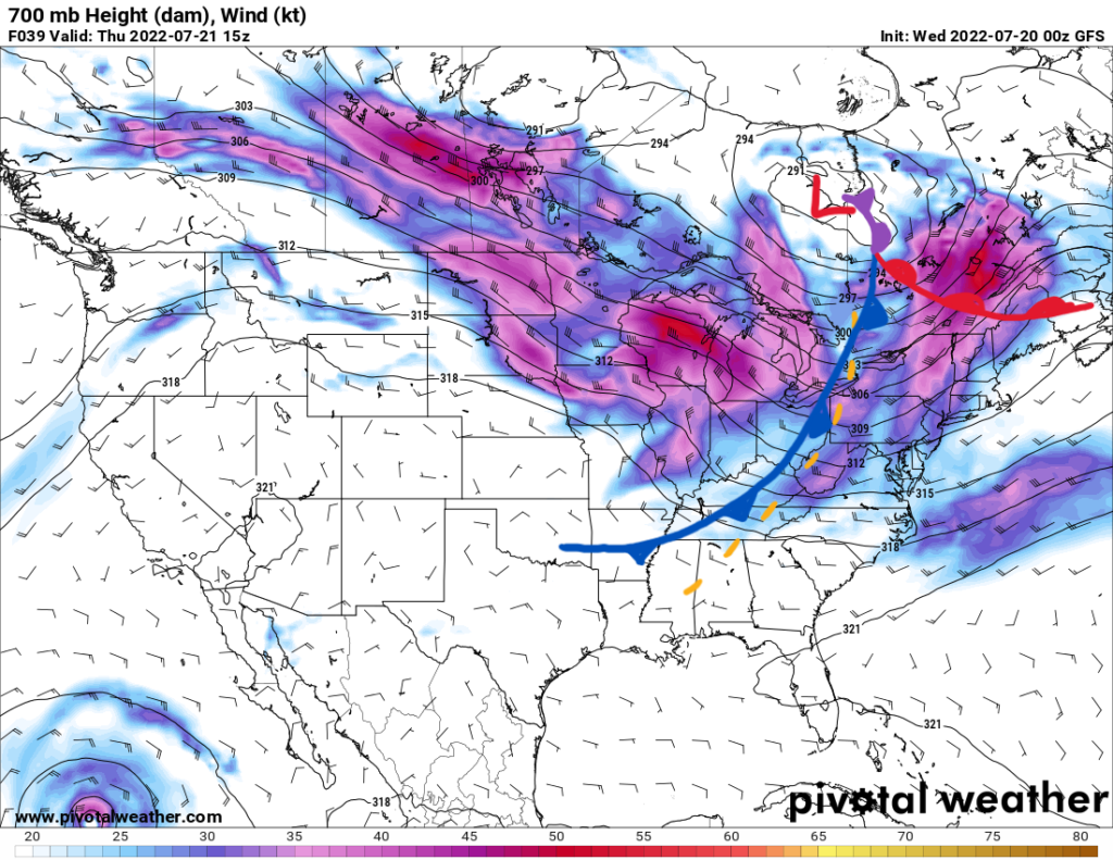
Scattered storms will form ahead of the front and might cluster together in a more organized fashion. This brings the risk for severe damaging winds from any storms lined up. Other pulse storms could be capable of severe wind gusts from downbursts with the stronger storms as there is ample moisture in the mid-levels. The airmass in front of the boundary will be rather moist with dewpoints into the mid 70s and precipitable water values greater than 2.2″. Locally heavy rainfall can also be expected with some storms. When temperatures reach their peak, storms will take advantage of this increased instability. Mixed Layer CAPE (available energy in the atmosphere) values will be around 3000 J/kg.
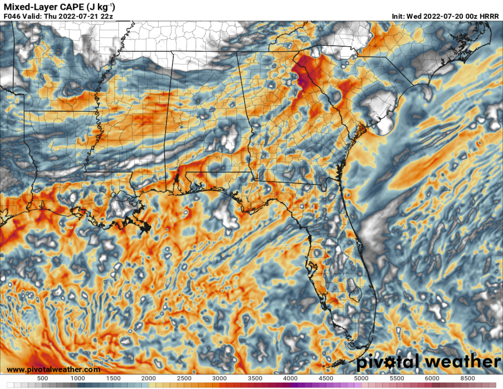
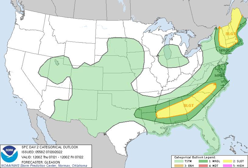
Storm motion, due to mid and upper-level steering, will be towards the south-southeast. Once the sun sets and we lose daytime heating, storms will begin to dissipate as they lose energy. The SPC outlook for Thursday shows a slight risk (2/5) for the northern counties and a marginal risk (1/5) for the southern counties.
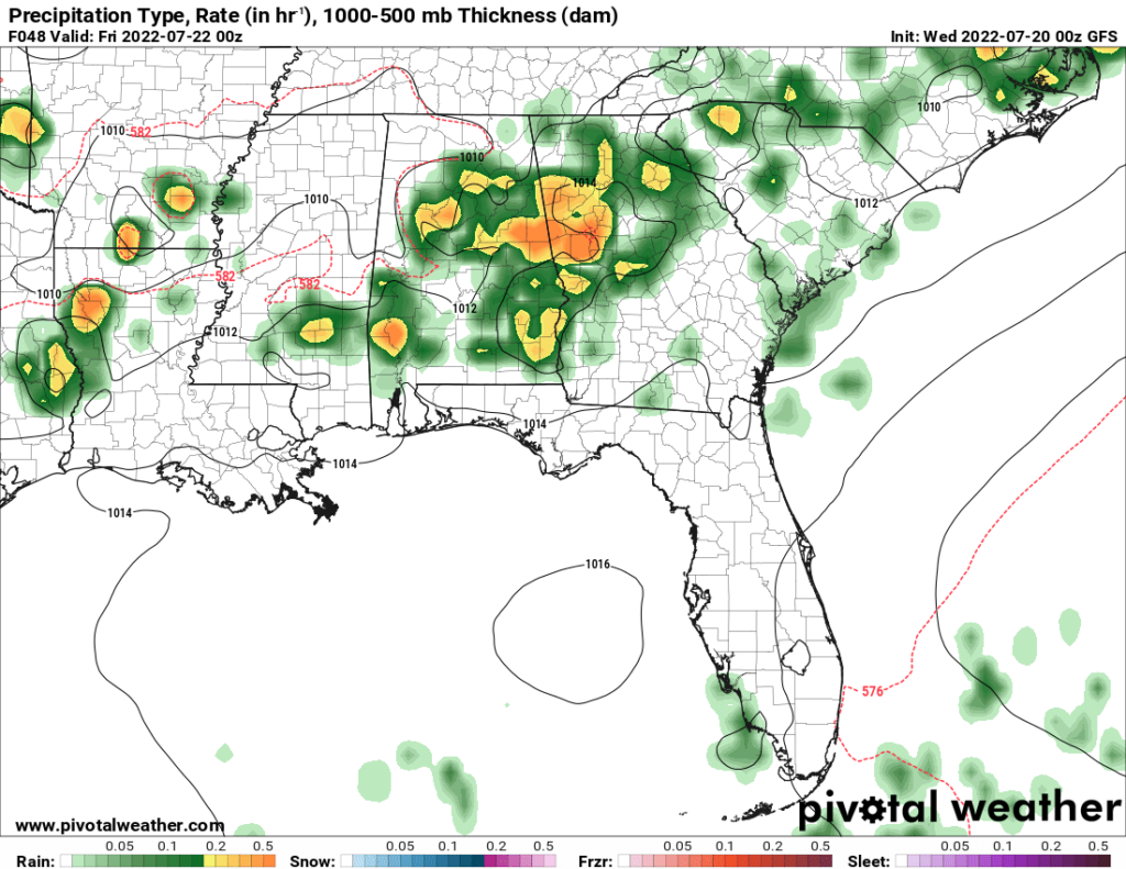
Friday will also have increased coverage of storms in the afternoon from daytime heating and some leftover energy from Thursday’s trough. Heading into the weekend, rain chances will decrease as the upper-level ridge works its way back to the east and the trough flattens out. Any showers and storms that initiate through the weekend will be driven by diurnal heating and be scattered in nature.
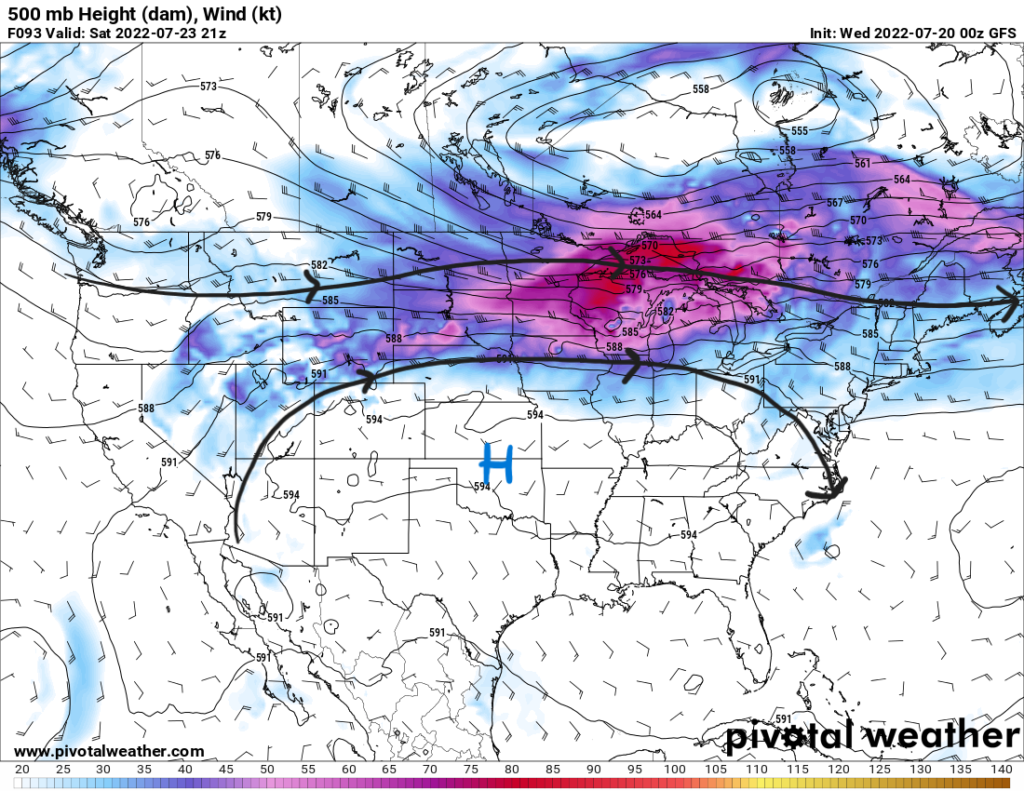
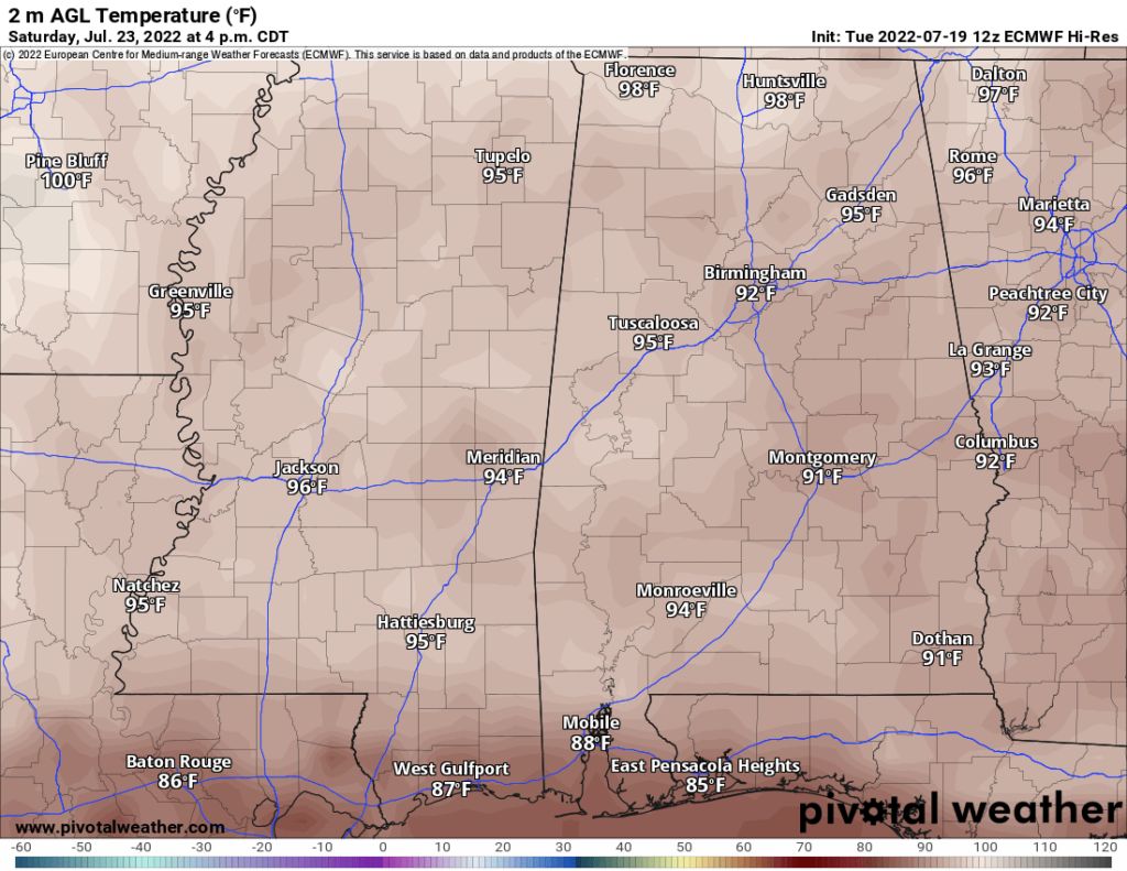
With this ridge stretching to the east, temperatures will increase as rainfall coverage decreases. Highs will be in the mid-to-upper 90s with heat indices reaching 105F on Saturday and Sunday. Stay hydrated, cool, and safe as you work towards the end of your week.
Day-to-Day Forecast
Wednesday
Mostly sunny and hot with a 10-percent chance of showers or storms in the northern counties and a 20-percent chance for the southern counties. Highs in the mid 90s with the heat index reaching 105F. Lows in the upper 70s.
Thursday
Partly cloudy with a 50-percent chance of showers and storms beginning in the late afternoon. Highs in the low-to-mid 90s with the heat index reaching 108F. Lows in the mid-to-upper 70s.
Friday
Mostly cloudy with a 70-percent chance of showers and storms throughout the day. Highs in the low 90s with the heat index reaching 105F. Lows in the mid 70s.
Saturday
Sunny with a 30-percent chance of precipitation. Highs in the mid 90s with heat indices between 100F and 105F. Lows in the mid 70s.
Sunday
Sunny and hot with a 20-percent chance of precipitation. Highs in the upper 90s with heat indices between 100F and 108F. Lows in the mid 70s.
Monday
Sunny with a 30-percent chance or precipitation. Highs in the mid 90s with heat indices between 95F and 100F. Lows in the mid 70s.
Tuesday
Mostly sunny with a 30-percent chance of precipitation. Highs in the mid 90s with heat indices between 100F and 105F. Lows in the mid 70s.

