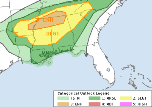
The Storm Prediction Center has maintained the Slight Risk for severe weather in the area today. There were some morning showers and storms across parts of northern Mississippi, but that won’t have much of an impact on the weather across parts of southern Louisiana, Mississippi and Alabama.

The good news for the region is that the overall threat for severe weather closer to the Gulf coast is a bit lower. The bad news is that it isn’t zero.
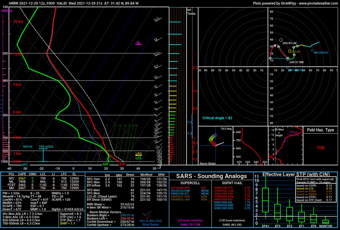
Here is a look at the forecast sounding from the HRRR computer weather model for this afternoon:

While there are a lot of things that look ominous in the data above, it doesn’t line up with what historical data suggests would give the region a better chance for severe weather – and in particular tornadoes.
Looking at some of the historical numbers on a box-and-whisker plot, you an see that the places where the data above applies, it doesn’t apply very well.

Notice that we only check 2 of the 6 boxes. We are close on others, sure. But these data suggest that we aren’t talking about a ‘Slam Dunk’ event for the area. It will be a bit of a boom or bust. In places where we can line up all of those parameters we have a better chance for severe weather to develop.
Looking at the Updraft Helicity Streaks, and most model guidance – across five different models – shows that most of the stronger storms will be north of I-20.
All of this means we have to do some mental gymnastics to explain for the forecast.
While there is the potential for severe weather (1) across the region today and tonight, the potential for any one specific storm to develop and become severe (2) is on the lower end of the scale. But if a storm does become severe (3) and is able to tap into some of the parameters shown above (4), it will have a chance to produce very heavy rain, frequent lightning, hail up to the size of half dollars, wind gusts up to 60mph, and the potential for produce up to an EF2 tornado.
So, the forecast is very conditional. There are the four outlined conditions above that we have to meet in order to have a true threat for severe weather. So the chance isn’t zero by any means, but it also isn’t a “good” chance, either.
Day to Day Forecast
Today
Mostly cloudy with scattered showers and storms this afternoon and evening. Highs in the lower 80s. Breezy. South winds 10 to 15 mph. The chance of rain 60-percent.
Tonight
Cloudy with chance of showers and thunderstorms. Lows in the upper 60s. The chance of rain 30-percent.
Thursday
Mostly cloudy with a few showers possible. Highs in the upper 70s. The chance of rain 30-percent.
Thursday Night
Partly cloudy. Lows in the mid 60s.
Friday
Mostly cloudy with a few showers possible. Highs in the upper 70s. The chance of rain 30-percent.
Friday Night
Mostly cloudy. Lows in the upper 60s.
New Years Day
Mostly cloudy with showers and storms possible. Some storms may be severe during the evening hours. Highs in the upper 70s. The chance of rain 70-percent.
Saturday Night
Showers and storms possible before midnight. Then turning much cooler. Lows in the mid 40s. The chance of rain 60-percent.
Sunday
Partly cloudy. Much cooler. Highs in the upper 40s.
Sunday Night
Mostly clear. Colder. Lows around 30.
Monday
Sunny. Highs around 50.
Monday Night
Mostly clear. Lows around 30.
Tuesday
Sunny. Highs in the upper 50s.

