The Storm Prediction Center has upgraded much of Mississippi and Alabama to an Enhanced risk (3 out of 5) this afternoon and evening. Much of this is because the severe weather parameters have increased with model guidance over the past several hours. Much of the Pinebelt along with parts of western Alabama should be on the alert for severe weather happening come this afternoon.
As the warm front moves northward towards northern Mississippi, much of the moisture inflow and potential temperature will increase in a wave as the day progresses. Dewpoints up to 70 degrees are a good indicator of some major inflow and with a slim line of discrete cells (like you can see from the Pearl River to Meridian above). These are ingredients for some incoming severe weather this afternoon.
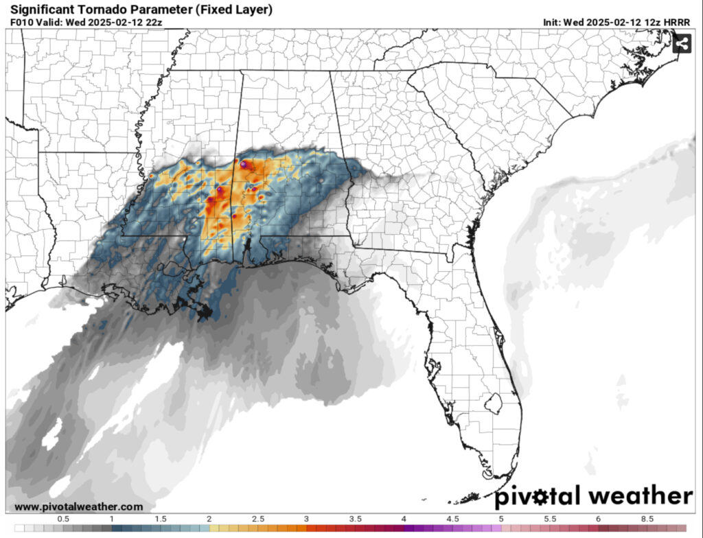
The discrete cells will develop after 12pm near the Pearl River border between MS/LA and move northeast. As the cells spread out, we’ll likely see storms along the MS/LA border around Marion County and they will move towards central Mississippi. They spread out laterally between I-55 and I-59 while they move north northeast. There is a chance of some tornadoes with these cells as they mature. Afterwards, there will be a more organized line of cells developing across the I-59 corridor around 3-5pm. These cells seem a little less matured than the ones before them, but I wouldn’t be surprised if some of these develop into supercells as they progress eastward. Afterwards, we will see the main line move in around 7-9pm and remain until after midnight.
The model data is constantly changing, however I think areas from the Hwy 98 corridor to I59 will see some discrete cells develop in the early afternoon with severe weather probable. Hail, wind gusts around 60mph, and tornadoes are all possible. As the cells develop around Hwy 84, we’ll have a similar story with cells maturing across much of central Mississippi and a higher chance of severe storms, this should be around 3-4pm. By 5pm, most of the Pinebelt, the Hwy 98 corridor and I-59 corridor will see a line of cells moving towards the east as the cold front propagates along towards central Mississippi. Afterwards, the main line will move in bringing some heavy rain and some other potential severe weather risks. Expect this to hit after 8pm and hang around till after midnight.
Keep your weather radio or your phone with you if you’re at work today and make sure to have a place to hide if severe weather approaches. This isn’t an outbreak kind of day, but I’m sure we’ll see some tornadoes possible along with strong winds and even hail in some areas.


