Happy Tuesday, everyone! Unfortunately, the heat will continue to stick around this week and not everyone’s going to get the opportunity at seeing some rain. Ridging is forecasted to dominate late this week into the weekend, so above average temperatures will be likely for all of us.
Rain Chances On Wednesday & Thursday
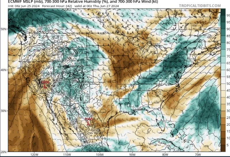
As of now, a weak stationary front extends along the Alabama-Mississippi state line that may provide a few showers west of the front, but most of us will stay dry today.
However, by Wednesday, there is an increased coverage of rain due to strong mid-level ridging placed over western Texas and a deepening longwave trough over the Mississippi River Valley. This will drive a boundary down and provide more convergence at the surface, dragging in higher moisture. As the boundary moves in from the northwest, rain chances are forecasted to be more scattered to numerous by the afternoon and evening hours.
Strong winds and small hail are possible in northern Mississippi, but confidence is pretty high that most of these storms won’t be severe. The best chance to see over 0.5″ of rain will be across northwest Mississippi with the rest of the forecast area being more hit or miss.
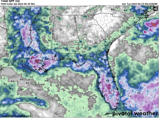
On Thursday, the boundary will continue to dive southward, but less oppressive heat and humidity are likely. Better storm chances will be southeast of the Natchez Trace near the Highway 84 and I-59 corridors. Similar to Wednesday, this will be more hit or miss, so areas closer to the coast will have a greater chance of seeing at least 0.5″ of rainfall.
Weekend Heat
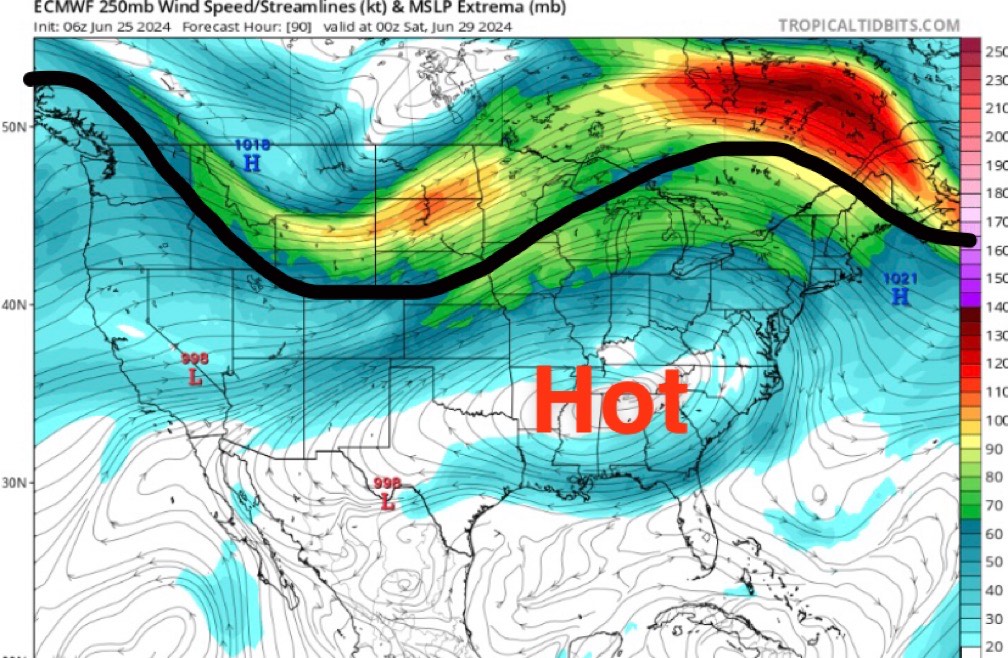
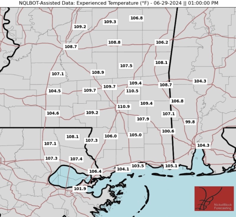
As the mid-level ridge continues to push east into the weekend, temperatures are forecasted to get even hotter with more sunshine likely. Most locations will be dealing with high temperatures in the mid to upper 90s with heat index values above 105 degrees.
Rising height lines, weak surface winds, and limited cloud cover are all ingredients for some intense heat, especially on Saturday and Sunday. Cities such as Laurel, MS and Hattiesburg, MS could see heat indices over 110F Saturday afternoon.
Regardless, it’s going to be HOT once again for the whole forecast area, so just another reminder to drink plenty of water, avoid time outside during the afternoon, wear lots of sunscreen, and keep a close eye on children and pets.
By early next week, a longwave trough is forecasted to move across the Great Lakes which could help return rain chances for our area.
A Glance At the Tropics
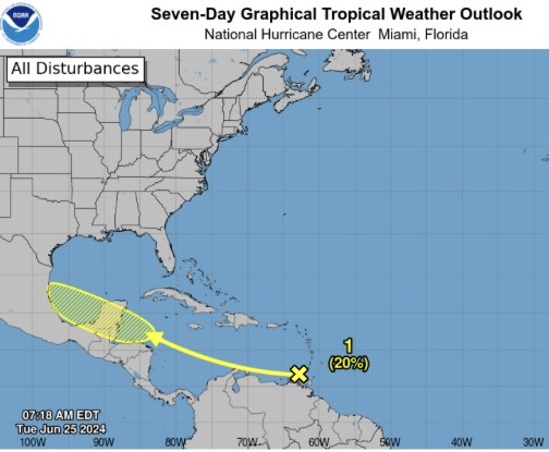
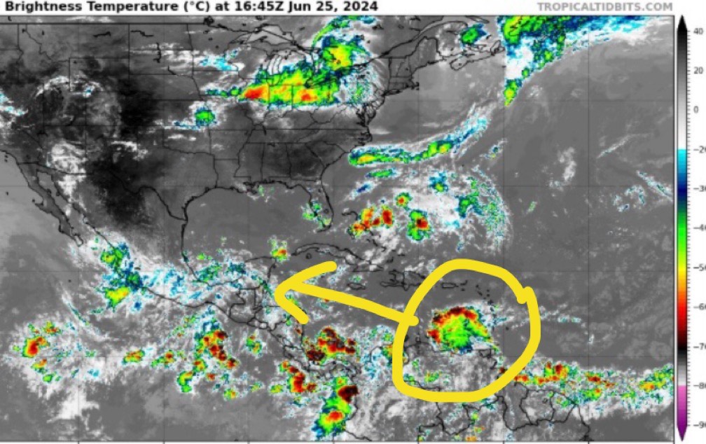
Currently, a disorganized area of showers and thunderstorms is just west of the Lesser Antilles. As it continues to move off to the west-northwest, conditions will be less favorable for development over the next few days. However, as this area approaches the western Caribbean, there should be less dry air, allowing for a slight chance of organization. Luckily, we have plenty of time to watch this, so continue to check the latest forecasts posted here.
Some models are hinting at a wave moving off the coast of Africa next week, but wind shear and dry air tend to disrupt these systems this early in the year. We’ll see if forecasts remain consistent with this area the rest of the week. Now is the time to review your hurricane plans while things are quiet.


