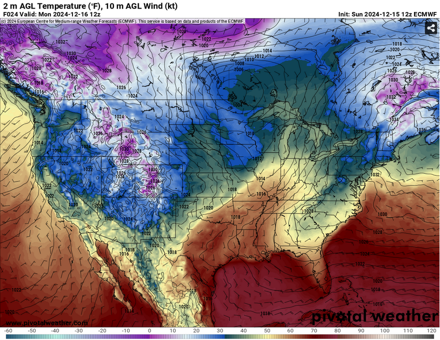
We’re shifting to a warmer weather pattern for the next several days as the remnants of a stout high pressure system in Quebec slowly move towards the Atlantic. Since the southeast is on the back side of this high, it’s going to be quite warm for this time of year, but that’s not too unusual. Let’s take a look.

//Courtesy: Pivotal Weather
A stalled front in the central Plains will slowly gain traction after a weak surface low moves in from the southern Rockies. In the upper levels, this is a fairly weak shortwave trough that moves it into our neck of the woods on Tuesday and Wednesday. This will bring in a more linear cold front that will rain across much of the eastern US and dissipate by the time it reaches the coastal South.
What this means for us is that temperatures will be warm from Monday into Wednesday. Temperatures will be in the low 70s and reach the mid 70s by Wednesday with lows in the mid to upper 50s. Not only that, we’ll see some foggy mornings ahead with barely any wind and plenty of moisture at the surface. Tuesday will be a chance for some isolated rain showers mainly north of Hwy 84. By Wednesday, the main system I mentioned earlier will move in across much of Louisiana, central and northern Mississippi and parts of Alabama.


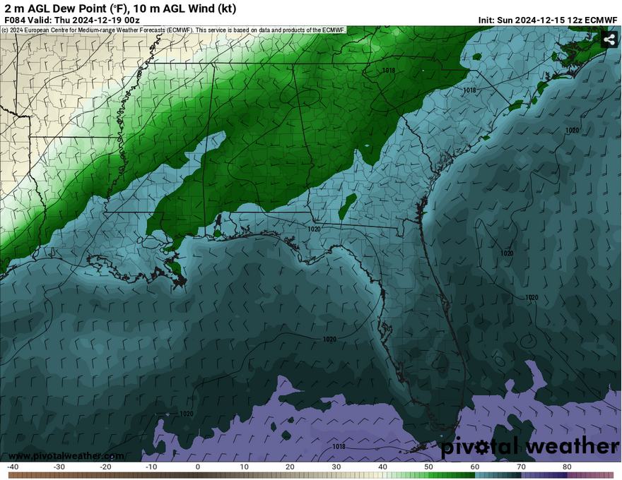
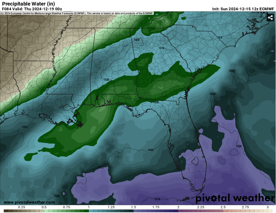
Taking a close look at Wednesday… it’s not looking like much. There’s a slim amount of precipitable water available and the saturation from the dewpoints is also pretty weak. Much of the northern parts of Mississippi and Alabama will see rain, but it’ll be fairly scattered by the time it gets to us. This looks to hit around mid-afternoon to early evening and pass by during the early night hours. Afterwards, winds will shift to the north indicating the cold front’s arrival.

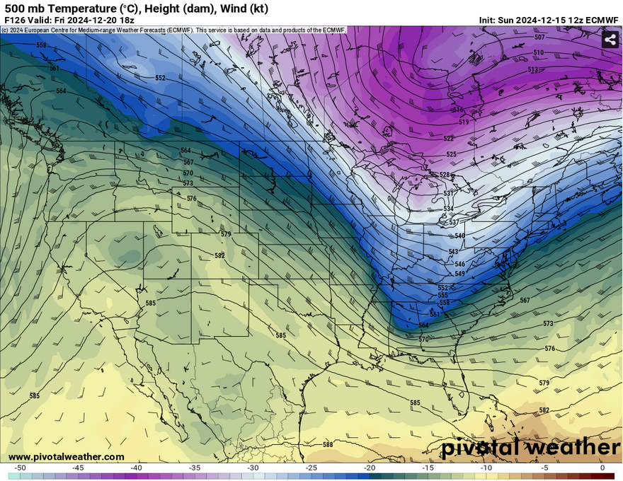
Thursday will be a cooler one with temperatures in the upper 50s to low 60s. Winds will pull from the north and another shortwave trough will bring us colder weather by Friday evening. Temperatures will reach the upper 50s during the day and dip close to the freezing point by Saturday morning. By Sunday, we’ll be in a much cooler weather pattern with temperatures in the upper 40s to low 50s during the day and well below freezing (mid to upper 20s) by early morning. I wouldn’t be surprised if there’s a hard freeze watch or warning for most of us by Sunday.
Hope you all have a good week ahead!
Select Data Set:

Regional Day-to-Day Forecast
This Afternoon – Partly sunny, with a high in the low 70s. Southeast wind around 5 mph.
Tonight – Mostly cloudy, with a low in the mid 50s. Southeast wind around 5 mph becoming calm in the evening.
Monday – Patchy fog between 7am and 9am. Otherwise, mostly cloudy, with a high in the mid 70s. South southeast wind around 5 mph.
Monday Night – Mostly cloudy, with a low in the mid 50s. Calm wind.
Tuesday – Mostly sunny, with a high in the mid to upper 70s. Calm wind becoming south southeast around 5 mph.
Tuesday Night – Patchy fog after 8pm. Otherwise, partly cloudy, with a low in the mid 50s. Calm wind.
Wednesday – A 20 percent chance of showers after noon. Patchy fog before 9am. Otherwise, mostly sunny, with a high in the mid 70s. Calm wind becoming west around 5 mph in the afternoon.
Wednesday Night – A 20 percent chance of showers before midnight. Partly cloudy, with a low in the mid 40s. North wind around 5 mph.
Thursday – Sunny, with a high in the low 60s. North northeast wind around 5 mph.
Thursday Night – Clear, with a low around 40.
Friday – Sunny, with a high in the upper 50s to low 60s.
Friday Night – Clear, with a low around 34.
Saturday – Sunny, with a high in the mid to upper 50s.

