I’m back on US soil and up and at it nice and early this morning. So! Let’s break down the forecast.
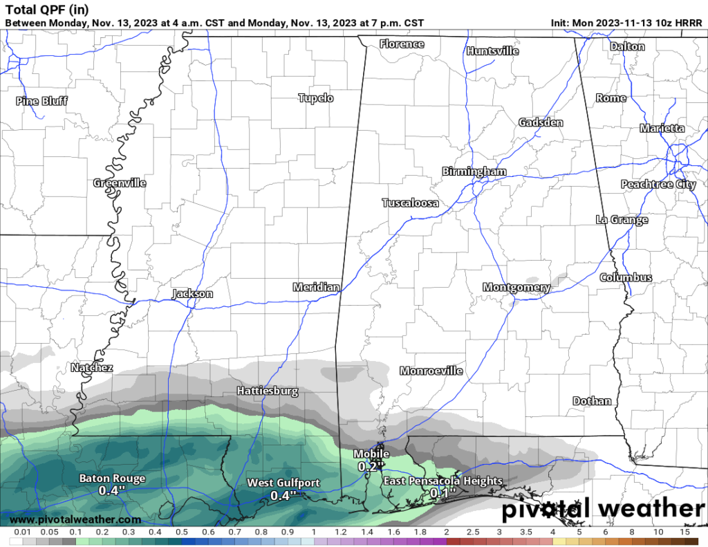
There’s this low-pressure system and a shortwave ridge leading to some interesting weather during the next few days, making the flow over the Lower Mississippi River Valley region a bit all over the place. As this low cruises over Texas today, it’s gonna create a surface low near the Gulf Coast, bringing rain to the coastal zones. Inland might not get as much action, but we’re looking at some sprinkles turning into light rain. The chances of getting 0.25 inches or more of rain by tomorrow morning along the US Highway 84 corridor are about 50-60 percent. Oh, and expect northeast winds and mostly cloudy skies. That’s the scoop for today and tonight.

Who’s excited for some more rain? We’re talking serious rain potential that could help out with the ongoing drought.
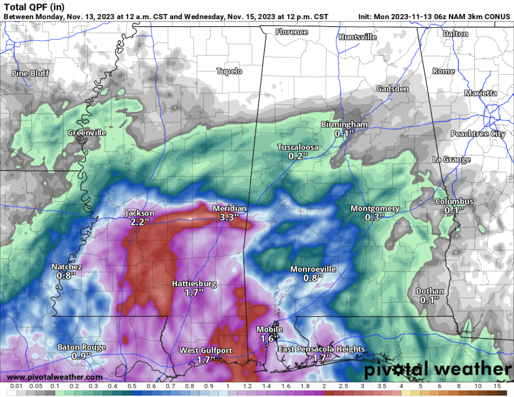
Noah mentioned this over the weekend, the NWS noted this in their morning discussion, and I’ve got to say I’m pretty onboard, too. High-res guidance is saying we’ve got a 70-90% chance of rain across our neck of the woods by Tuesday evening. You’re looking at the shot for 1 to 3 inches of rain. Good news for the drought situation!

Rain keeps coming on Wednesday as moisture flows in. Models are a bit wishy-washy, but we’re leaning towards the wetter side, pushing our rain chances up to about 70% east of I-55.
By Thursday, the rain eases up as the low moseys east toward the Florida Panhandle. Friday might bring some scattered showers, especially up north, and the weekend looks dry thanks to a high-pressure buddy in the Central Plains.
High temperatures each day this week will be around 60F to 65F, given the cloud cover an anticipated rainfall. This weekend, we should warm back to around 70F
But wait, there’s more – next week might see another round of showers with a low-pressure system on the High Plains. Models aren’t totally on the same page, so we’re keeping an eye on things.
Fingers crossed for some good, soaking rain!

