Normally I’d say, it’ll be a great, dry and sunny Fall day. However, the clear skies aren’t doing us any favors in the moisture department. Our relative humidity is gonna be stuck between 20 to 30 percent, which is not good news for our ongoing drought situation.
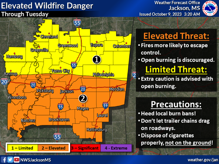
And speaking of that, we’re gonna have to keep an eye on the fire danger situation. It’s gonna stay “elevated” through Tuesday, especially for areas along and south of Interstate 20.

Looking ahead to Tuesday through Sunday, we can expect dry conditions to persist through Tuesday. An upper-level low-pressure system will maintain the dry offshore flow originating from the Gulf Coast. Although moisture levels might see a slight uptick on Tuesday, we should remain vigilant about the fire danger due to low humidity in the afternoon.
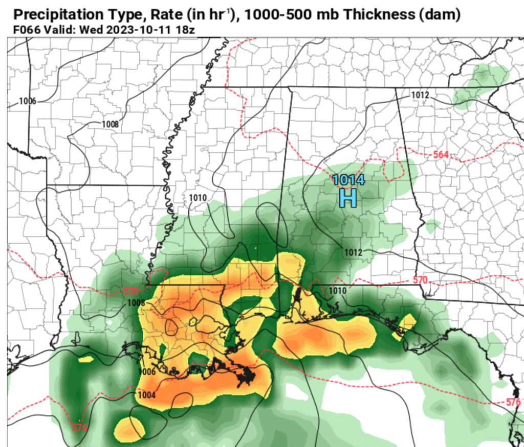
As we move into Tuesday night and Wednesday, the atmospheric dynamics become more complex. There’s the potential for the development of a low-pressure system along the Gulf Coast, influenced by shortwave troughs. While model forecasts are somewhat uncertain, it appears that we may experience some morning rain. Consequently, temperatures might struggle to reach 70 degrees, partly due to the rain and the northward progression of the warm front.


With a noticeable increase in atmospheric moisture, the formation of this low-pressure system could result in appreciable rainfall. Although there is a Marginal Risk for excessive rainfall in southeast LA and southeast MS, we’re not sounding the alarm for flash flooding at this point. However, we’re closely monitoring the situation.
Towards the end of the week, a low-pressure system advancing eastward across the Central U.S. will usher in a trough passage to the north of our region on Friday. Unfortunately, it appears that the moisture won’t have ample time to recover before the arrival of the cold front.
Consequently, the likelihood of thunderstorms remains low, and any precipitation accompanying the front will be relatively light. It is looking like back to seasonably cool temperatures – and dry conditions – for the weekend following the passage of this cold front.
REGIONAL DAY TO DAY FORECAST
Today: Sunny. Highs in the lower 80s. Southwest winds 5 to 10 mph.
Tonight: Clear in the evening, then becoming partly cloudy. Lows in the lower 50s. Southwest winds around 5 mph.
Tuesday: Partly sunny. Highs in the mid 80s. Southwest winds around 5 mph.
Tuesday Night: Mostly cloudy. with a few showers possible. Lows in the lower 60s. South winds around 5 mph. Chance of rain 20 percent.
Wednesday: Cloudy with a 60 percent chance of showers. Cooler with highs in the lower 70s.
Wednesday Night: Mostly cloudy with a 30 percent chance of showers. Lows around 60.
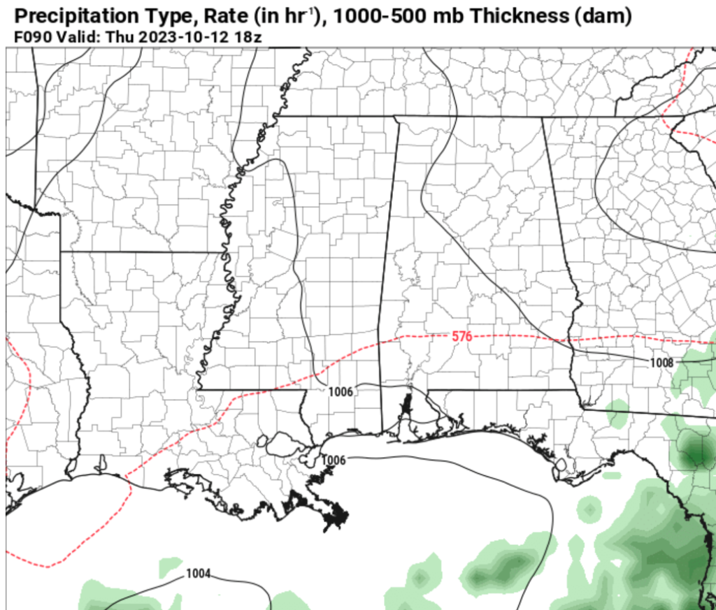
Thursday: Mostly cloudy with a few morning lingering showers. Not as cool with highs in the lower 80s. Chance of rain around 20 percent.
Thursday Night: Mostly cloudy. Lows in the upper 60s.
Friday: Partly sunny. Highs in the upper 80s.
Friday Night: Partly cloudy. Lows in the lower 60s.
Saturday: Sunny, cooler with highs in the upper 70s.
Saturday Night: Mostly clear. Cooler with lows in the lower 50s.
Sunday: Sunny. Highs in the mid 70s.

