It looks like today will be relatively calm with passing showers and rumbles of thunder here and there. Then tomorrow there is the potential for some severe weather – including large hail and tornadoes.
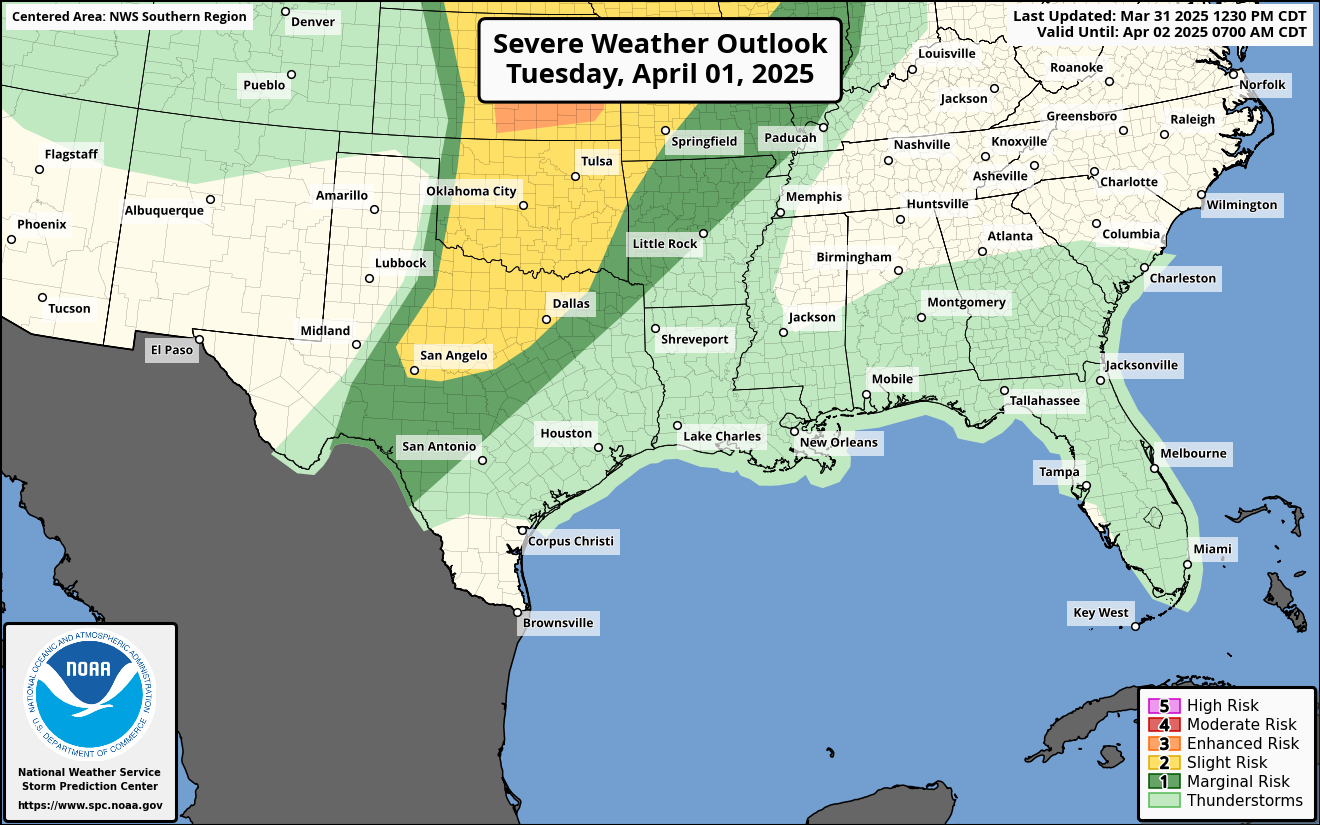
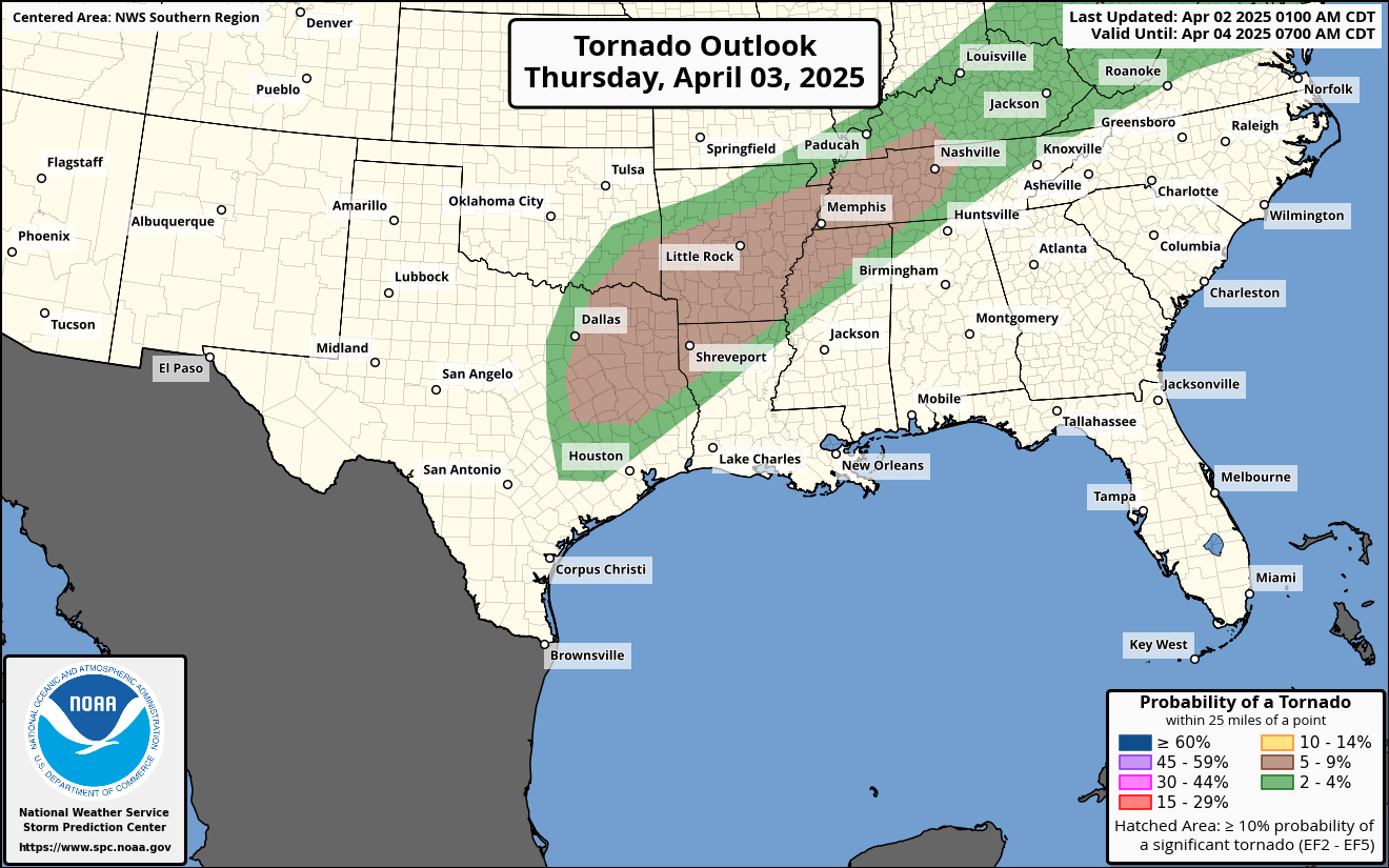
The STorm Prediction Center has increased our risk to a Moderate Risk, that is a “4” ont eh 1-to-5 scale where “5” is the highest risk for the most significant severe weather. They have also outlined the area with a 15% risk for a tornado with an increased risk for strong tornadoes.


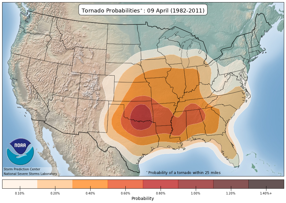
A 15% risk may sound pretty small, but that is the SPC’s way of saying that the potential for a tornado is 15x to 20x higher than a normal severe weather setup would provide.

And the threat for any type of severe weather is about 5x to 8x normal.
Here are the take-home points from the SPC:
- A Moderate Risk of severe thunderstorms is identified in central and southern Mississippi (MS), eastern Louisiana (LA), and southwest Alabama (AL), with the potential for numerous to widespread severe thunderstorms beginning Wednesday morning. The forecast anticipates many tornadoes, including strong ones (EF2-EF3 caliber), and widespread damaging wind events with significant severe gusts.
- The severe weather event is associated with a southern-stream shortwave trough over west Texas, which will phase with a northern-stream wave, leading to an amplified trough near the Mississippi Valley. This setup will increase flow through the troposphere and support the development of a surface cyclone moving northeastward from eastern Texas towards the Lower Ohio Valley.
- In the Central Gulf Coast/Deep South, particularly from the morning to afternoon on Wednesday, there is a high likelihood of severe storms, including a nocturnal tornado and wind threat persisting into Wednesday night across southern Alabama, the Florida Panhandle, and southwest Georgia. Conditions conducive to severe weather include a mix of strong low-/deep-layer shear and moderate buoyancy, driven by a surge of moisture and moderately steep mid-level lapse rates.
- An intense Quasi-Linear Convective System (QLCS) is expected to develop and spread east-northeast during the afternoon, with the potential for embedded supercells and bowing segments leading to tornadoes and damaging winds. Uncertainty exists regarding the northern extent of the severe threat due to varying environmental conditions.
I know the Number 1 question will be: “Will they go to a High Risk?”
Maybe? I don’t know that it will change the impacts, though. Whether it is “high” or “moderate” the end result will be a chance for storms during the day with the potential to see severe weather and potentially significant severe weather, at that.
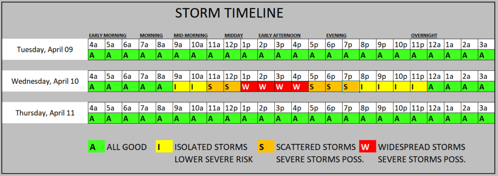
Looking at the timeline, it looks like this will be a mid-morning through evening event.

On top of the threat for severe weather there will also be the chance for some flash flooding. Model guidance is showing 2″ to 4″ of rain likely across the area with some spots pick up 6″ of rain possibly. And a few select spots could see up over 8″ of rainfall.
A quick breakdown for impacts looks like this:
EVERYONE — Brief heavy rain, some lightning, wind gusts up to 45mph
MOST FOLKS — A few rounds of brief heavy rain, brief localized flash flooding, lightning, wind gusts up to 50mph
SOME SPOTS — A few rounds of extended heavy rain, brief flash flooding, a lot of lightning, wind gusts up to 60mph, small hail
FEW PLACES — A few rounds of extended heavy rain, brief flash flooding, a lot of lightning, wind gusts up to 70mph, ping-pong ball sized hail
VERY SELECT LOCATIONS — A few rounds of extended heavy rain, brief flash flooding, a lot of lightning, wind gusts up to 80mph, ping-pong ball sized hail and a tornado (up to EF4 in strength)
Not everyone will see the worst of the worst. It will only be a select few locations. But since we can’t pinpoint who and where will see the worst of the weather, it is important that you prepare for the worst and hope for the best.
REGIONAL DAY TO DAY FORECAST
Today: Partly sunny this morning, then becoming mostly cloudy. Highs in the upper 70s. Southeast winds 10 to 15 mph with gusts up to 25 mph. A 10 percent chance for a shower or storm. Severe weather is unlikely.
Tonight: Mostly cloudy. Lows in the mid 60s. Southeast winds 15 to 20 mph with gusts up to 30 mph.
Wednesday: Showers likely with a chance of thunderstorms in the morning, then showers with thunderstorms likely in the afternoon. Some thunderstorms may be severe. Locally heavy rainfall possible in the afternoon. Highs in the mid 70s. Southeast winds 15 to 20 mph with gusts up to 30 mph. Chance of rain near 100 percent.
Wednesday Night: Showers and thunderstorms likely, mainly in the evening. Some thunderstorms may be severe. Lows in the upper 50s. South winds 15 to 20 mph, becoming southwest 10 to 15 mph after midnight. Chance of rain 70 percent.
Thursday: Mostly sunny and breezy and less humid with highs in the mid 70s. West winds 15 to 25 mph with gusts up to 40 mph.
Thursday Night: Clear, cooler with lows in the upper 40s.
Friday: Sunny. Highs in the upper 70s.
Friday Night: Mostly clear. Lows in the upper 40s.
Saturday: Sunny. Highs in the lower 80s.
Saturday Night: Mostly clear. Lows in the lower 50s.
Sunday: Mostly sunny. Highs in the lower 80s.
Sunday Night: Partly cloudy. Lows in the upper 50s.
Monday: Mostly sunny. Highs in the mid 80s.

