Things are starting to dry out a bit as we head through the next few days.. And that may be a welcomed change for some folks. The official rain gauge on the year is sitting about half-a-foot ahead of schedule. So, the area has been mighty wet so far in 2021.
As high pressure builds into the area it is going to ‘cut off the spigot’ so to speak.
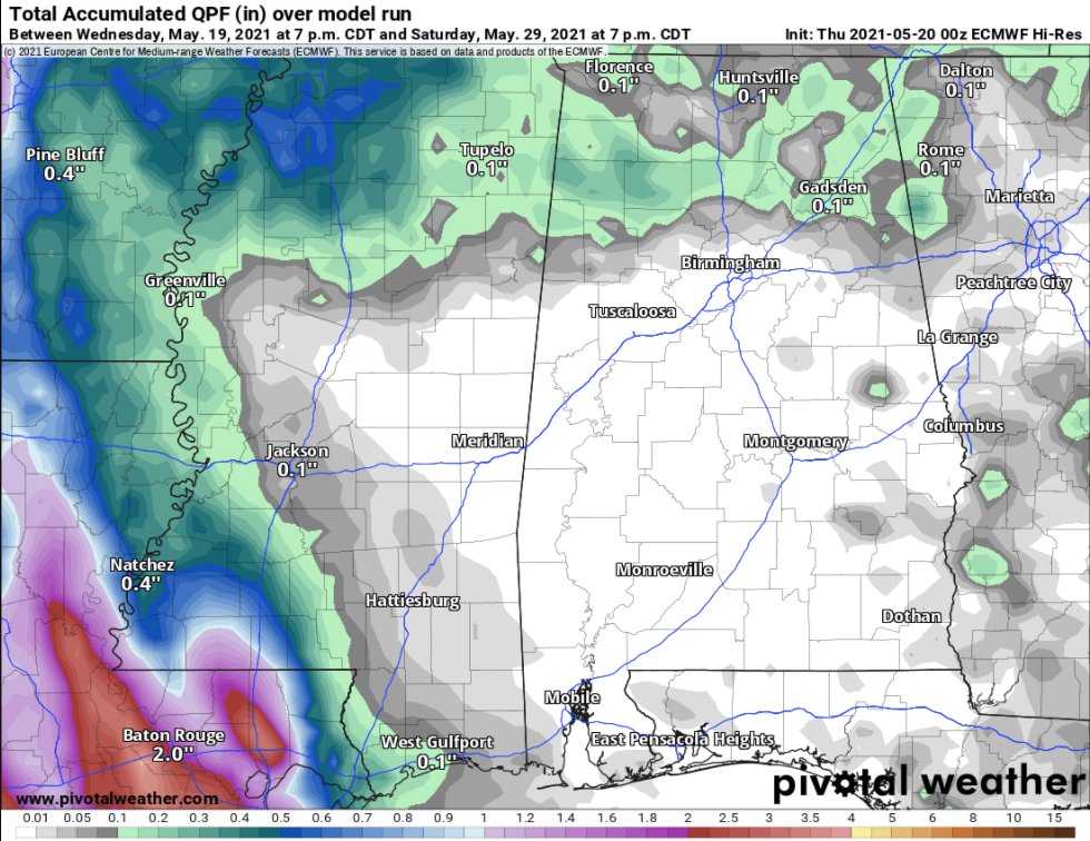
The ECMWF (above) shows very little rainfall to speak of during the next few days. And outside of a 20- to 30-percent chance for rain today, it looks like the area should be dry into and through the weekend and even through most of next week.
Day-by-Day Forecast
Today
Partly cloudy with chance of showers and slight chance of thunderstorms. Highs in the lower 80s. Southeast winds 10 to 15 mph. Gusts up to 25 mph in the afternoon. The chance of rain 20-percent.
Tonight
Partly cloudy. Lows in the mid 60s. Southeast winds 5 to 10 mph.
Friday
Pasing cirrus and cumulus clouds. Highs in the mid 80s. Still a bit breezy with southeast winds 10 to 15 mph.
Friday Night
Partly cloudy. Lows in the mid 60s. East winds around 5 mph.
Saturday
Mostly sunny. Highs in the upper 80s. East winds 5 to 10 mph.
Saturday Night
Partly cloudy. Lows in the lower 60s.
Sunday
Mostly sunny. Highs in the upper 80s.
Sunday Night
Mostly clear. Lows in the mid 60s.
Monday
Sunny. Highs around 90..
Monday Night
Mostly clear. Lows in the mid 60s.
Tuesday
Sunny. Highs around 90.
Tuesday Night
Partly cloudy. Lows in the mid 60s.
Wednesday
Increasing clouds, but still nice. Highs around 90.
In the Tropics
Over in the Tropics, there is an area of interest from the National Hurricane Center. They are currently monitoring an area of disturbed weather near Bermuda.
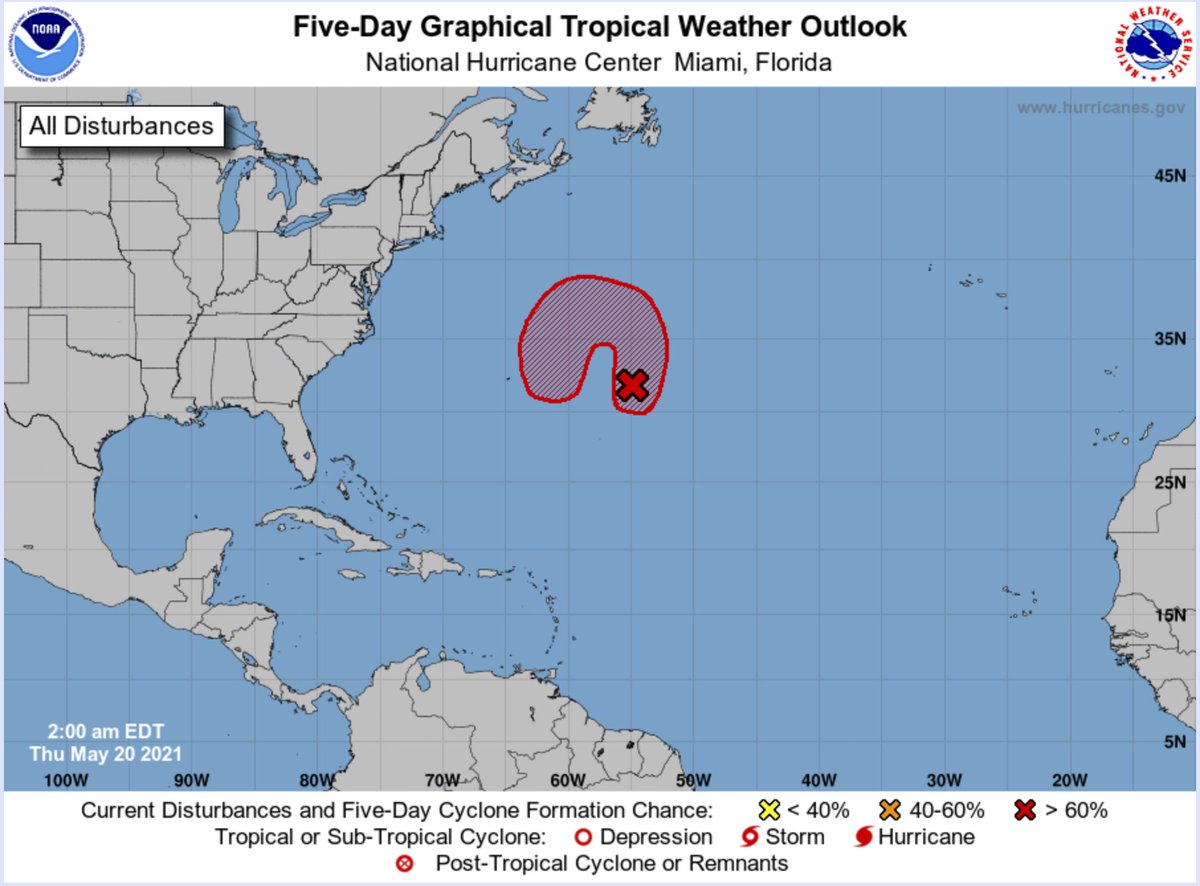
This doesn’t really pose any threat to the United States. But it may swirl around near Bermuda and develop into a sub-tropical system.
From the NHC:
Tropical Weather Outlook
NWS National Hurricane Center Miami FL
200 AM EDT Thu May 20 2021
For the North Atlantic…Caribbean Sea and the Gulf of Mexico:1. A non-tropical low pressure system has developed within a broad area of cloudiness and thunderstorms about 600 miles east-southeast of Bermuda. The low is expected to develop gale-force winds later today while it moves generally northward. The low is forecast to move westward and southwestward over warmer waters on Friday, and will likely become a short-lived subtropical cyclone near and to the northeast of Bermuda on Friday. The system is expected to move toward the north and northeast into a more hostile environment by late Sunday into Monday. For more information on this developing low pressure area, please see High Seas forecasts issued by the NOAA Ocean Prediction Center and forecast products issued by the Bermuda Weather Service.
* Formation chance through 48 hours…medium…50 percent.
Courtesy: nhc.noaa.gov
* Formation chance through 5 days…high…80 percent.
Looking at the model data, Jim Cantore tweeted out a slick little loop that shows what this area is pegged to do by the models:
And while this may ‘feel’ like, “Oh no! It is starting early! That means it will be a bad season!” that isn’t necessarily the case. We have had early-season systems form in many years since 2000, and only two have been super-active. Others have been duds.
That is the good news about early-season development: It isn’t a ‘sign’ of anything.


That’s right on the early season storms. In 2006, seems like, we had one or two pretty early in the season and we thought ‘oh no, another 2005’, but it turned out to be a ‘so-so’ season. Glad to see you back. Hope all went well for your sister’s wedding!