More rain in the forecast for today as the area is sandwiched between Elsa to the east and a mid-level low to the west. That plus an extra boost in low-level moisture means it may end up being a bit of a soggy day.
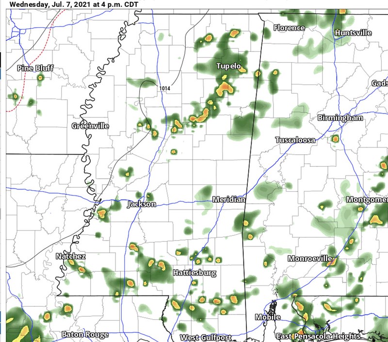
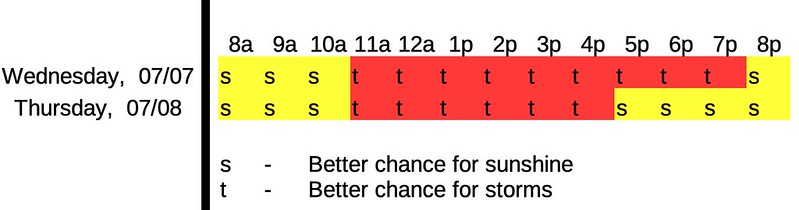
But it won’t be a complete washout. It looks more like on-again-off-again showers that will be hit-and-miss from about 11a through about 8p.
Daily Timeline
Day-to-Day Forecast
Today
Showers and thunderstorms. Mostly cloudy. Highs in the mid 80s. The chance of rain 80-percent.
Tonight
Mostly cloudy with slight chance of showers ending by midnight. Lows in the lower 70s.
Thursday
Partly cloudy with a 30-percent chance for rain. Highs in the upper 80s.
Thursday Night
Partly cloudy. Lows in the lower 70s.
Friday
Passing clouds with a 50-percent chance for rain. Highs in the upper 80s to around 90.
Friday Night
Partly cloudy. Lows in the lower 70s.
Saturday
Mostly sunny with a 30-percent chance of showers and thunderstorms. Highs around 90.
Saturday Night
Partly cloudy. Lows in the lower 70s.
Sunday
Mostly sunny with a 40-percent chance of showers and thunderstorms. Highs around 90.
Sunday Night
Partly cloudy with a 20 percent chance of showers and thunderstorms. Lows in the lower 70s.
Monday
Mostly sunny with a 30-percent chance of showers and thunderstorms. Highs in the lower 90s.
Monday Night
Partly cloudy. Lows in the lower 70s.
Tuesday
Mostly sunny with a 30-percent chance of showers and thunderstorms. Highs in the lower 90s.
Graphical Forecast


