Happy Friday and the first day of the 2024 Olympics; I hope your week went well. For us on the Gulf Coast, the wet weather pattern that has been soaking the region for the past week is expected to continue for the next several days. Although our temperatures have been below average this past several days, our rainfall trends have been the same, with daily showers and thunderstorms. This trend is expected to continue as we approach the end of the month before a major shift in the weather pattern next week.
More rain is expected this afternoon
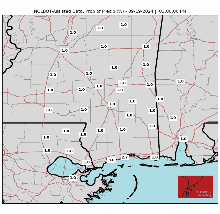
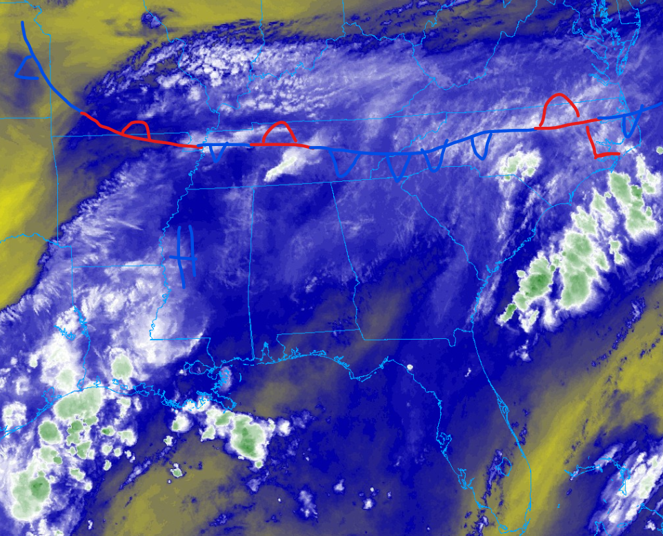
If you are done with the relentless rainfall, I am sorry to say that the rainfall trend is expected to continue today. Our friendly upper-level low-pressure system that has parked itself in Eastern Texas has allowed for moisture to be drawn in from the Gulf of Mexico. Since we had above-average temperatures this past June, the Gulf is extremely warm and prime for convective storm development. There is also a stationary front parked to the north of us, allowing the upper-level low to stay put, as well as keeping the area very unstable. I am expecting rainfall to start by the early afternoon hours, with some heavy downpours expected. Areas along the coast and further west should expect rainfall first, while areas inland will need to wait until this evening for a shot at rainfall. Some flooding is expected in areas that receive heavy rainfall due to the already-soaked ground.
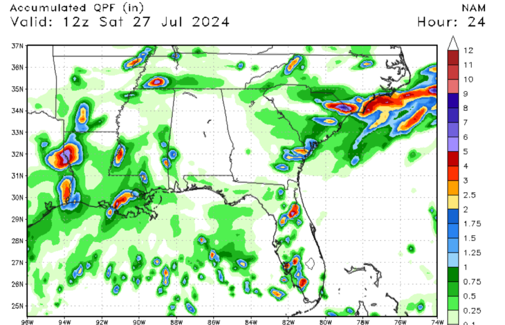
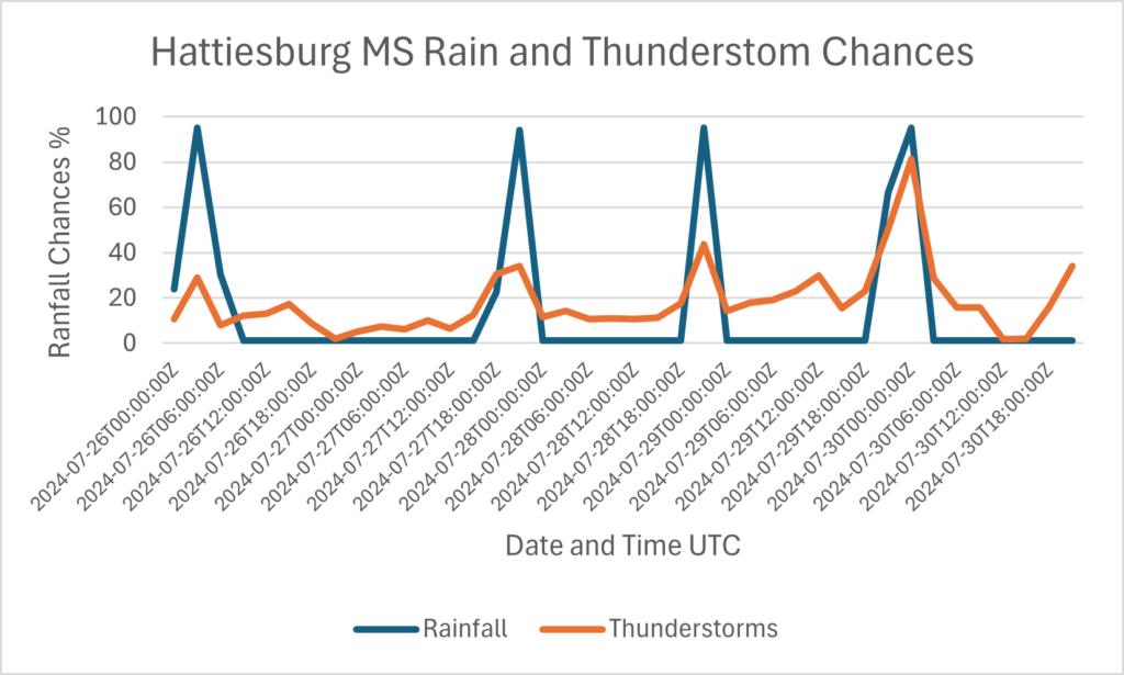
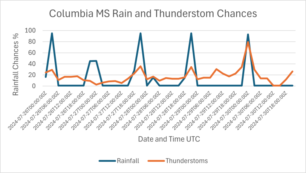
Looking at how much rainfall is expected over the next 24 hours, most of the area should see anywhere between 0.10 inches for our northern communities to over 2 inches for areas west of New Orleans, LA. Because of the positions of the upper-level low in Eastern Texas, areas further west should expect more rainfall. As typical with thunderstorms, frequent lightning is expected with these storms. Remember that lightning can be dangerous, so make sure to seek shelter in a sturdy building if you hear thunder. In terms of our temperature forecast, today’s highs will depend on the number of storms this afternoon. I expect high temperatures for today to only be in the mid to upper 80s, as the numerous showers will keep our temperatures lower. Looking at the next several days, our rainfall chances will be high, as shown in the graphs below.
Will the rain stop


If you are just sick of the relentless rainfall, I do have some good news: we should see a major change in the weather pattern for next week. The upper-level low pressure to our west and the stationary front to the north is expected to move back to the north. This will allow for high pressure to move back to the region, lowering our rainfall chances by next week. I still do expect some convective showers along the coast next week, but they will be much more scattered in nature. Although our rainfall chances will decrease, our temperatures are expected to climb back into the 90s next week.
A look in the tropics

Looking at the tropics, there are no tropical storms expected in the next several days. There are a few areas of tropical moisture that are moving off the coast of Africa, showing me that there is a high level of moisture in the area. Although there is a lot of moisture moving across the Atlantic, there is also a lot of windshear in place, which hinders tropical development. So, for now there is little concern for tropical development.


