No major changes to the forecast. Still looking rather damp.
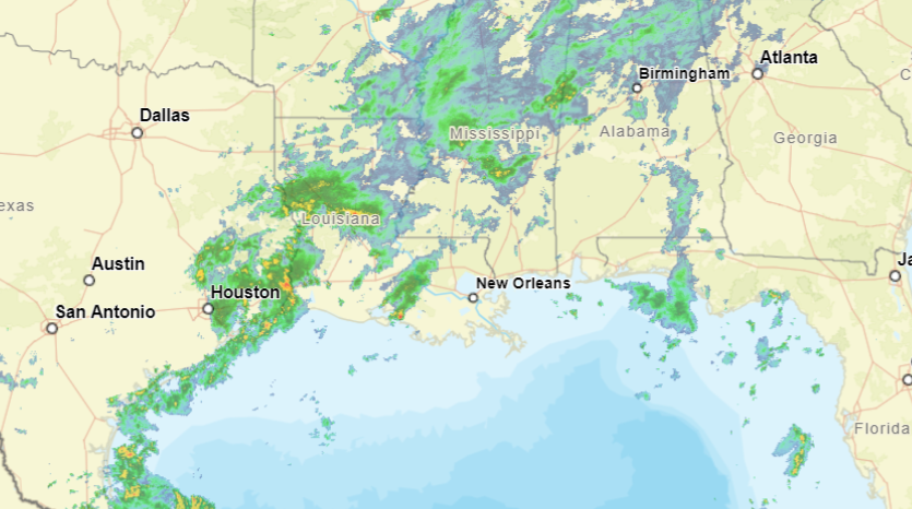
There are showers and a few rumbles of thunder out there this morning as you get up and moving. Radar shows more rain stretching from Houston to Lake Charles, too, and that is expected to spread northeast.
With PWAT values (a measure of available moisture in the atmosphere to rain out) still well above normal and plenty of instability (a measure of the atmosphere’s ability to make clouds and storms) we are still looking at the chance for localized flash flooding today and tomorrow. And likely through the weekend. Severe weather is less likely, but cannot be completely ruled out.
In short, Doge says:
And given the high PWATs and plentiful instability trying to pinpoint when a storm forms where is an even bigger exercise in futility.
A high-pressure system will begin to build over the area this weekend, leading to slightly warmer temperatures. But with the ridge anchored in the Gulf, it may still allow some Gulf moisture to ozze this direction.
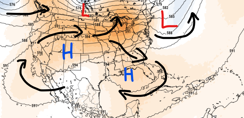
Temperatures will gradually rise, potentially causing limited heat stress early next week, though confidence in this forecast is low due to the ongoing rain and storm chances. Overall, expect continued muggy conditions typical for summer.
Further into the future, it looks like by the ned of next week we may have something to keep tabs on in the Tropics near the NW Caribbean.
REGIONAL DAY-TO-DAY FORECAST
Today: Showers and thunderstorms. Highs in the upper 80s. East winds around 5 mph, becoming southwest around 5 mph this afternoon. Chance of rain 90 percent.
Tonight: Mostly cloudy. A chance of showers and thunderstorms in the evening. Lows in the lower 70s. North winds around 5 mph in the evening, becoming light and variable. Chance of rain 30 percent.
Thursday: Mostly sunny. A slight chance of showers and thunderstorms in the morning, then showers and thunderstorms likely in the afternoon. Humid with highs around 90. Northeast winds around 5 mph, becoming northwest around 5 mph in the afternoon. Chance of rain 70 percent.
Thursday Night: Partly cloudy. A slight chance of showers and thunderstorms in the evening. Lows in the lower 70s. Northeast winds around 5 mph in the evening, becoming light and variable. Chance of rain 20 percent.
Friday: Mostly sunny. A chance of showers and thunderstorms in the afternoon. Highs in the lower 90s. Northeast winds around 5 mph, becoming southeast around 5 mph in the afternoon. Chance of rain 40 percent.
Friday Night: Partly cloudy. Lows in the lower 70s.
Saturday: Mostly sunny. Showers and thunderstorms likely in the afternoon. Highs in the lower 90s. Chance of rain 60 percent. Heat index values up to 105.
Saturday Night: Mostly cloudy in the evening, then becoming partly cloudy. Lows in the mid 70s.
Sunday: Mostly sunny. A slight chance of showers and thunderstorms in the morning, then showers and thunderstorms likely in the afternoon. Highs in the lower 90s. Chance of rain 60 percent. Heat index values up to 110.
Sunday Night: Mostly cloudy with a slight chance of showers and thunderstorms in the evening, then partly cloudy after midnight. Lows in the mid 70s. Chance of rain 20 percent.
Monday: Mostly sunny. A chance of showers and thunderstorms in the morning, then showers and thunderstorms likely in the afternoon. Highs in the lower 90s. Chance of rain 70 percent. Heat index values up to 105.
Monday Night: Partly cloudy. A slight chance of showers and thunderstorms in the evening. Lows in the lower 70s. Chance of rain 20 percent.
Tuesday: Mostly sunny. A chance of showers and thunderstorms in the morning, then showers and thunderstorms likely in the afternoon. Highs in the lower 90s. Chance of rain 60 percent. Heat index values up to 105.
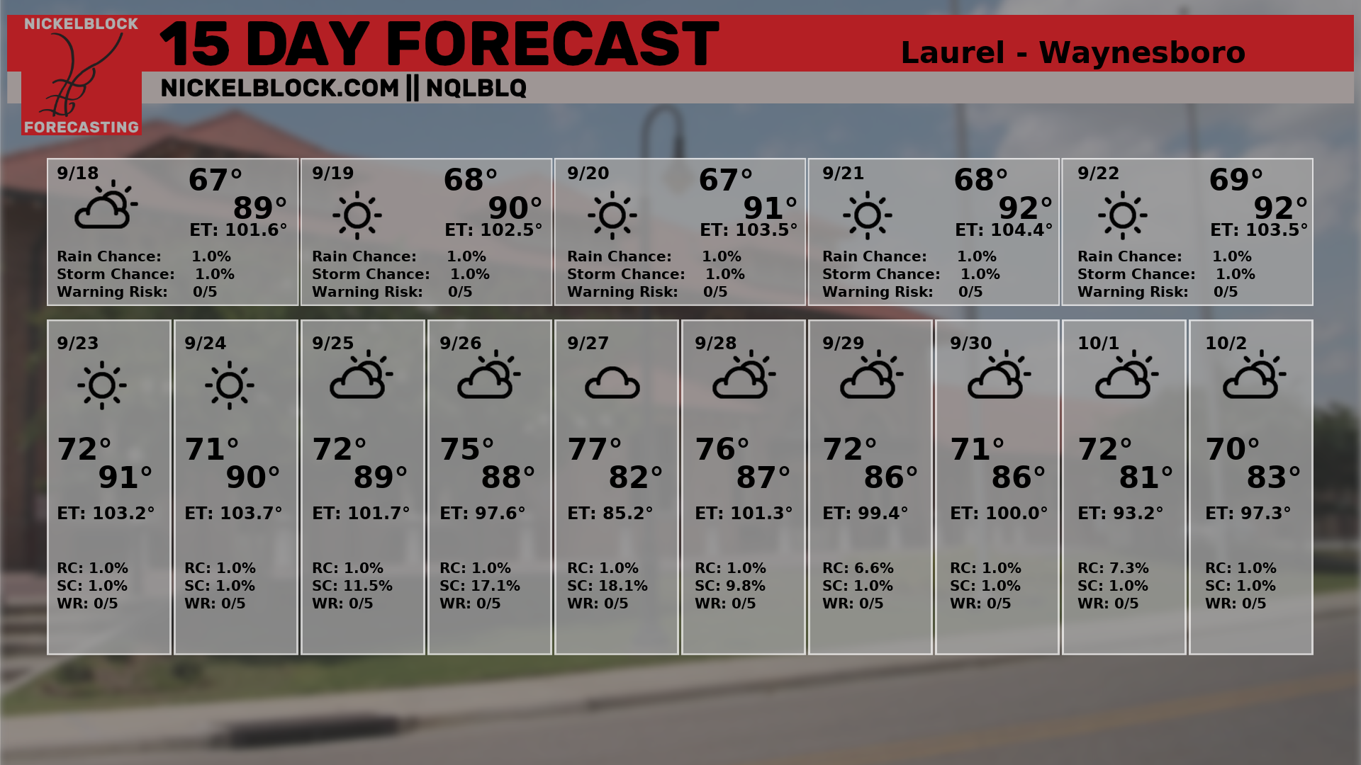
SPECIFIC 15-DAY FORECAST