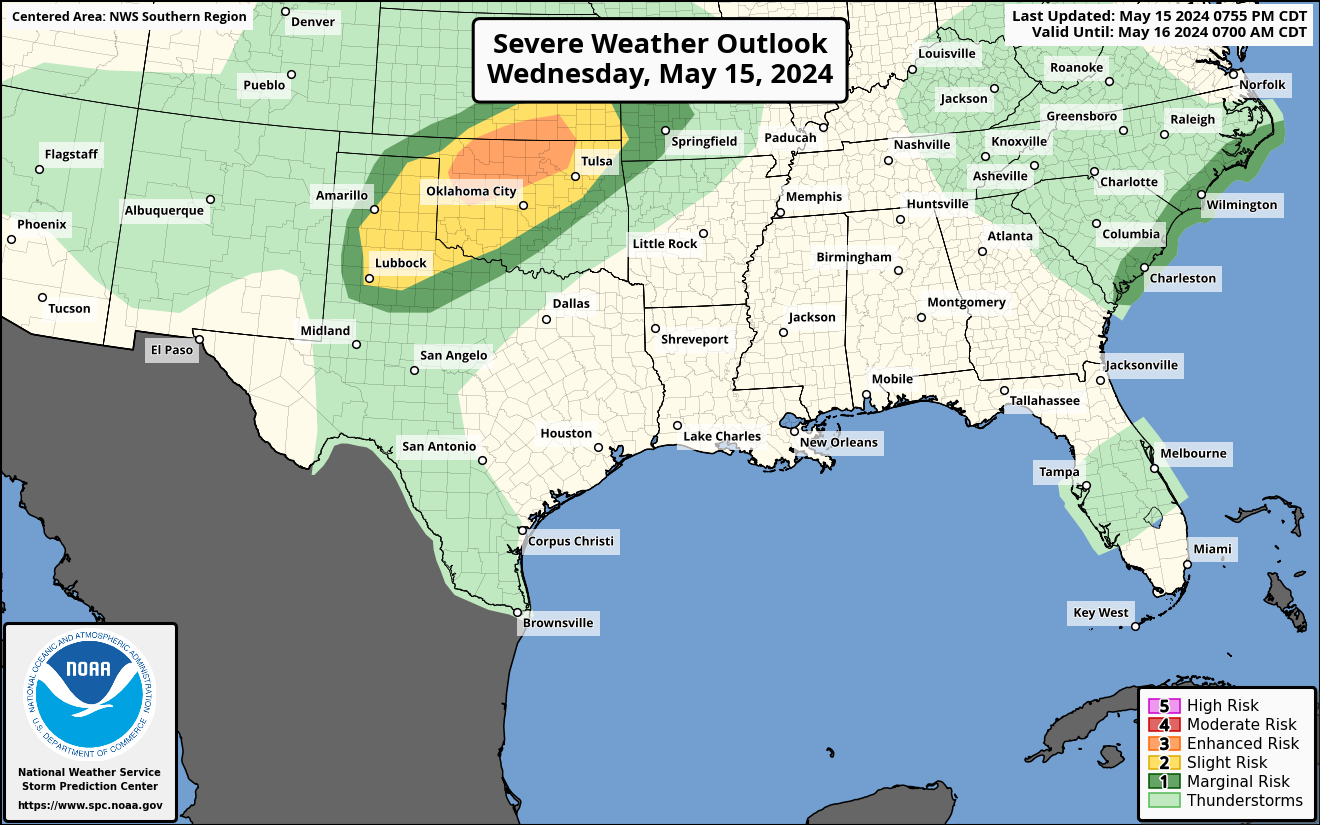
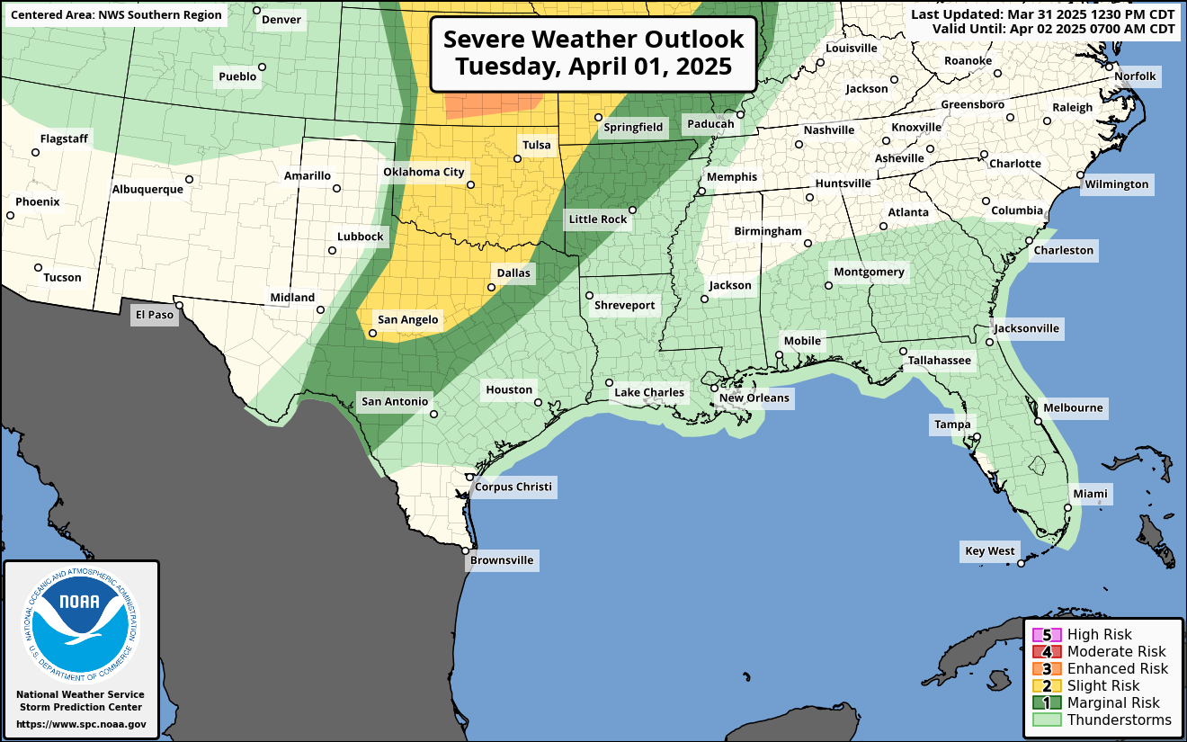
We are still looking at the potential for some severe weather on Friday morning as well as a shot of cold air as we move into next week. So the “story” is the same, but the details of the story have shifted slightly.
First, let’s talk about the severe risk. Today and tomorrow there is a Slight Risk for severe weather across the area. That is a “2” on the 1-to-5 scale where “5” is the highest risk for the most significant severe weather.


The reason for the risk is the anticipation of a line of showers and storms that will be moving through the region Friday morning.


As the cold front kicks through it will push a broken-up line of storms across the area between about 7am and 1pm. On the maps above, the line of storms looks a bit more robust than I think it will end up being. And there is a chance for some storms to fire ahead of the line, but right now that threat looks limited.
I know a lot of people like to know, “How does this compare to last time?”
And while I don’t like comparing weather systems because each event is unique, it looks like the ceiling on this event is slightly lower and the storms may not be as widespread.
And that is reflected in the SPC Risk being one category lower.
There is also some question about just how warm and humid we get before the front kicks through. And, unlike last time, where the closer we got, the warmer it looked… In this case, the closer we get the cooler it looks. And that would also help to limit the severe weather threat.
Once we get through the storms, we get a calmer weekend and then we get into a shot of colder air arriving on Monday and into Tuesday and Wednesday. Right now it looks like any precipitation would arrive before the real cold….


…. However, I think there is a higher-than-normal risk for the cold air to undercut some of the precipitation and offer the chance for some wintry precip for parts of the area on Tuesday. Any risk of this would be higher to the north and much lower to the south. And any risk right now is still very low, but it isn’t zero.
Beyond the shot for precip it does look like Tuesday and Wednesday mornings will be quite chilly. Wednesday morning in particular looks rather cold with model guidance a bit split, but showing temperatures in the 20s (at least).
That kicks out of the area on Thursday and we should moderate by the weekend abck to around normal.
REGIONAL DAY TO DAY FORECAST
Thursday: Partly sunny. Not as cool with highs in the upper 60s. Southeast winds 5 to 10 mph.
Thursday Night: Mostly cloudy. Showers likely with a slight chance of thunderstorms after midnight. Not as cool with lows in the mid 50s. Temperature rising into the lower 60s after midnight. Southeast winds 15 to 20 mph. Gusts up to 30 mph, increasing to 40 mph after midnight. Chance of rain 70 percent.
Friday: Mostly cloudy with showers likely with a chance of thunderstorms in the morning, then sunny in the afternoon. Breezy with highs in the lower 70s. Temperature falling into the lower 60s in the afternoon. South winds 15 to 25 mph, becoming west 20 to 25 mph in the afternoon. Gusts up to 50 mph. Chance of rain 70 percent.
Friday Night: Clear. Much cooler with lows in the lower 30s. Northwest winds 10 to 15 mph with gusts up to 30 mph.
Saturday: Sunny. Much cooler with highs in the mid 50s.
Saturday Night: Partly cloudy in the evening, then becoming mostly clear. Cold with lows in the lower 30s.
Sunday: Sunny. Highs in the lower 60s.
Sunday Night: Partly cloudy in the evening, then becoming mostly cloudy. Lows in the upper 30s.
Martin Luther King Jr Day: Partly sunny. A slight chance of showers in the afternoon. Cooler with highs in the lower 50s. Chance of rain 20 percent.
Monday Night: Partly cloudy. A slight chance of rain showers in the evening before the cold arrives. Much colder with lows in the mid 20s. Chance of rain 20 percent.
Tuesday: Sunny, cooler with highs in the lower 40s.
Tuesday Night: Partly cloudy. Cold with lows in the lower 20s.
Wednesday: Mostly sunny. Highs in the upper 40s.


Thanks so very much Nick, for taking the time to still cover and protect The Pine Belt. Your weather forecast is the one I trust the most!