We’re currently stuck between two battling systems. The high pressure system in the Gulf of Mexico will stay put while a trough will move further northeast bringing increasing rain chances closer to mid-week. For the next couple of days we’ll have some approaching shortwave troughs with some southwest flow to enhance our chances for rain.

From this afternoon until Friday, we’ll see a myriad of rain chances, mainly in the afternoon. While there’s a more potent high pressure system setting up in the northeast US, a clash with the trough in the Plains will allow for moisture flow to occur from the Gulf. Our highest chances for rain look like Monday and Wednesday. The good news is that there doesn’t look to be any severe weather, but some of the storms could become stronger depending on how they develop. Most of these storms look to be around the Pinebelt.
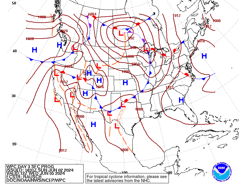
The low pressure system will likely send an MCS our way on Wednesday before it dissipates and moves further north towards Canada. This looks like a fairly organized line that could bring some heavy rain and gusty winds in the afternoon to evening. The cold front looks to organize and move in during the late week into the weekend with rain chances reducing into the weekend.
Temperatures will build into the low 90s during the week with heat indices reaching up to 100 during the day. We may see a day of relief after the cold front moves out during the weekend, but this looks to be short lived with the high pressure system building right after, so be sure to bring water and electrolytes with you during the day.
Regional Day-to-Day Forecast
This Afternoon – Scattered showers and thunderstorms, mainly before sunset. Partly sunny, with a high in the mid 80s. South wind around 5 mph. Chance of precipitation is 40%.
Tonight – Isolated showers and thunderstorms before sunset. Partly cloudy, with a low in the upper 60s. Calm wind. Chance of precipitation is 10%.
Monday – Scattered showers and thunderstorms, mainly in the afternoon. Mostly sunny, with a high in the upper 80s. Calm wind becoming south around 5 mph in the afternoon. Chance of precipitation is 40%.
Monday Night – A 40 percent chance of showers and thunderstorms before midnight. Mostly cloudy, with a low in the low 70s. South wind around 5 mph becoming calm.
Tuesday – A 30 percent chance of showers and thunderstorms in the afternoon. Partly sunny, with a high near 90. Light southeast wind becoming south 5 to 10 mph in the morning.
Tuesday Night – Partly cloudy, with a low in the low 70s. South wind around 5 mph becoming calm in the evening.
Wednesday – A 20 percent chance of showers and thunderstorms after 1pm. Mostly sunny, with a high in the low 90s. Calm wind becoming south southwest around 5 mph in the morning.
Wednesday Night – A 20 percent chance of showers and thunderstorms. Mostly cloudy, with a low in the low 70s. South southwest wind around 5 mph becoming calm in the evening.
Thursday – A 40 percent chance of showers and thunderstorms, mainly in the afternoon. Mostly sunny, with a high in the low 90s. Calm wind becoming west around 5 mph in the morning.
Thursday Night – Mostly clear, with a low in the low 70s.
Friday – A 20 percent chance of showers and thunderstorms. Sunny, with a high in the low to mid 90s.
Friday Night – Mostly clear, with a low in the upper 60s.
Saturday – Sunny, with a high in the low 90s.


