Looking ahead to Wednesday night, and it looks like that will be the best bet for storms across the region. So I wanted to run you guys through some of the early data as well as an update on the data.
On the weather setup side of things, as a semi-stalled boundary pools moisture south of it, it should create a reasonable pocket of unstable air to pop off storms ahead of – and along – a cold front set to push through Wednesday night and through Thursday.
And given the air in place, it looks like we may have a better shot for some severe weather to break out.
THE DATA
The latest 12z ECMWF weather model shows a line of storms pressing across the area Wednesday between about 3p and Thursday morning at 3a. Moving from West to East.
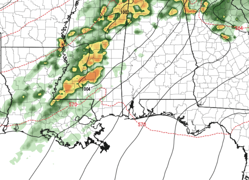
The Skew-T data from the ECMWF model suggests a pretty potent atmosphere, primed for the development of rotating updates and the possibility for a few tornadoes. The GFS data is less aggressive with the severe potential Wednesday afternoon and evening, and instead pushes the timeline back about 6 to 12 hours and has storms rolling through during the overnight hours.
The CIPS Analogs out of Saint Louis University shows a 5% tornado risk for the area. That means we are about 25-times more likely to see a tornado from this potential setup than on any typical, normal day.
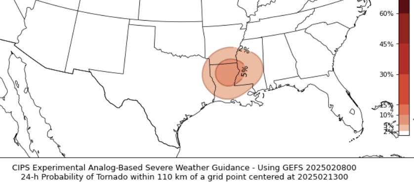
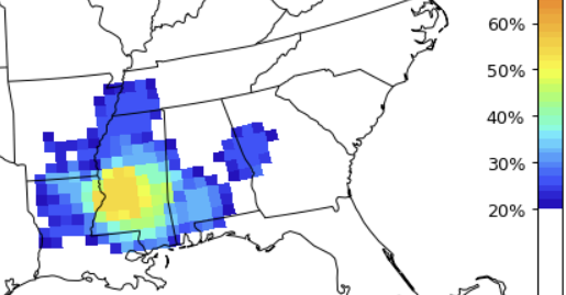
Looking at the analog table to identify the last time we had a similar setup to this one, and there are some dates that stand out – including Feb 11, 2013. That would be the hattiesburg EF4 tornado day. The percentages from the CIPS data for “any severe” event is closer to 50 or 60 percent. That means there is a 50-to-60 percent chance that some sort of severe weather event (hail, wind, tornado) occurs in the yellow/orange area on the map. .
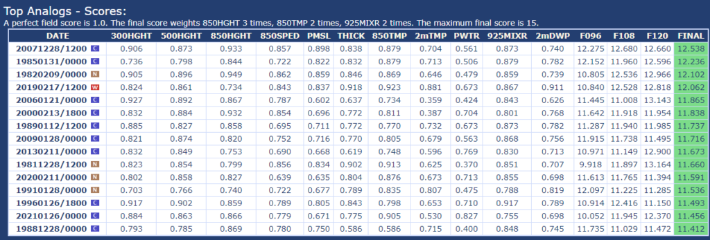
Keep in mind, just because we have a similar setup, doesn’t necessarily mean we see similar results. But it does mean that all of the ingredients are there for a repeat performance.
The Karrie Meter is currently at a 4.33. Generally that converts back to a “2” on the Storm Prediction Center scale, where “5” is the highest risk for the most significant severe weather.
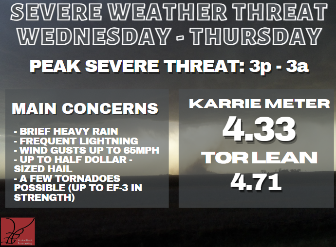
And the “Tor Lean” value is only slightly higher than the Karrie Meter which suggests that the environment isn’t overly conducive than normal for tornado development.
THE BOTTOM LINE
I think we will see the Storm Prediction Center start to highlight our area with a potential for severe weather on Wednesday as early as tomorrow and probably through the next few days. The main concern will be heavy rain and gusty wind, but given some of the analogs and the data from the model guidance, I would say there is als the risk for a few tornadoes. And potentially a chance for a strong tornado or two, as well.
The timeline on this is between Wednesday afternoon and the pre-dawn hours on Thursday, but there is still some wiggle room on exactly when the worst of the weather will develop and when it may pass by your house. But I would keep tabs on Wednesday night through Thursday morning as your window of opportunity.


