11:30AM UPDATE:
The SPC has extended the Enhanced Risk farther east.

ORIGINAL:
The front, this morning, continues to move through parts of Texas. In fact, the line of storms is set to move through Houston shortly after Rush Hour over here. After that, it’ll march across Louisiana, Mississippi and Alabama through this afternoon, evening and into the overnight hours.
The SPC has issued an Enhanced Risk for severe weather across parts of southern Louisiana. A Slight Risk and Marginal Risk are issued elsewhere.

The Enhanced Risk area is likely a result of some of the overnight model guidance showing a corridor of potential stronger storms across southern Louisiana and may lift northeast into western and southern Mississippi. While the “Enhanced” area does not currently include any counties of Mississippi, I wouldn’t be surprised if that changes.
All of that being said, that corridor is going to be dependent on a few things. Including how far inland the secondary warm front makes it and how far the storms outrun the cold front.
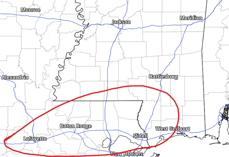
Based on the latest data, though, I would say the corridor for the strongest storms to develop is going to be inside the red circled area below.

The main threats from storms today will be heavy rain, frequent lightning, wind gusts up to 65mph, hail up to the size of quarters, and the potential for a tornado (up to EF2 in strength).
Karrie Meter
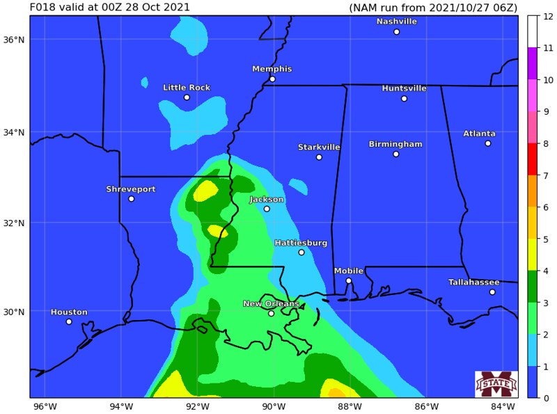
The Karrie Meter isn’t as impressed with this system as the SPC.


The Karrie Meter continues to show the highest numbers off the coast. But, I think in this case, it may be under-doing the risk a bit. While it isn’t perfect, It does have a really good track record of success, so I can’t simply ignore it.
I’ll continue to monitor trends this morning and, if needed, post an update on the Karrie Meter this afternoon.
Storm Timeline
Most of the showers and storms will be possible starting early afternoon through the late evening. It looks like overnight storms will be possible, but not likely at this point. The cluster of storms along the front will likely out-run the front itself and arrive a bit earlier.

Day to Day Forecast
Today
Mostly cloudy with storms likely. Some severe. Main threats will be heavy rain, lightning, gusty wind, small hail, and a tornado or two cannot be ruled out. Highs around 80. The chance of rain 70-percent.
Tonight
Mostly cloudy with storms possible through midnight, then clearing. Lows around 60. The chance of rain 70-percent.
Thursday
Partly cloudy. Highs in the lower 70s. West winds 10 to 15 mph. Gusts up to 25 mph in the afternoon.
Thursday Night
Partly cloudy. Lows in the lower 50s.
Friday
Partly cloudy. Cooler. Highs in the upper 60s. West winds 10 to 15 mph.
Friday Night
Partly cloudy. Lows around 50.
Saturday
Sunny. Highs in the upper 60s.
Saturday Night
Mostly clear. Lows in the upper 40s.
Sunday
Sunny. Highs in the lower 70s.
Sunday Night
Clear. Lows around 50.
Monday
Sunny. Highs in the lower 70s.
Monday Night
Mostly clear. Lows around 50.
Tuesday
Sunny. Highs in the mid 70s.
Graphical Forecast


Thanks
Thank you. I miss the Carrie meter