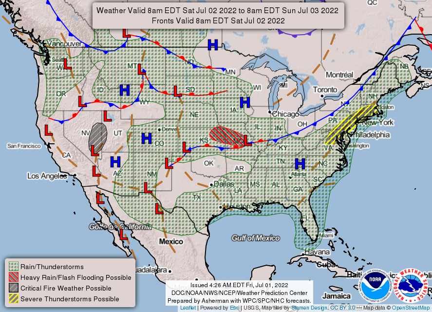
More of the same pattern is expected for a while. Isolated to scattered thunderstorms will continue to be triggered by daytime heating. The low pressure disturbance over Louisiana formerly known as Invest 95L will also help increase storm chances as it drifts to the northeast. The big picture shows that showers and storms are expected for most all of the Southeast. There is a frontal boundary draped across the Ohio Valley into the Plains that is confining a tropical airmass to the Southeast and Mid-Atlantic. This airmass contains high dew points with the highest being near the coasts. Drier air exists behind this front that will push through to the Northeast in the coming days.

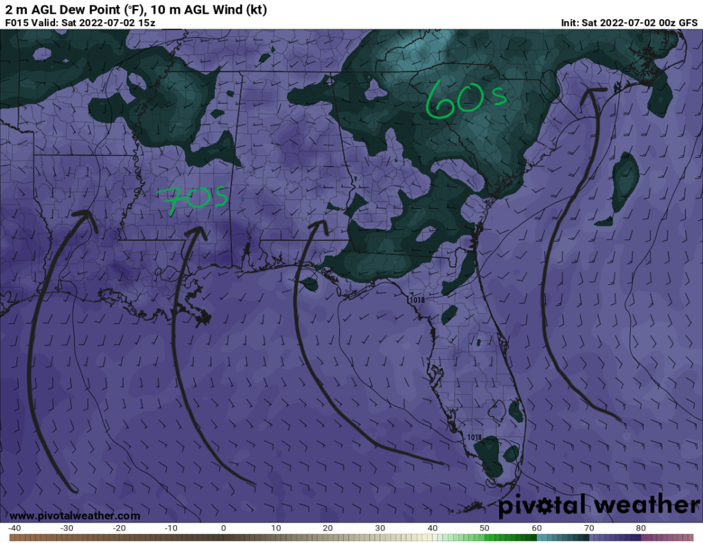
Closer to home near the Central Gulf Coast, southerly flow as a result from the Bermuda high in the Western Atlantic is advecting moisture northward from the Gulf of Mexico. Dewpoints the 70s for the region in addition to precipitable water values more than 2″ will aid in the development of afternoon thunderstorms. Similar to the past couple of days, once the sun sets, daytime heating will be lost and instability will decrease to result in a decreased coverage of storms. Temperatures for Saturday will be in the upper 80s and lower 90s across the region. Storm activity will help cool off the area with rainfall that will also keep heat indices down too.

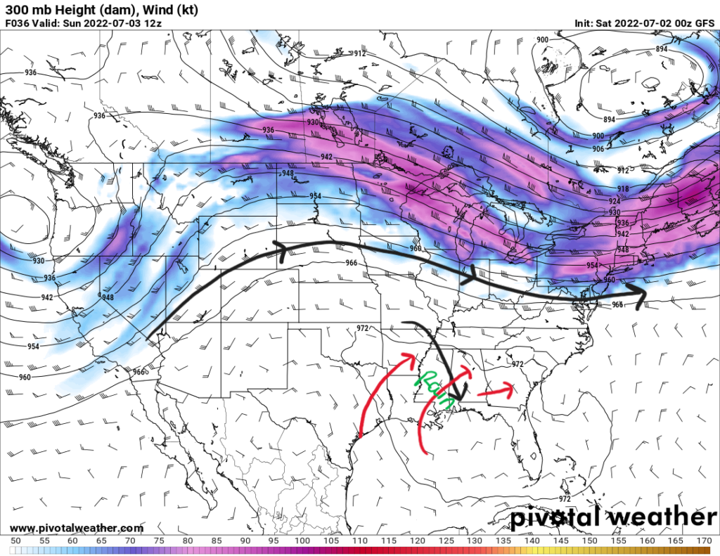
Sunday will be similar to Saturday with scattered storms in the area. Aloft, the upper-level ridge will shift slightly to the east to usher in northwesterly flow. In the morning, that aforementioned trough disturbance will make its way into the MS/AL border to force some showers and storms inland in the morning. The upper-level flow should aid in storm motion to southeast. Rainfall rates will be highly dependent on where storms pop up and how fast they move. Some places could see 0.5″ to 1″ of rain Saturday through Monday.

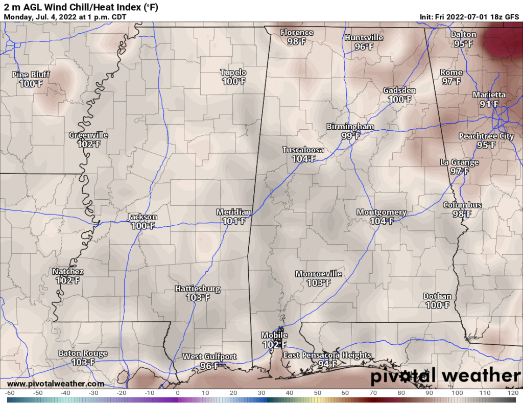
Heading to Independence Day, temperatures will begin to increase to the upper 90s, which coupled with dewpoints still in the mid-to-upper 70s will prompt heat indices to rise past 100F. From NWS Jackson, heat stress will see a limited risk (1/4) for the region on Monday. So, during your 4th of July activities, plan to bring lots of water and try your best to stay in the shade.

In addition to the heat, there still exists the chance of isolated to scattered thunderstorms diurnally driven. As you head out to the festivities, keep an eye on the radar here to stay safe and out from the rain and lightning. Throughout the rest of next week, isolated storms will continue in a similar fashion with the heat returning slightly.
Day-to-Day Forecast
Saturday
Cloudy with a 70-percent chance of isolated to scattered thunderstorms in the late morning, afternoon and evening hours. High temperatures will be in the upper 80s and overnight lows in the low 70s.
Sunday
Mostly cloudy with a 50-percent chance of isolated storms in the late afternoon and evening hours. Highs in the upper 80s and low 90s with lows in the mid 70s.
Monday
Mostly cloudy with a 40-percent chance of precipitation. Highs in the mid 90s with heat indices reaching past 100F. Lows in the mid 70s.
Tuesday
Partly cloudy with a 40-percent chance of precipitation. Highs in the mid 90s with heat indices around 105F. Lows in the mid 70s.
Wednesday
Partly cloudy with a 40-percent chance of precipitation. Highs in the mid 90s with heat indices around 105F. Lows in the mid 70s.
Thursday
Partly cloudy with a 40-percent chance of precipitation. Highs in the mid 90s with heat indices past 100F. Lows in the mid-to-upper 70s.
Friday
Partly cloudy with a 30-percent chance or precipitation. Highs reaching the upper 90s and the heat index past 100F. Lows in the mid-to-upper 70s.

