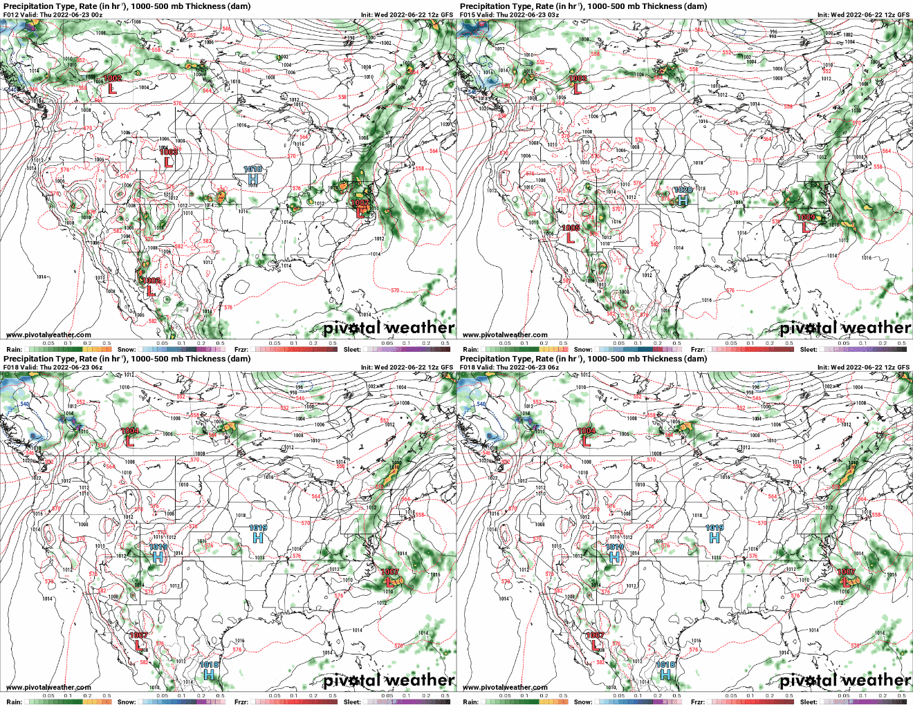
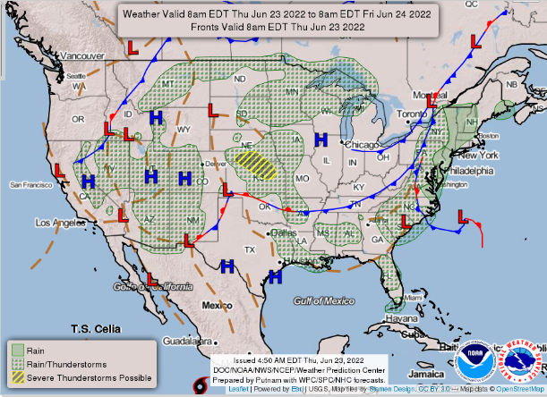
Hello everybody, With the high-pressure systems still staying in the south will bring warmer temperatures and drier weather for the south. While there are two low pressure system from west coast and east coast will bring more precipitation and slightly cooler temperatures in those regions.

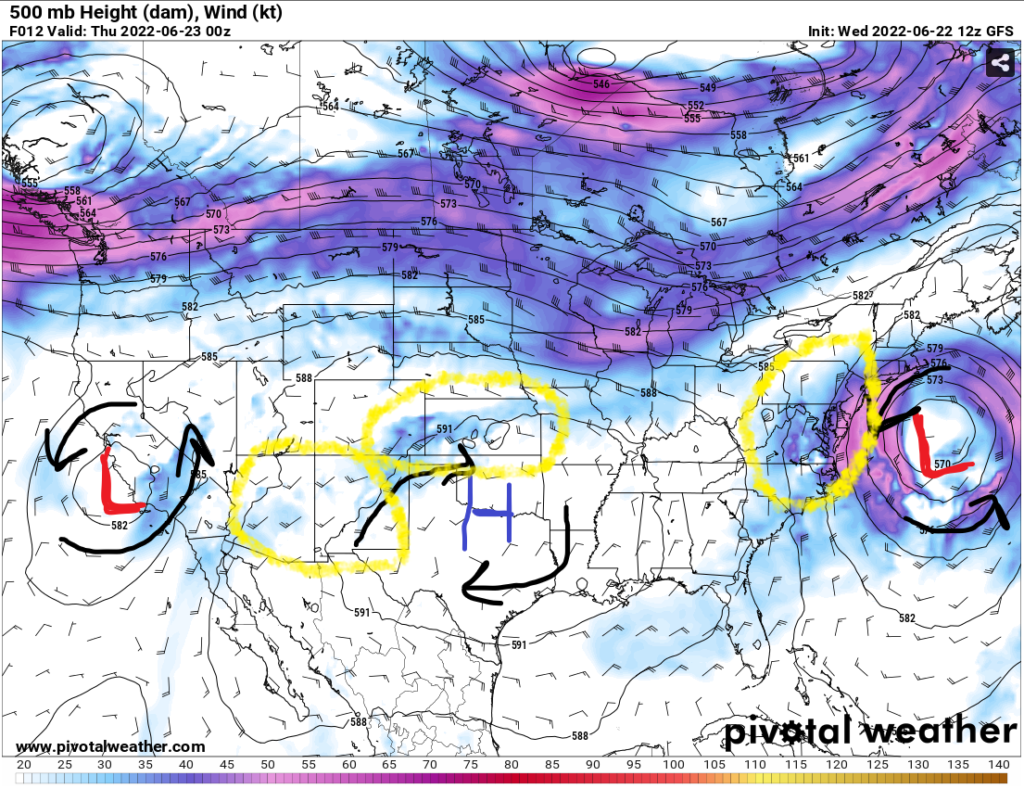
In the yellow circles, on the map above, show the three main concerns for any severe weather or widespread rain. The three areas are (1) the low-pressure system in the east coast, (2) isolated thunderstorms at Kansas, and (3) the monsoon rain continues in the Four Corners states.
The east coast low will move out from the east coast to the Atlantic Ocean at end of the day. The pacific low will continue to move into the central plains in the weekend.

Monsoon Four Corners States and Kansas severe weather

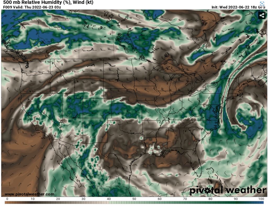
With the high-pressure system going clockwise and the low pressure going counterclockwise, they are moving the humid air from Mexico and Gulf of Mexico into the Southwest states. This humid air will allow the monsoon rain to continue in the Arizona, New Mexico, Utah, and Colorado.
There will be humid air travelling to Kansas between the high-pressure system and the jet stream will fuel the thunderstorms from the humid air in the afternoon or evening. In the next few days, the low-pressure system and the moisture from California and Four corner states will continue to travel to Midwest states.
East coast and Northeast weather

There will be a cold front boundary coming through in the east coast and the northeast. This will bring necessary lift to form thunderstorms or widespread rainstorms with the humid air in the east coast. Also, this will bring colder temperatures for the northeast and east coast for some relief from the warm temperatures in the Summer.
In the next few days, the cold front will move out to Atlantic Ocean and bring in sunny and dry weather in the east coast.

