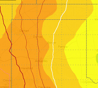
The latest 6z NAM computer weather model is showing an interesting scenario playing out in some of the western counties of Oklahoma and the eastern counties of the Texas panhandle.
It’s showing dewpoints in the 60s. Yeah, 60s.

I don’t recall the last time there were dewpoints in the 60s across the low-rolling plains of the Texas panhandle – save perhaps Childress and Quanah for a a few brief hours.
But by Thursday, the NAM is suggesting dewpoints in the 60s for points east of a line from Beaver Oklahoma south to Silverton, Texas.
Granted, this can probably be explained. Often times these computer weather models don’t take into effect just how dry the Texas panhandle is right now. The drought, the past two years of ridiculously dry conditions, make it very hard to get dewpoints above 50 degrees.
I don’t recall the last time a 60 degree dewpoint was in the cards at all. Last fall, maybe? Perhaps even last July?

Blue = 1000 // Orange = 2000 // Red = 3000
It will be interesting to see how this all plays out.
If both the temperatures and the dewpoints are as high as suggested on Thursday there will be a fair amount of instability. The same 6z NAM suggests CAPE Values will be hovering in the 1,000 J/kg to 3,000 J/kg range.
That said, the chances for rain on Thursday – even with the higher dewpoints – aren’t great.
Right now there are few things precluding thunderstorm development. Number one, there might not be enough forcing to get things moving, and two, the “cap” of warm air aloft might keep everything in check.
The Skew-T leaves me indifferent. The hodograph does the same. Shear values on Thursday will be minimal. A dramatic severe weather event doesn’t look immanent. But the chance is there.

This scenario does deserve some attention, though. And, like always, we’ll be watching it closely.

