Hello everybody, for today, there will be deeper insight of the lack of tropical weather in the Atlantic and Invest 95E development to be a tropical storm during the weekend in the Pacific.
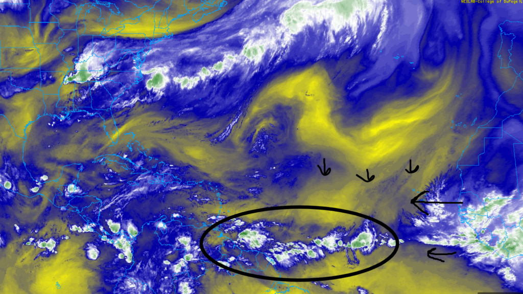
In the Atlantic, the Sahara dust and dry air is moving down south into the tropical waves coming from western Africa coast. This massive Sahara dust and dry air to prevent any convection for any of the tropical waves near South America Coast. There will be a minimal development of any of the tropical waves to try becoming a tropical system until they travel to the eastern Pacific. The eastern Pacific has more favorable factors to develop a strong low pressure and a good tropical system.
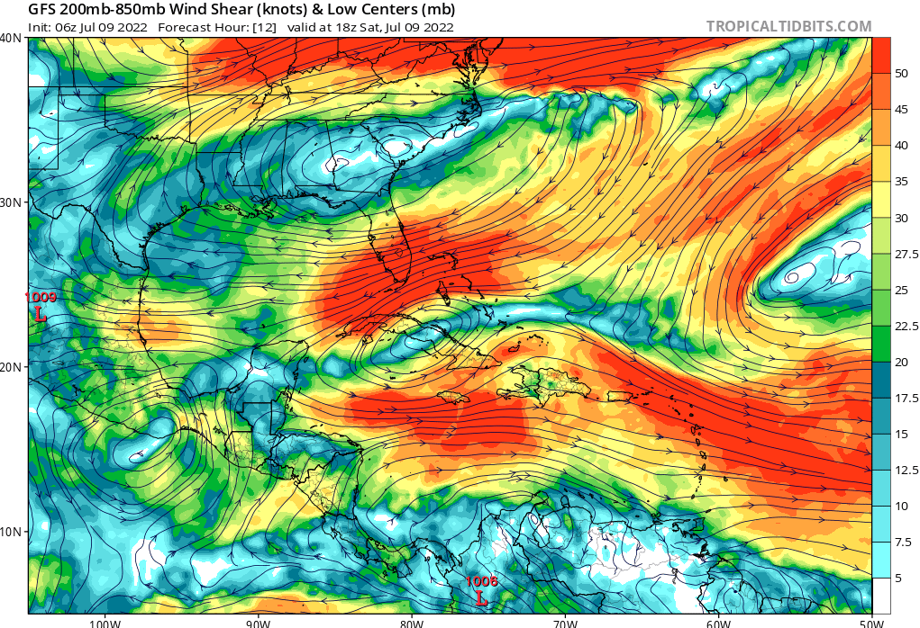
Another factor of denying any tropical development from these tropical waves is this massive wind shear circulating around the Atlantic Ocean. Its might be possible for the tropical waves to travel near the South America coast to avoid the high wind shear to stay strong till it gets too the eastern Pacific Ocean as it has less wind shear.
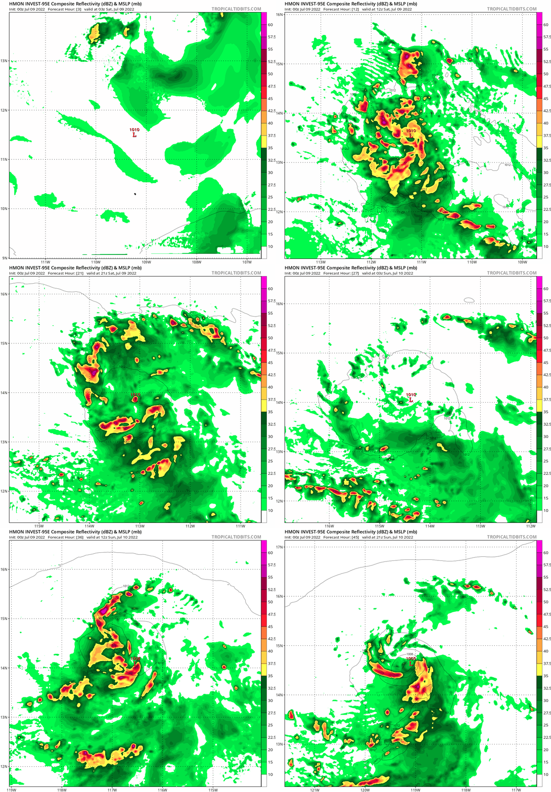
Here is a visual look that Invest -95E will try to organize itself over the weekend to be a tropical storm in the Pacific. For now, it will not a threat to the mainland as it will move deeper in the Pacific Ocean.
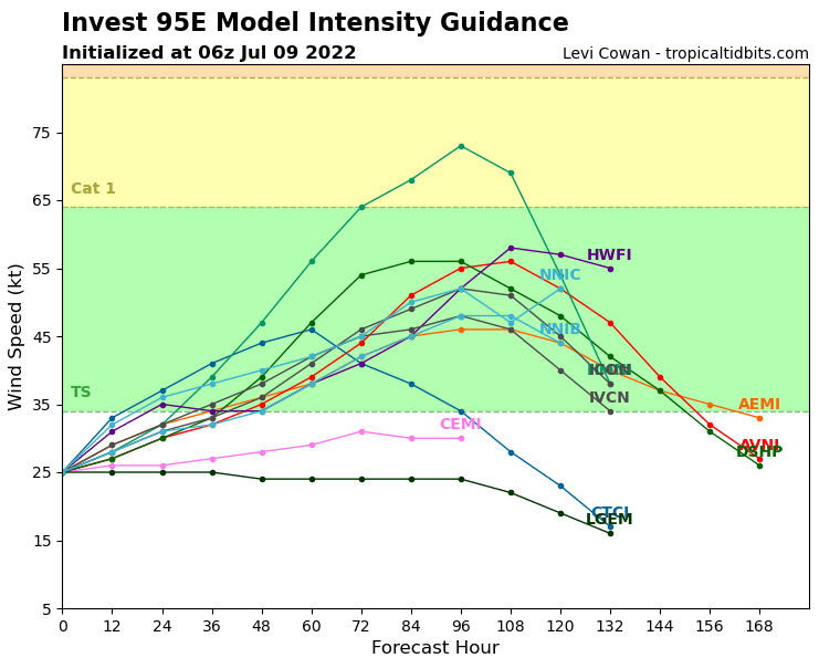
Here are the models for Invest 95E that it is predicted to be a tropical storm in the next 2-3 days. There will less wind shear and favorable sea surface temperatures to start developing a stronger tropical system.
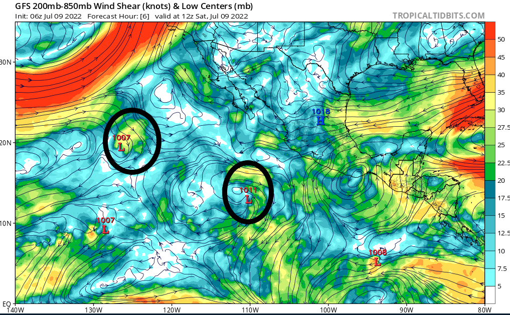
There are two tropical systems going on in the eastern Pacific for today. Tropical storm Bonnie will be starting to get weaker in the next few days as it gets closer to the stronger wind shear in the northern Pacific Ocean. While Invest 95E near the Mexico coast will starting to get stronger with the lack of wind shear in the Pacific Ocean.

