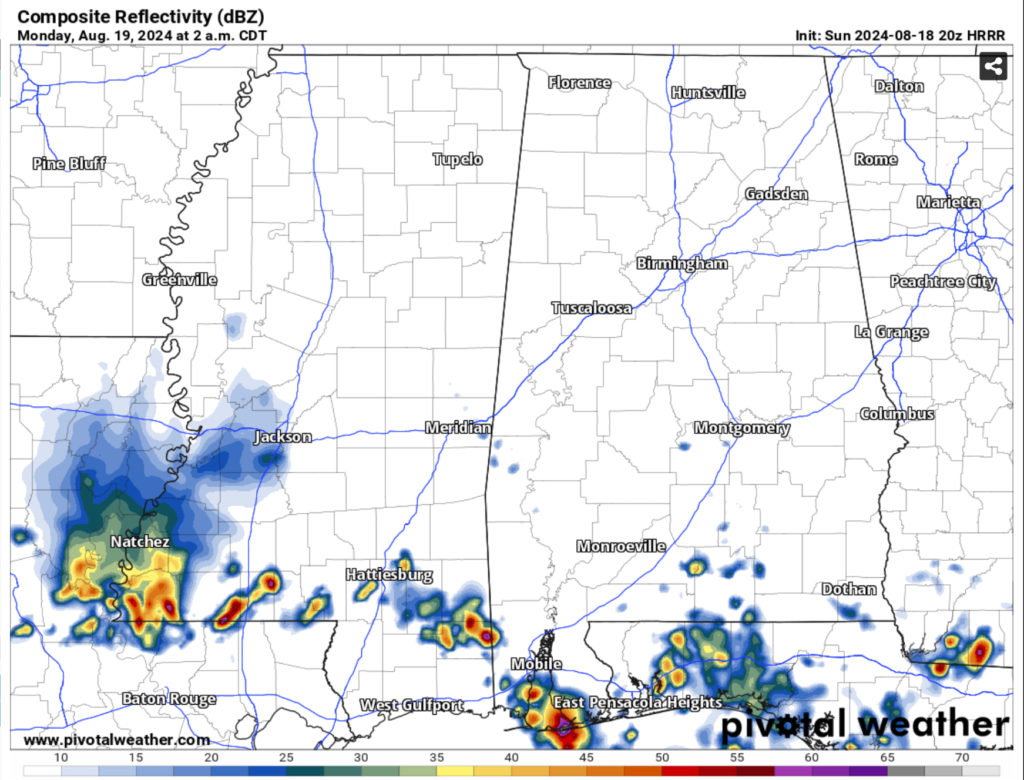
We’re in for some scattered storms tonight which could be strong to severe. The SPC has kept the slight risk and expanded it further south towards the Pinebelt. Looking at the recent models, the MCS doesn’t look as stout as it did yesterday, however it looks like it may split into two into Alabama and west Mississippi. However, areas around the Pinebelt will see some scattered thunderstorms. Our main concerns are high winds and locally heavy rainfall which may lead to flash flooding. This looks to reach us around midnight and pass south.
The Rest of the Week
The cold front will move south on Monday which will leave us hot, but much drier than the past few days. Thankfully, the heat index will only reach to 100 compared to 110+. Over the next several days, the temperatures will hover around the low and mid 90s with the heat index remaining around 100 or below. The low temperatures will drop into the upper 60s to low 70s which is testament to the lower dewpoints.
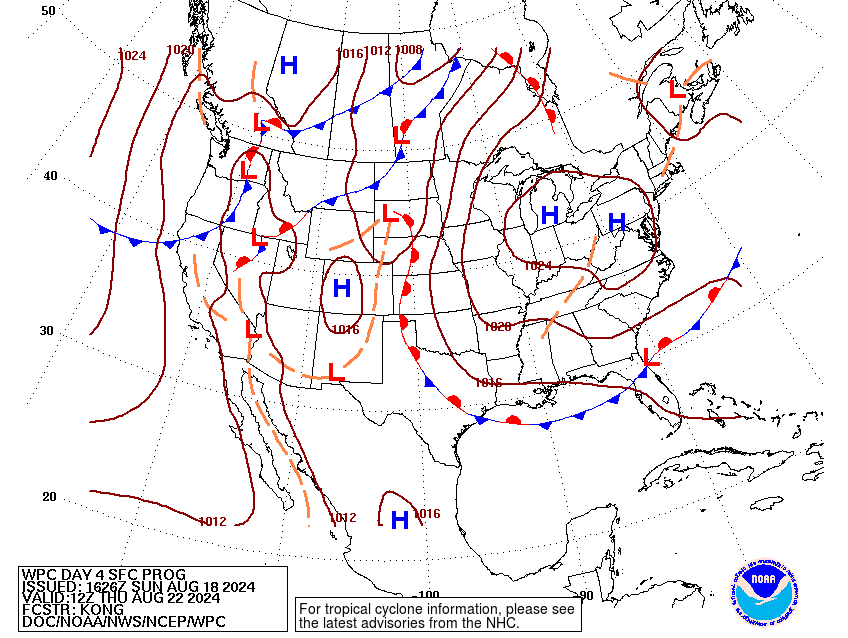
The surface analysis shows a strong high pressure system building over the Great Lakes and moving eastward as the week progresses. The middle and upper levels show a stout ridge over Texas and remaining until a low-level Gulf low develops later in the week.
What this means for the latter part of the week and the weekend is that we’ll be back in the more hot and humid weather that we’re used to. A few storms from the return flow from the Gulf may contribute to some rain from Friday to Sunday, but these look to be mainly afternoon storms. We’ll likely go back to the high heat index by the end of the weekend.
Select Data Set:

Regional Day-to-Day Forecast
Tonight – A slight chance of showers around midnight into the early morning. Mostly clear, with a low in the mid 70s. West northwest wind around 5 mph becoming calm in the evening. Chance of precipitation is 40%.
Monday – Sunny, with a high in the mid 90s. Heat index values as high as 98. Light north northwest wind increasing to 5 to 10 mph in the morning.
Monday Night – Mostly clear, with a low around 70. North wind around 5 mph becoming calm in the evening.
Tuesday – Sunny, with a high in the low 90s. North northeast wind around 5 mph.
Tuesday Night – Clear, with a low in the upper 60s. North wind around 5 mph becoming calm.
Wednesday – Sunny, with a high in the low 90s. North northeast wind around 5 mph.
Wednesday Night – Clear, with a low in the mid 60s. Northeast wind around 5 mph becoming calm.
Thursday – Sunny, with a high in the low 90s. East wind around 5 mph.
Thursday Night – Mostly clear, with a low in the upper 60s. East southeast wind around 5 mph becoming calm in the evening.
Friday – Sunny, with a high in the low 90s.
Friday Night – Mostly clear, with a low in the upper 60s.
Saturday – A 30 percent chance of showers and thunderstorms. Sunny, with a high in the low 90s.
Saturday Night – Mostly clear, with a low in the low 70s.
Sunday – A 30 percent chance of showers and thunderstorms. Sunny, with a high in the low to mid 90s.


