To steal a phrase from WTNH’s Chris Velardi – good morning early risers and up-all-nighters! Here are my latest thoughts on the blizzard.
Monday 12pm:
Light snow begins falling in New York City and points south and west. Winds will be gusty, but not bad, sustained around 15mph. Still dry to the northeast.
Monday 6pm:
Heavier snow falling in New york City. Snow beginning in Boston. Sustained winds between 20 and 30mph with gusts to 45mph.
Tuesday 12am:
Between 1″ to 3″ of snow in New York City with winds sustained between 30 and 45mph. Between 2″ to 5″ of snow in Boston with winds sustained between 35 and 45mph. Visibility in both cities will be below 1/4 mile with full whiteout conditions possible. Travel is discouraged.
Convective snow banding will being to develop at this time. Heavy snow is anticipated from this time through noon.
Tuesday 6am:
Very heavy snow in New York City and Boston. Both cities will be near or under snow bands with snowfall rates between 2″ and 4″ per hour. Snow totals at this time could top 12″ in some locations. Winds between 40 and 50mph with gusts to 70mph. If you don’t need to be at work Tuesday in these cities, please stay home.
Tuesday 12pm:
Heaviest snow will be falling in Boston and points nearby. Moderate snow falling in New York City. Snow totals will be between 6″ and 12″ in New York City by this point. Snow totals between 12″ and 24″ in and around the Boston area possible by this point. Winds still blowing between 35 and 65mph.
Tuesday 6pm:
Things start to calm down in New York City, Boston is still dealing with moderate snowfall. Snow totals between 12″ and 20″ in New York City. Boston totals between 18″ and 28″ at this point. Winds beginning to decrease for New York City and still gusting to 45mph in Boston.
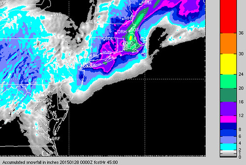
Computer Model Maps


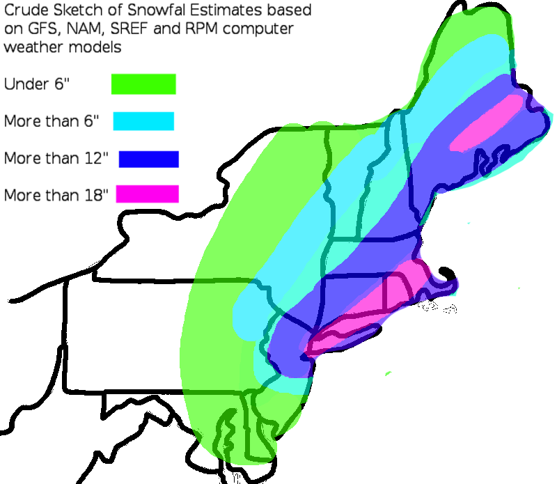
Forecast Map


