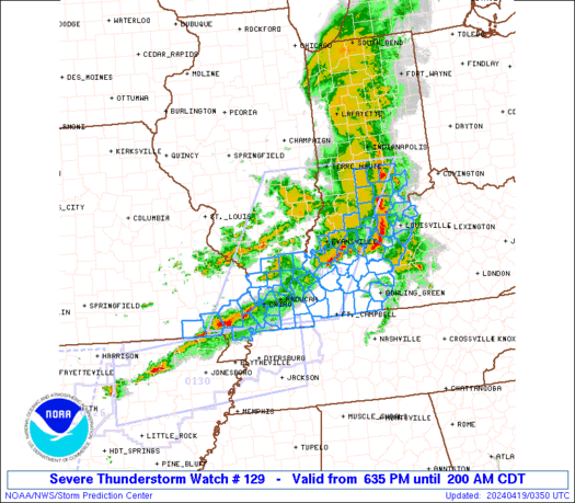
A Tornado Watch has been posted for parts of the area. This is in effect until 5am.
Looking at some of the latest model data and radar trends, the update for storms overnight is mixed.

On the one hand, I don’t think it will be as significant – nor as widespread – as the last few rounds of severe weather. I think everyone gets a shot at some rain, thunder, lightning, gusty wind (up to 40mph), with a shot for some folks to see some hail, too. But only a few select spots will need to worry about damaging wind or large hail tonight.
And even fewer spots will have to worry about tornadoes.
But that also means, some folks will see a shot for such things.
Looking at the timeline of events tonight, it really does look like an early morning problem for tomorrow morning. The earlier times on here are mainly for folks to the northwest and closer to Jackson, while the later times are for folks to the southeast and closer to Mobile.

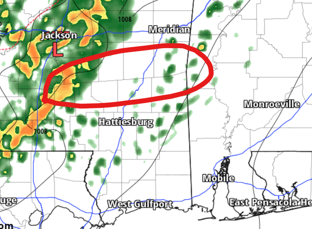
I made a quick post on facebook talking about two concerns I have as we move through the overnight hours. It is one low-end concern for one or two rogue storms possible ahead of the line with the potential for some larger hail and the ability to produce a tornado or two and a second higher concern for a segment of the line of storms that is set to roll through ‘bowing out’ with some stronger wind for a select section of the area.
For the wind concern, I’ve outline the area where I think that may happen in red on the map.
A line that “bows out” means a section of it jets forward much faster than the rest of the line of storms. In my – very artistic – diagram below, it is a faux-radar shot where green is rain and the yellow, red and dark red and white indicate increasingly stronger reflectivity on the radar (heavier rain).
Notice that the area shown with the “strongest wind” is poking out ahead of the rest of the line. This can happen for a host of different reasons. Sometimes it is driven by a stronger downdraft in one spot, or other times the cold pool behind the storms is deepened by rain cooled air.
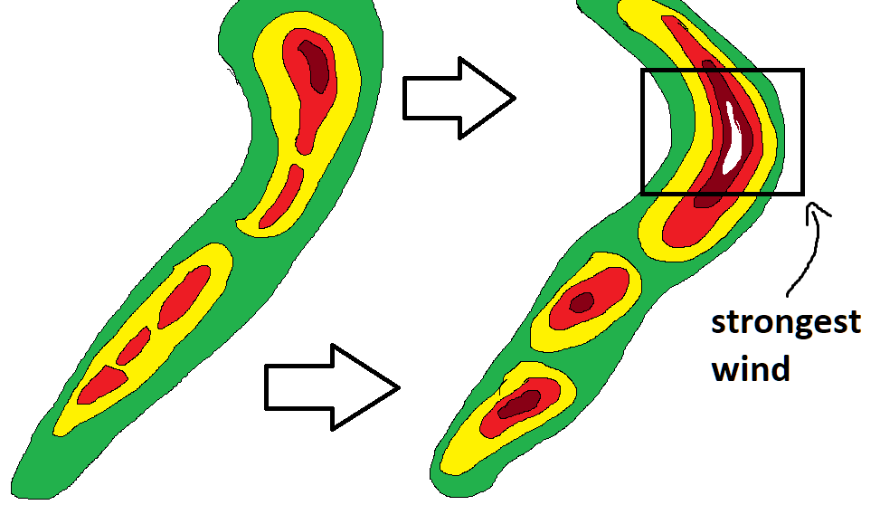
Other times the rear inflow jet can really kick up and push these storms ahead. And I do think that is what may happen early tomorrow morning. This would mean a brief window, in the highlighted area on the map, where wind gusts may be particularly potent. And where Severe Thunderstorm Warnings would likely be issued, if this all happened.
But I don’t think this is a guarantee by any means. But it something to monitor overnight and be prepared for in the morning.


