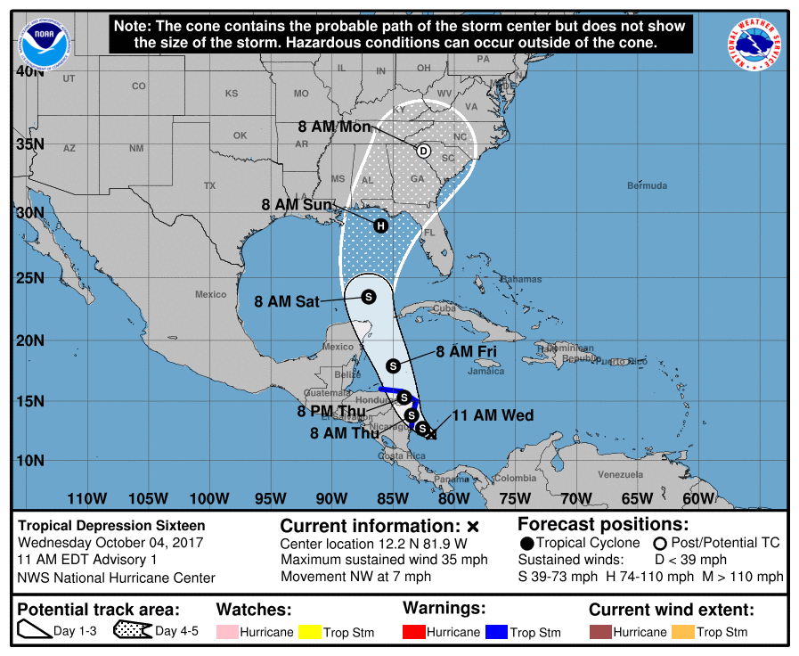
Now that we have a localized center, the models can start to really get a handle on where Tropical Depression 16 – and eventually Nate – will go.
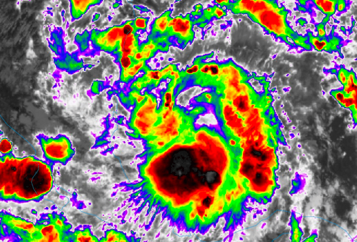
Here is a look at the storm on Infrared Satellite.

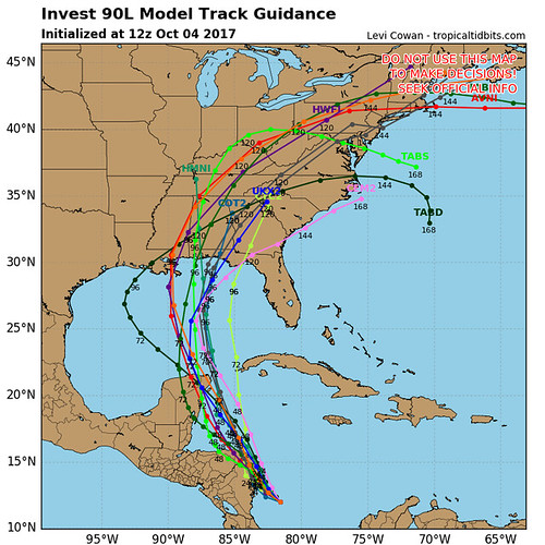
The 12z model guidance shows the storm moving north toward the Gulf of Mexico in the coming days.


