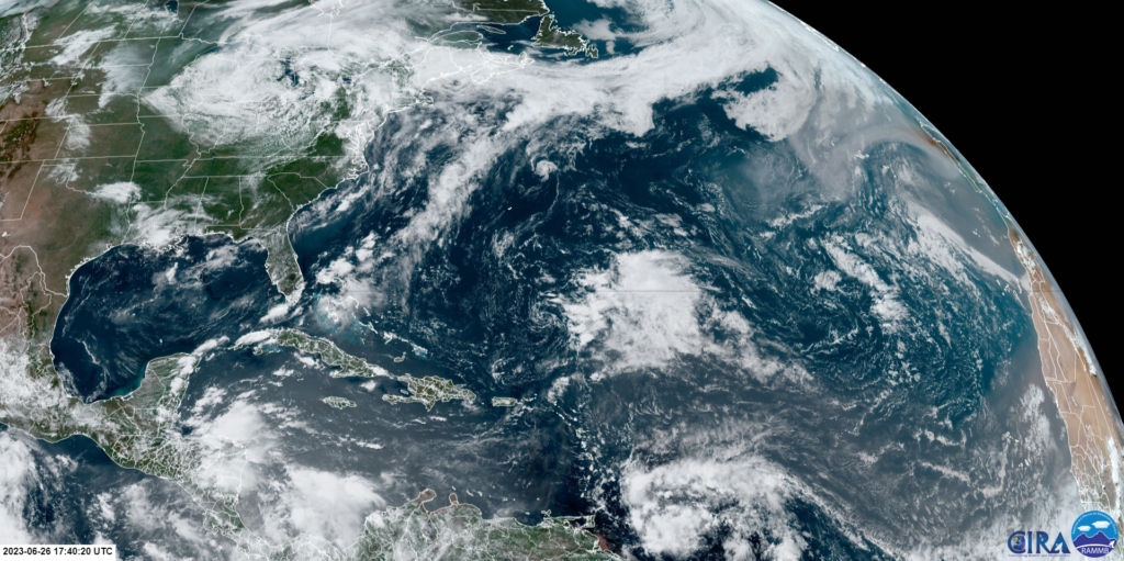
In comparison to the previous couple weeks, we are finally seeing the Atlantic Ocean calm down a bit while the Eastern Pacific off the coast of Mexico may see some development over the next few days. With two disturbances currently being monitored, we are looking at favorable conditions for further development over the next 7 days. The rest of the Central Pacific continues to remain uneventful for the time being.
The Atlantic Basin

Here we are looking at the remnants of Tropical Storm Cindy still sitting out in the Atlantic about 500 miles south of Bermuda. This system is still producing thunderstorms but has very little chance of redeveloping over the next few days due to prevailing upper-level winds that will blow the top off any storm attempting to form. Further into the week will have slightly more favorable conditions for redevelopment but it is still looking unlikely. The Gulf of Mexico is also looking at unfavorable conditions at the moment with a lot of dry air dominating the region, preventing any convection for storms.
The Pacific Basin

We have two disturbances currently developing in the Eastern Pacific. We have one collection of thunderstorms along a low pressure system off the southwestern coast of Mexico that will likely develop into a tropical depression as it travels northwest along the coast. However, this process is looking to be slow with only a 40% chance of development over the next 2 days as we could see some 300-700mb dry air blowing southwest from the land disrupt any strong development of this system. Overall, we are looking at a 90% chance of formation over the next week as conditions remain relatively favorable. But this is not expected to be too severe as strong wind shear will hinder any further development further into the week.
The other disturbance further to the southeast is expected to follow the same path along the coast but with only a 20% chance of formation over the 2 days and 70% over the next week. Although it is likely to develop into a depression, it will suffer a similar fate as the system further northwest as strong wind shear begins to move in by the end of the week. So we are currently expecting these storms to be not much to worry about in terms of threat to the US or Mexico.

Extended Outlook
The extended outlook for most of these regions are looking pretty bleak
Things are definitely starting to look more interesting as we head further into our hurricane season. And as we start to see El Nino conditions strengthen, we may start to see less activity in the Atlantic and more in the Pacific as trade winds along the Atlantic strengthen. The Central Pacific as of now however is continuing to remain calm for the next week of little disturbances as even the Madden Julian Oscillation is in a lull state right now. As the ocean waters continue to warm up however, we will start to see much more activity as we get closer to the month of September.
Conclusion
Overall, the tropics remain to be of little threat so far but still interesting to follow nonetheless. It will interesting to see how the Pacific systems will continue to develop over the next couple days as conditions remain favorable. The Atlantic will be another region to look out for in terms of possible development over the next week as well.

