Hello there, thank you for reading this tropical update for June 14, 2024. Looking at the overall picture, there is not too much to talk about, at least in the short term. Both the Atlantic and Pacific basins are relatively quiet, with only two areas of possible development in the next two days. Looking at the next seven days, however, an area in the Gulf of Mexico shows some potential signs of development. This does not mean that a tropical system will develop; instead, we need to keep an eye on this system and see what it does in the near future.
The Atlantic Basin
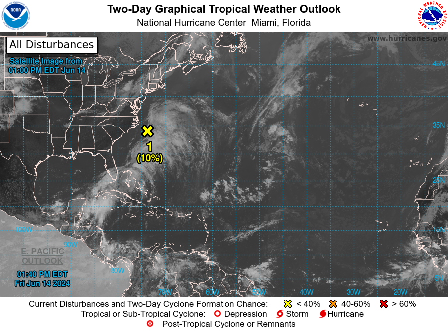
Looking at the Atlantic Ocean, there is only one active system that we are keeping an eye on. This area of low pressure off the coast of the Carolinas is the same system that drenched South Florida earlier this week. This system is forecasted to move to the northeast into the open ocean and collide with a front this weekend. Because of this, any chance that this system had of development is all but gone, as the front is expected to absorb all of the energy that this system had. Regarding whether this system will develop or not, more heavy rain is forecast for South Florida, which could pose more flooding risk for this region. Please make sure that you stay away from flooded areas and don’t drive through flooded roads.
7 Day Outlook
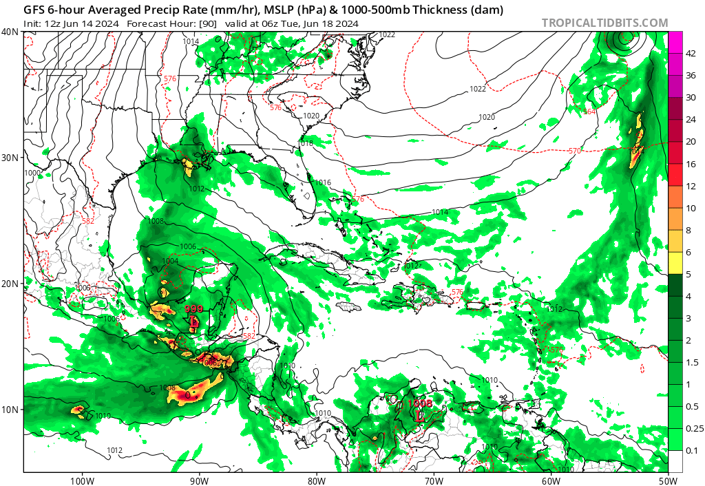
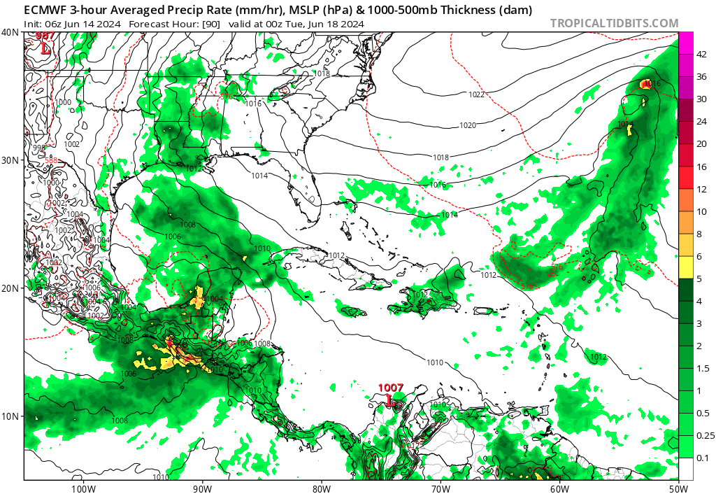
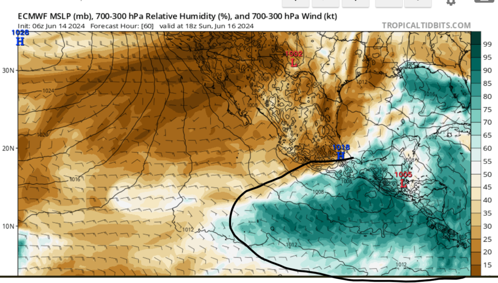
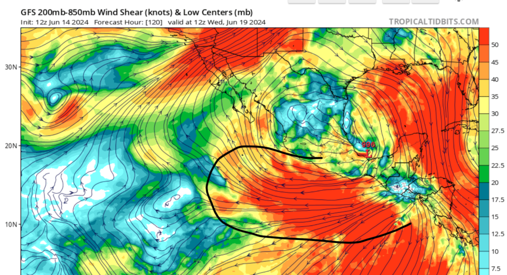
Looking out over the next several days, we are seeing a lot of moisture in the Gulf of Mexico and Centeral America. This is the result of a broad area of low pressure forming in the southwestern part of the gulf. Both models are in agreement on some type of possible tropical development over the next several days. I do believe that some type of tropical development is possible; however, strong windshear from the subtropical jet will likely inhibit development for the next several days. As we continue through the month of June, it is crucial to keep a close eye on the tropics and to check the website daily for tropical updates.
The Pacific Basin
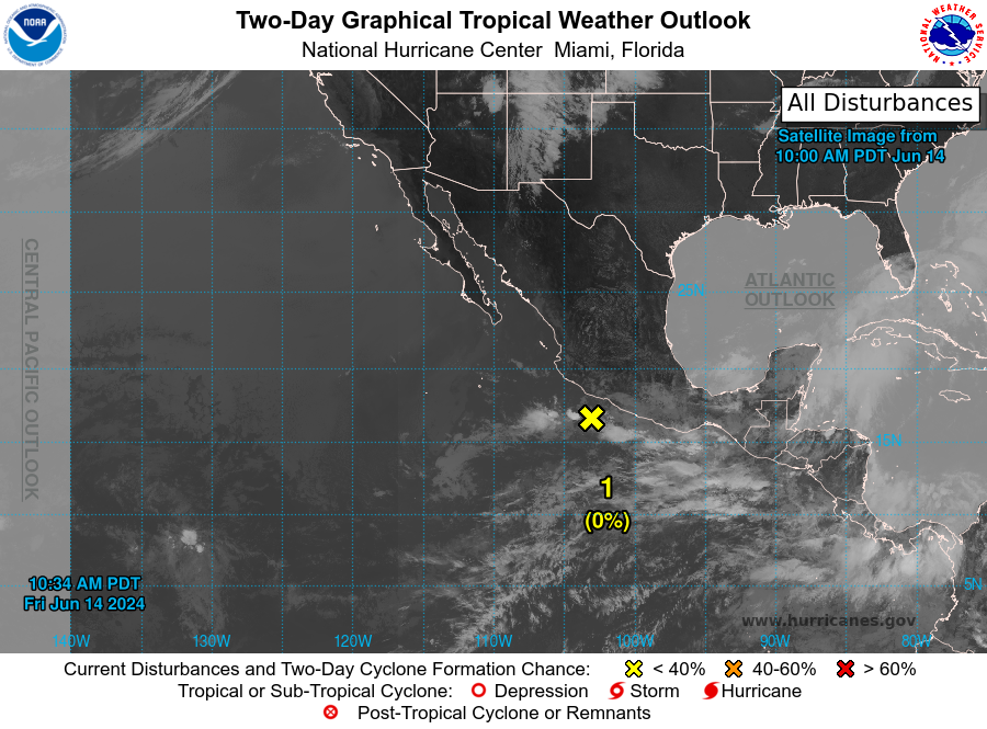
Looking west to the Pacific, far less activity is occurring or expected in both the next 2 and 7 days. Our only spot of activity is off the coast of Mexico. Currently, this center of the low is only producing showers and thunderstorms. As of the 14th, environmental conduction will continue to be unfavorable for the development of tropical cyclones. The primary two reasons why there is a lack of tropical development in this region is because of dry air and wind shear. These two aspects inhibit tropical development, as the wind shear distorts the shape of a tropical system, and dry air cuts off moisture to the storm.
Overall, it is still relatively quiet in both the Atlantic and Pacific basins; however, I am keeping a close eye on the center of low pressure in the Gulf of Mexico. We are officially two weeks into hurricane season, so now is a great time to review and prepare your hurricane survival kit and make sure you know where to go in case of an evacuation.


