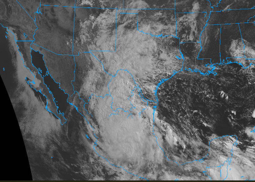
Hello, everyone. Believe it or not, we have already seen our first tropical cyclone in the Atlantic Basin this hurricane season. That storm is Tropical Strom Alberto, which formed in the Gulf of Mexico on June 18th, 2024, off the coast of the Texas-Mexico border. The system is expected to make landfall in the state of Tamaulipas, Mexico, today as a tropical storm. The primary threat from this storm is heavy rainfall and high surf along the coast. Flash flooding is a significant concern with this system, especially in the mountains of Northeastern Mexico. Areas of southern Texas are expected to also see heavy rainfall from this system. Please know that even if you are not in the immediate path of this storm, you could still be impacted by heavy rains and high winds. I am also closely watching another possible system in the Atlantic. Looking at the Pacific basin, no tropical activity is present at this time.
Tropical Storm Alberto
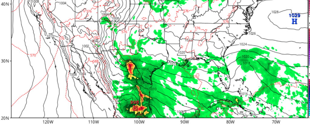
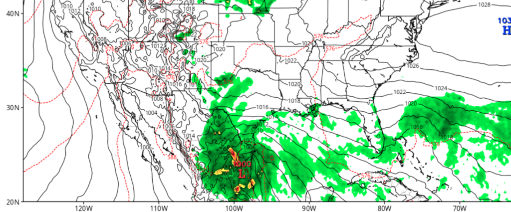
Looking at the general picture of Tropical Storm Alberto’s impacts as it makes landfall, the primary two are heavy rains and high surf along the coast. This is an extensive system that spans hundreds of miles from north to south. Impacts are expected to be felt from as far north as Central Texas to as far south as Centeral Mexico. Winds are expected to be sustained at about 40 mph, with higher gusts in some of the bands. The storm is expected to make landfall near the city of Tampico, along the east coast of Mexico. If you don’t live near the area of direct landfall, remember that this system spends hundreds of miles, so expect impacts, even if you aren’t directly in the path of this system.
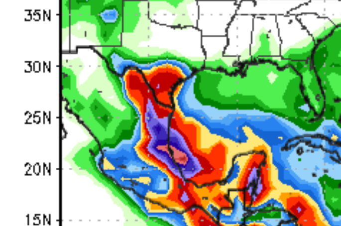
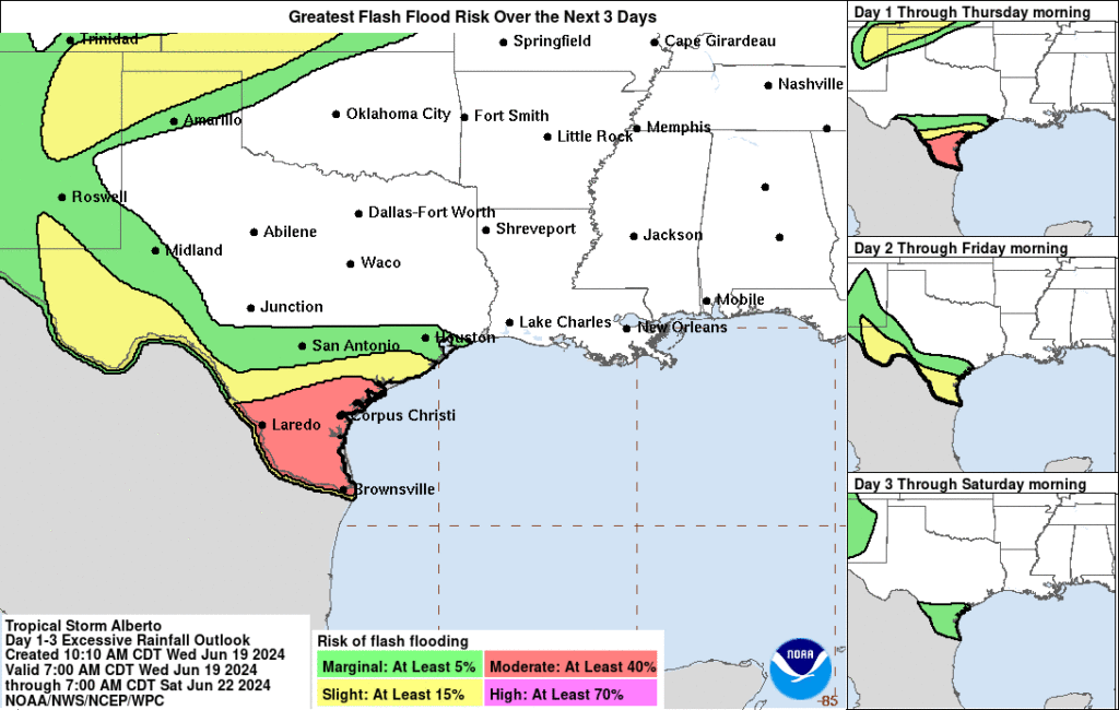
As stated before, the primary threats from this system are heavy rains and coastal flooding. Areas of Northeastern Mexico should expect rainfall of over six inches, with localized amounts of over 10 inches possible. Areas of southern Texas should expect rainfall between four and six inches. The coastlines of Mexico and Texas are expected to see coastal erosion and storm surge. Persons along the coasts should take the necessary precautions and stay away from the ocean during the duration of the storm. Persons inland need to be prepared for flash flooding and mudslides in the states of Coahuila, Nuevo Leon, and Tamaulipas in Mexico. These include the cities of Ciudad Victoria and Monetary. Back in Texas, cities such as Corpus Christi and Brownsville are the primary areas that could see flooding associated with Alberto. Please remember the term “turn around, don’t drown.”
Another System in the Atlantic
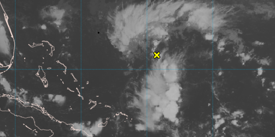
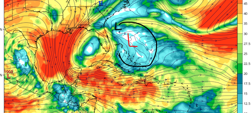
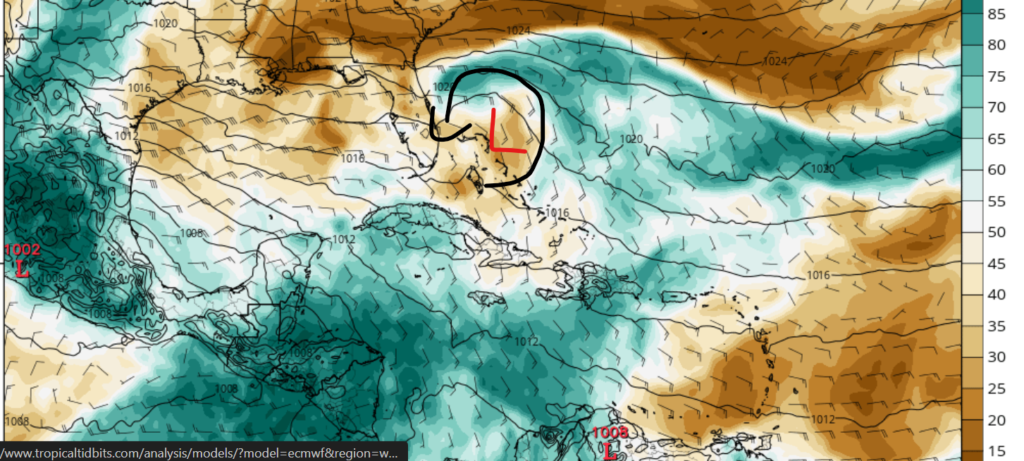
Looking further east, we have another possible system east of the Caribbean. This system is currently just a cluster of thunderstorms and is associated with a center of low pressure off the coast of the Bahamas. Current models are showing weakening windshear over the next couple of days in the mid-level, which could help with development. A broad area of moisture at 500mb is expected to eject into the area where the center of low is currently located. These two factors could help in the development of a tropical system, although the chances of development are still relatively low for the next several days. If this system does develop, it would most likely develop in about a week’s time, and it’s expected to move in a north-northwest direction.
Overall, we have quite an active start to the 2024 Atlantic hurricane season, with our first system already making landfall in Mexico. As stated in this report, anyone near or in the path of Tropical Storm Alberto needs to take flooding precautions, as heavy rain and coastal flooding is the primary concern of this system. Looking to the east, I am currently keeping an eye on this potential tropical system that could develop in the Atlantic Ocean in the latter half of next week.


