Hello there. I hope that your Saturday is going well. We have quite a lot of new news regarding the tropics. As of yesterday evening, we officially have our second named storm of the season, Tropical Storm Beryl. Beryl is expected to move west and impact the Windward islands by the end of the weekend. These islands are expected to see major hurricane conditions, with destructive winds, heavy rains, and significant storm surge. Hurricane conditions are expected from Sunday night through Monday morning. After moving through the Windward Islands, Byerl is expected to continue in a north/northwest direction towards the Yucatan Peninsula. As of this writing, it is too far out to produce proper reports of the impacts this storm could have on North America, but possible impacts could occur. Besides Beryl, the other two systems in the Atlantic could develop, as environmental conditions have been more favorable in the last 48 hours.
Beryl’s Forecast
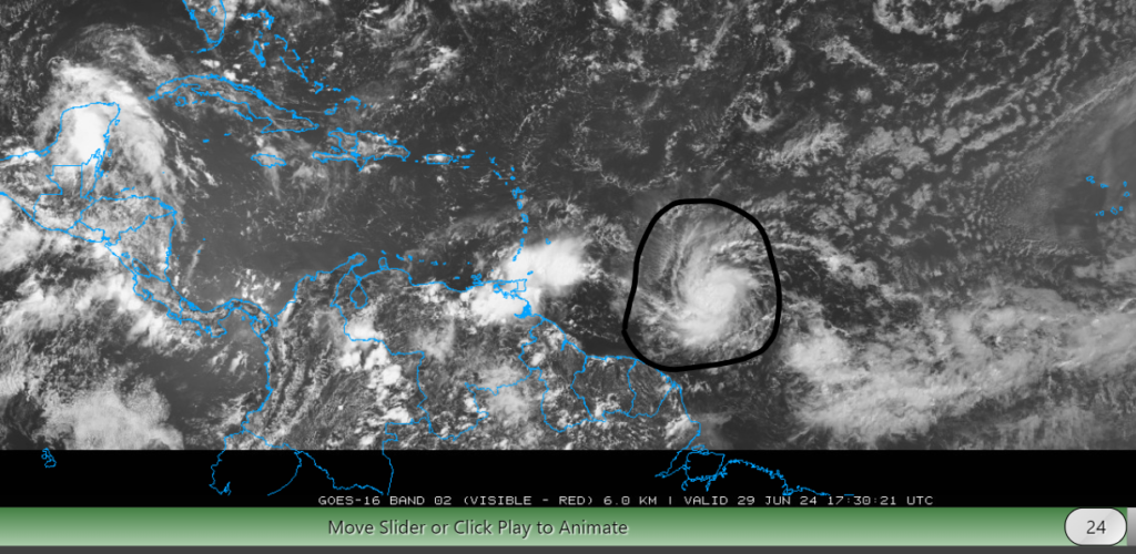
Tropical storm Byerl is expected to quickly strengthen over the next 48 hours and become a major hurricane (winds>111 mph). As of 11 AM CDT, Byerl is located at latitude 10.0N and longitude 48.4W and has maximum sustained winds of 65 MPH. The minimum central pressure last measured was 998mb and is currently moving west at 20 MPH. Hurricane watches and advisories have been issued for the Windward Islands. The primary effects that the Windward Islands should expect are heavy rainfall, destructive winds, and significant storm surges. Although you may not be directly in the path of this storm, you will still feel the effects of this system, even if you are 100s of miles from the center.
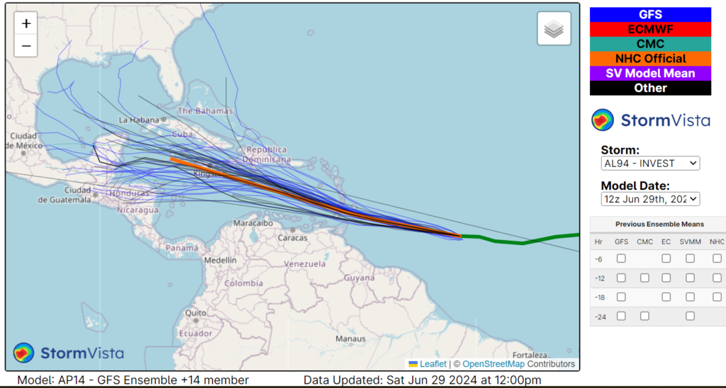
Now, the fun part begins: where and what impacts could Beryl have on North America? As of this writing, most of the models are putting the storm to impact the Yucatan Peninsula and/or the northern parts of Centeral America. After those impacts, it is less confident of where this system will move.


You might be asking yourself why this forecast has 500mb anomaly height charts. Well, these medium-range forecasts can give you some information on where a hurricane could impact, even if the models don’t show much after 5 days. Looking at the maps above, two things are present to me: a trough in the central U.S. and a ridge in the southeastern U.S. The location of this ridge could block the hurricane from making landfall in the Southeast and help deflect the storm to the west. This area of high pressure could also cause weakening, as a ridge of high pressure is associated with drier weather. The trough in the Centeral U.S. will likely cause the storm to move to the north/northeast, possibly having impacts on the Gulf Coast; however, other factors such as windshear and low lever moisture could have additional effects on Beryl’s track. Although impacts on the Gulf Coast are possible, it’s still too early to say where this storm could impact North America as of this writing. Regardless of where this storm goes after its impacts on the Yucatan, it’s vital to stay up to date on the latest tropical information.
The other storms in the Atlantic

Besides Beryl, we have 2 other systems that could form into tropical systems. Looking at Invest 94L (the orange x) environmental conditions are showing possible development in the Bay of Campeche. Whether this low-pressure system developed or not, heavy rain is expected for parts of Mexico and Centeral America. Back to the Atlantic, we have another tropical wave that’s started to organize behind Beryl. As this system moves northwest, tropical development will likely occur by mid-next week. Environmental conditions are favorable for developing another tropical system, as warm waters and high moisture levels are in place.
Overall, it’s been a quick and active start to the 2024 Atlantic hurricane season, with 2 named storms and 2 more developing storms. Tropical Storm Beryl is expected to strengthen into a major hurricane before making impacts on the Windward Islands late this weekend. After that, most of the models suggest a second landfall on the Yucatan Peninsula. Impacts on the United States are still very uncertain at this time, but the way the mid-level atmosphere is setting up suggests a possible landfall on the Gulf Coast, but this is still very much up in the air. As for the other two systems, we will be keeping a close eye on their possible development.


One thought on “Tropical Outlook for 6/29/24: Tropical Storm Beryl has formed; what should you expect?”
Comments are closed.