After quite an active past two weeks of tropical weather, things have calmed down quite a bit. There are no current storms in the Atlantic and Pacific Basins. The only signs of tropical development are some tropical waves off the coast of Western Africa. Even though these pockets of moisture are a critical ingredient for tropical development, there is a lack of moisture in the Tropical Atlantic. Looking at the Pacific, there is a small area of disturbance off the coast of Mexico; however, there is little chance of development in the next 7 days.
The Atlantic Basin

If you looked at the tropical weather discussions for the past few days, you may have seen a disturbance off the coast of the Carolinas. Well, that system died off, and as of this writing, there is no tropical activity currently in the Atlantic Basin. This is thanks to a ridge of high pressure sitting in the middle of the Atlantic, which is allowing some moisture to come ashore in the southeastern U.S. but limiting tropical moisture in the Atlantic Ocean. I am expecting this ridge of high pressure to stick around for the next week, which will continue to limit tropical activity.
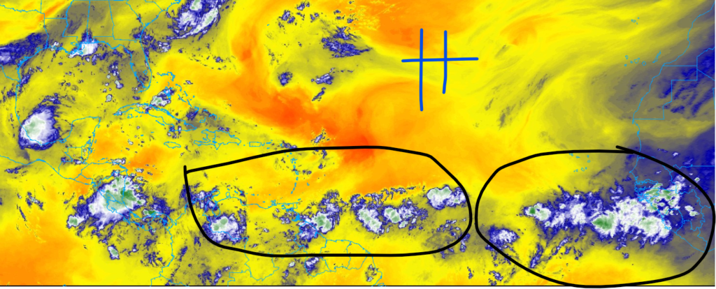
Looking at the intertropical convergence zone, there are multiple areas of moisture moving off the coast of Western Africa. Even though plenty of moisture is in place, high windshear and dry air from the ridge of high-pressure system to the north will limit tropical activity through this week. Although no activity is expected this week, please remember that we expect an above-average hurricane season this year.
The Pacific Basin

Looking at the Pacific Ocean, we do have small tropical waves that have moved off the coast of Mexico. As of this writing, this tropical wave is just an area of disorganized showers and thunderstorms. I think this system’s development will be slow in nature because of a large area of dry air aloft northwest of this low-pressure system. This tropical wave is expected to move to the northwest at 15 mph. Any possible development will occur throughout this week.


