It’s been another generally quiet week for hurricane activity in the United States, and I am expecting this trend to continue for the next several days. Looking into the Atlantic, I am expecting no tropical activity for the next several days. This is thanks to a t high-pressure system in the Atlantic that is causing dust from Africa to move into the ocean. This and a broad area of windshear are currently reducing tropical development in the Atlantic. Looking into the Pacific, we are currently keeping an eye on an area of disturbance off the coast of Costa Rica. As of now, this is just a disorganized group of thunderstorms, and development is marginal for the next several days.
Current Atlantic activity
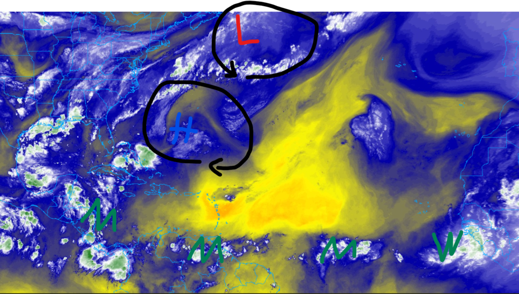
Currently, there is little to no activity in the Atlantic Ocean. The only expectation is a center of low pressure off the coast of Nova Scotia, Canada. I do not think that this low pressure will do much over the next few days as it enters the area of drier air to the east. The area of high pressure off the coast of the Carolinas is currently allowing for Sahara dust (the dry area near the center of the high pressure) to make its way across the Atlantic. This and a broad area of windshear (shown in the image to the right) north of the areas of moisture are preventing tropical development despite the multiple areas of moisture and areas of westerly wind flow.
Looking at the image on the left, you can see a couple of areas of moisture that have moved across the Atlantic. This is thanks to the westerly trade winds that blow across the Atlantic, allowing moisture to flow off the coast of Africa. Although these are a key ingredient for tropical development, the broad area of Saharan dust and wind shear is preventing development. I only expect these areas of moisture to produce heavy rain for parts of Mexico and parts of the Southeastern U.S.
Looking into the future
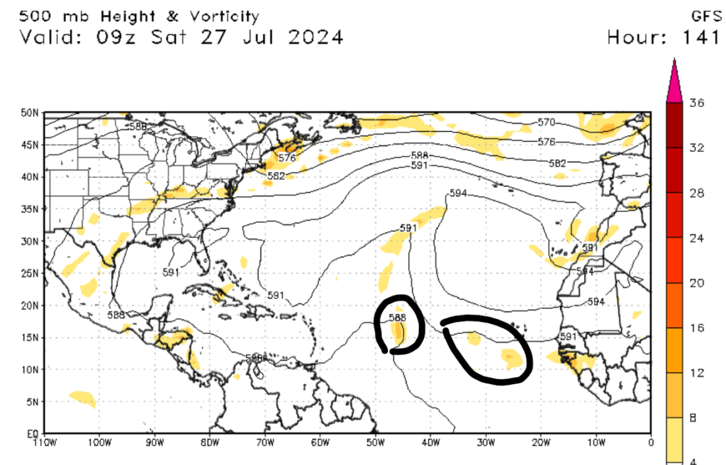

Looking into the future, we may see a pattern change as we enter August. The map on the left shows a couple of areas of moisture moving off the coast of Africa. As of this writing, these areas of moisture are expected to be weak and unorganized, and I don’t expect any formation in the next seven days. Moving into next month, models agree that August could be a wet and active month. Ocean temperatures are running above average, which will allow for more rapid tropical development. As we continue to move into the height of hurricane season, now is a great time to review your hurricane protocols.
A bit more activity in the Pacific


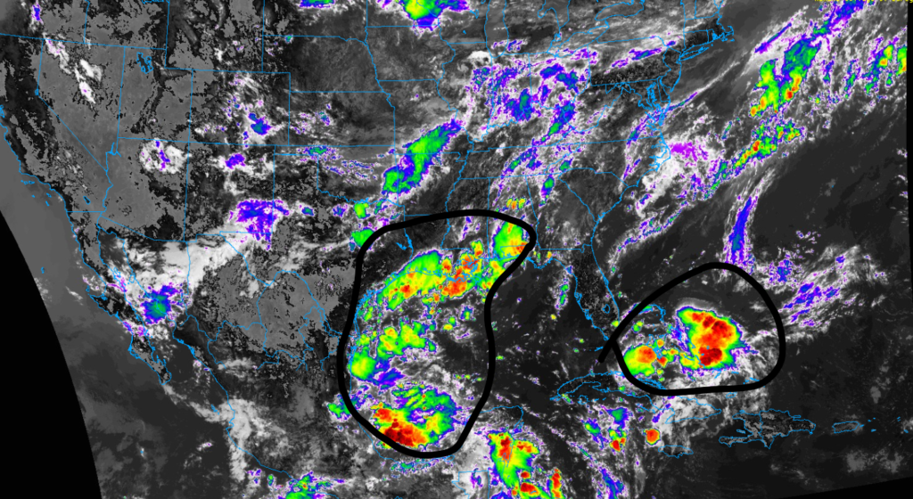
Looking west now, we are currently watching two systems in the Pacific Ocean. System one is currently about to cross the 140th parallel line of longitude, meaning it will cross into the Central Pacific. Currently, this system is just a disorganized area of showers and thunderstorms. Some development is possible in the next couple of days, but as this system moves closer to the Hawaiian Islands, it is expected to encounter upper-level winds, hindering development. I expect this system to have little impact on Hawaii, so if you are reading this, Mom, the Hawaii house will be fine. System Two has just formed in the Eastern Pacific and, like System One, is just an area of disorganized showers and thunderstorms. As it moves west-northwest, some development is possible over the next few days.


