As we continue through the month of July, we are starting to see some more action in the tropics. As of this writing, there are no active storms in both the Pacific and Atlantic Oceans, but that may not be the case for much longer. In the Atlantic Ocean, multiple areas of moisture are making their way west and may collide with an area of disturbance, possibly leading to a tropical system. Looking west to the Pacific, multiple tropical waves are moving off the coast of Mexico and could form into a storm next week. August starts this Thursday, which is the second most active month for hurricanes in the northern hemisphere, so now is a great time to review your hurricane preparations.
The Atlantic Basin

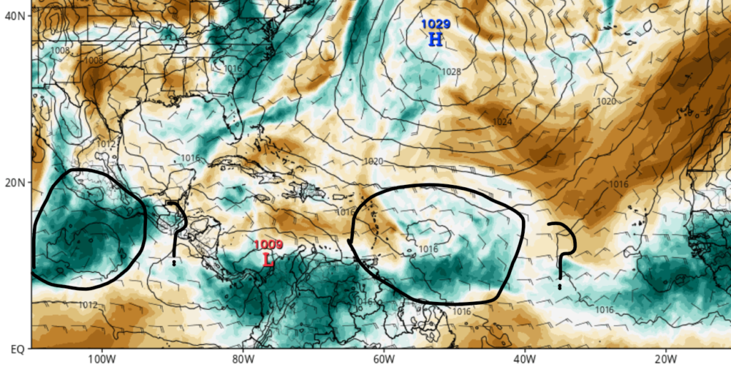
Looking at the Atlantic, there is quite a lot more action than there was last week. Multiple tropical waves have moved off the coast of Africa and could contact an area of disturbance near the Caribean shown in the image to the left. If they do combine, we may have another named storm in the next week or two.
Our next storm?

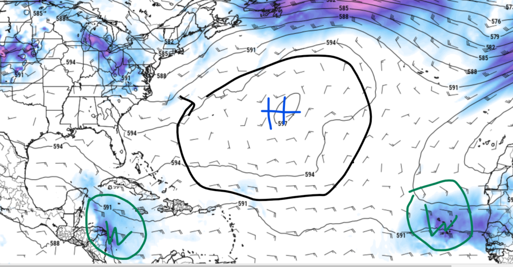
Looking out a little further, we may have our next named storm by next week. Multiple models are starting to agree that our next storm may form near the Lesser Antilles, with strengthening expected as the area of disturbance continues to move northwest. Current environmental conditions are showing some possible development. If a tropical system does form, it will most likely start out around the Northern Leeward Islands of the Caribbean or somewhere in the Southern Atlantic. Whether this system forms or not, heavy rainfall is expected for several island nations throughout the Caribbean. Some areas could see over 2” of rainfall, with localized amounts of 4”. Whether this storm does form and cause impacts, its very important to stay up to date on tropical weather.
The Pacific Basin
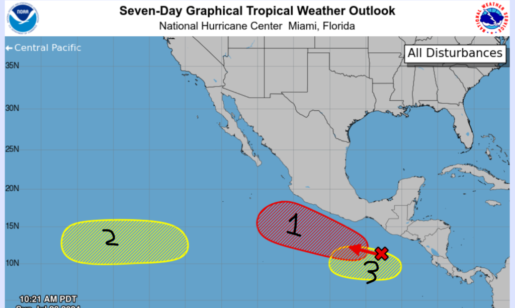
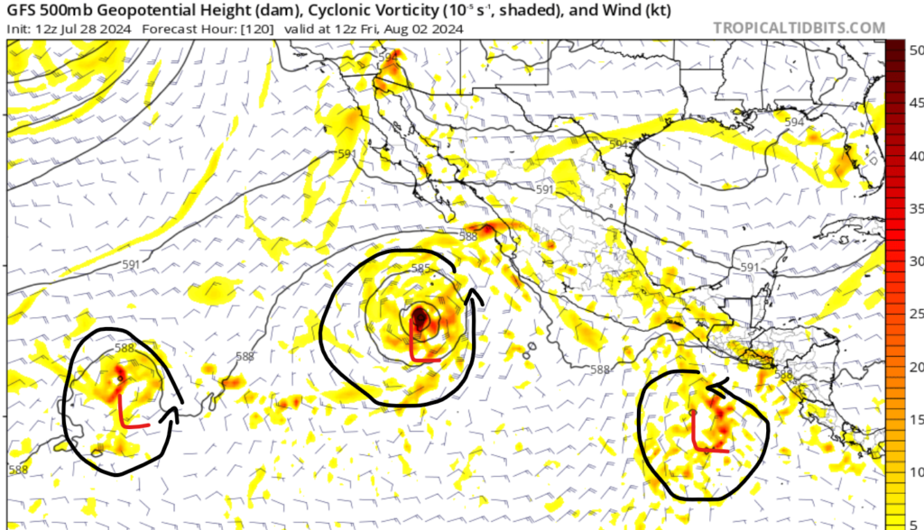
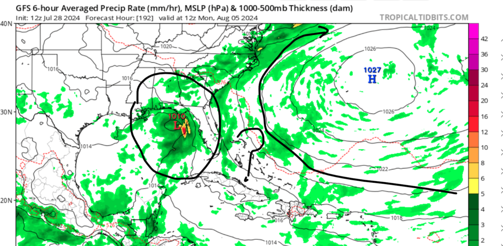
Over the last 48 hours, the Pacific basin has gotten quite a lot more active, with three areas of disturbances, so let’s get into it. The first and most concerning system is currently a large area of showers and thunderstoms off the coast of Mexico. Over the next week, environmental conditions such as a lot of moisture and low windshear are expected to set up in the region. This will allow for tropical development as early as this next week. This system is expected to move northwest at 15 mph and is expected to stay off the coast of Mexico.
System 2 is an area of low pressure moving west over the next several days. It is expected to slowly organize as it moves into the Centeral Pacific Basin. The NHC is giving this system a 30% chance of developing in the next 7 days. System 3 is yet another area of low pressure expected to move off the coast of Panama after system 1 moves northwest. This system is not expected to form for another week, if this system is developed at all. The NHC is giving this system a 30% chance of development in the next 7 days.


