Happy Wednesday, I hope that you had a great 4th of July. As you may know by now, we are about a month into hurricane season, so that means that the chances of seeing a storm will continue to increase as the month progresses. As of this forecast, we don’t have any active storms in both the Atlantic or Pacific Basins; however, look for this to possibly change as tropical waves are forecasted to move through both the Atlantic and Pacific Basins.
Atlantic Basin

Looking at the Atlantic Basin not much is happening at the moment. This is quite different from last month, where we had three named storms form, which is unusual for the month of June. Looking at the next 72 hours, not much is expected because of the dry air aloft, high wind shear, and a ridge of high pressure centered in the Atlantic. Looking at the next 7 days, there is some possible convection off the coast of Africa; however, little development is expected. Remember that tropical storms can form with little warning, so keep an eye on NickelBlock Forecasting.
Pacific Basin


After quite an eventful start to the Pacific hurricane season, we may see some development in the near future. An area of moister is expected to move off the coast of Mexico in the next couple of days. This band of moister could produce environmental conditions right for tropical development off the coast of Mexico. The timing of this storm’s development will depend on when the band of moister reaches the coast, but I expect sometime this weekend. If this storm does develop, it will most likely move parallel to the coast of Mexico. As for the Central Pacific, no development is expected in the next 7 days.
Extended Outlook

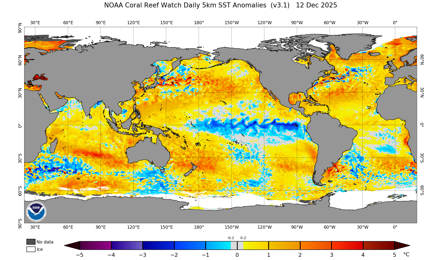
Looking at our extended outlook, one thing catches my eye: the warmer-than-usual section of water off the coast of South America. This means that an El Neno pattern has developed, which has certain consequences, especially during hurricane season. Looking at the equator, water temperatures are about 2 to 3 degrees warmer than usual. These warmer waters would normally help in the development of hurricanes, but there is a patch of cooler waters off the coast of Mexico, which will inhibit the development of hurricanes in that region. Still, though, I expect that we will see an above-average hurricane season in the Pacific. I still think this will be an average hurricane season for the Atlantic Basin, despite an active start to the season. Despite a warmer-than-normal Atlantic Ocean, I believe other factors, such as wind shear, will help inhibit development.
Conclusions
The Central Pacific, the only area that I see, has little to no chance of seeing a hurricane in the next 7 days. The Atlantic Basin has a small chance of development, but this is unlucky as well. The area that has the greatest chance of seeing a storm is the Eastern Pacific region. Remember to always refer to NickelBlock Forecasting for the latest information on hurricane development.

