Tropical Storm Francine’s structure has improved since the last update, showing clearer curved bands and a developing inner core.

Recent reconnaissance data revealed winds of 65mph and a pressure drop to 996 mb, signaling strengthening. A mid-level eye feature has also appeared on radar, supporting continued intensification.

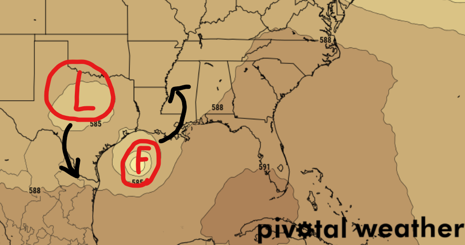
Francine is now moving north-northwest and is expected to shift northeast tomorrow due to an upper-level trough moving into Texas. With its current position slightly west of earlier projections, the forecast track has also shifted west and shows a quicker approach to landfall, now expected between 48 to 60 hours.
The NHC now has landfall Wednesday afternoon.
Conditions are favorable for rapid strengthening, and Francine is likely to become a hurricane tonight or tomorrow, with a forecast to reach Category 2 strength by Wednesday at landfall. Increased wind shear before landfall as well as some dry air, will slow further intensification, but Francine is still expected to make landfall as a Category 2 hurricane. Once inland, rapid weakening is anticipated.
I still think Category 3 is the ceiling for this storm. But we will have to see a lot happen to make that possibility a reality.
Given the changes to Francine, the NHC and local NWS offices are issuing Hurricane and Storm Surge Warnings for much of the Louisiana coastline.
Flooding and tornadoes are going to be the main concern for our area.

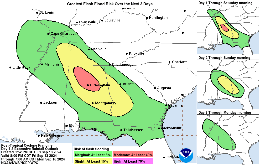
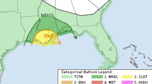
A Moderate Risk for flash flooding is the call from the WPC. And the SPC is showing a Slight Risk for severe weather – the main risk being quick-developing and quick-moving tornadoes.

Both of these forecasts are likely to change in the coming days. So please check back for updates!
MODEL DATA
This is where things get a bit interesting. If you’ll bear with me, I’m going to get into the weeds a bit here.
Looking at the incoming trough, there is a chance that a centralized area of low pressure holds together and slides back to the north of Francine as it moves northward. If so, then we would have to watch for some subtle deflection to the east as it gets closer to land.

That may be what we are seeing on some of the Tropical Models this afternoon. A few of them push Francine briefly east and then peel it back more northward.


If that does happen, we may see an extra bump in intensity briefly as it moves into an area where it will be venting (which would help by moving it into an environment that was preconditioned). But, again, this will be rather brief. But it would be happening near landfall.
But that jog eastward would also line up with when the SHIPS data suggests we would be watching for Rapid Intensification.

So we could see this system in the process of intensifying outside of the fact that it would be moving into an area that was preconditioned. But, all of this stuff would have to line up at exactly the right place and the right time. The likelihood of that is low. But certainly not zero.
THE BOTTOM LINE
- Francine is expected to be a hurricane when it reaches the coast of Louisiana on Wednesday, and there is a danger of life-threatening storm surge for portions of the Upper Texas and Louisiana coastlines where a Storm Surge Warning is now in effect.
- Damaging and life-threatening hurricane-force winds are expected in portions of southern Louisiana Wednesday, where a Hurricane Warning is now in effect. Preparations, along the Louisiana coastline in the path of this storm, to protect life and property should be complete by Tuesday night since tropical storm conditions are expected to begin within this area early Wednesday.
- Francine is expected to bring heavy rainfall and the risk of considerable flash flooding along the coast of northeast Mexico, the far lower and far upper Texas coasts, southern Louisiana, and southern Mississippi into Thursday morning. A risk of flash and urban flooding exists across portions of the Mid-South from Wednesday into Friday morning.
FORECAST POSITIONS AND MAX WINDS
INIT 09/2100Z 24.0N 96.0W 55 KT 65 MPH
12H 10/0600Z 24.8N 96.4W 65 KT 75 MPH
24H 10/1800Z 25.9N 95.9W 75 KT 85 MPH
36H 11/0600Z 27.4N 94.7W 85 KT 100 MPH
48H 11/1800Z 29.4N 92.8W 85 KT 100 MPH
60H 12/0600Z 31.8N 91.3W 45 KT 50 MPH…INLAND
72H 12/1800Z 34.2N 90.8W 30 KT 35 MPH…INLAND
96H 13/1800Z 36.9N 90.3W 25 KT 30 MPH…POST-TROPICAL
120H 14/1800Z 38.2N 89.1W 20 KT 25 MPH…POST-TROPICAL

