Hello everyone, the Eastern Pacific Ocean still remain having a strong season for hurricanes, meanwhile we still waiting for something to happen in the Atlantic Ocean.
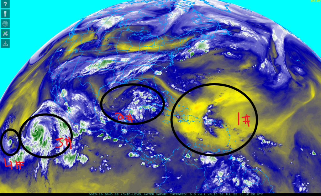
First, the Saharan Air Layer still remains in the middle of Atlantic Ocean to dry out any tropical activity in the Atlantic Ocean.
Second, there is a disorganized of thunderstorms has been developing near the entrance of Gulf of Mexico. There are few factors in Gulf of Mexico will be favorable for any tropical activity.
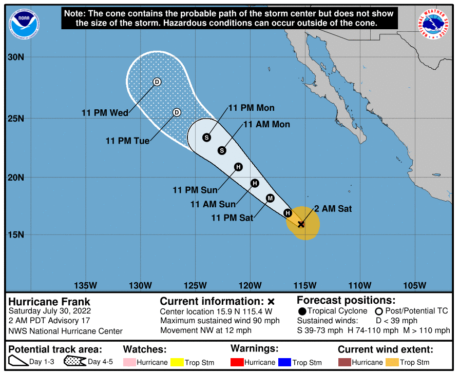
Third, Hurricane Frank is category one as of right now. It will be predicted it will reach to cat 2 or 3 in the next 24 hour to reach its maximums level. In the next 48 hours, it will start to meet some unfavorable conditions that will weaken Hurricane Frank.
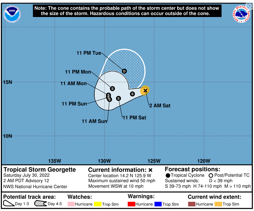
Fourth, Tropical Storm Georgette starting to become stronger and organize for today, but with its current predicted path will lead it with unfavorable conditions and make it unable to become a hurricane.
Atlantic Ocean and Gulf of Mexico
It seems like the wind shear is clearing up in the southern western Atlantic Ocean and Gulf of Mexico. For number one, it has no wind shear up north of it except the Southwest from it has some wind shear. In the Gulf of Mexico, there is minor amount of wind shear to have a small effect on the disorganize thunderstorms.
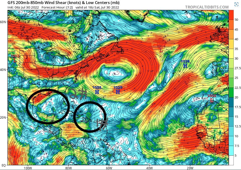
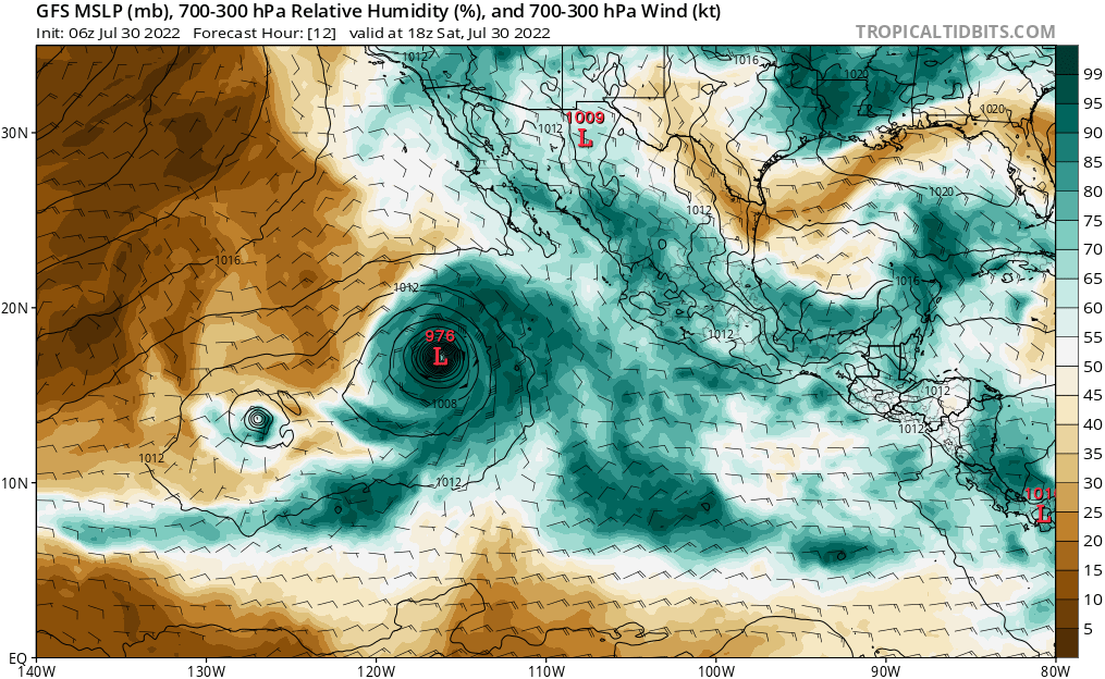
The biggest factor on limiting any tropical activity is the lack of relative humidity in the Atlantic Ocean. It very unlikely that number one will become into something stronger other than providing some rain in the Caribbean. It will be surrounded by lack of relative humidity. Meanwhile, there is more relative humidity for the disorganized thunderstorms from Mexico. But, there are some Saharan Air manage to come into Gulf of Mexico to dry out any tropical activity in the Gulf of Mexico.
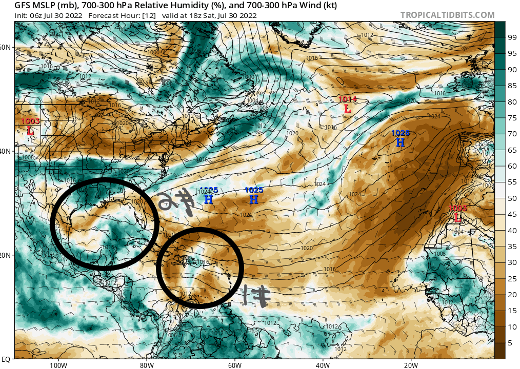
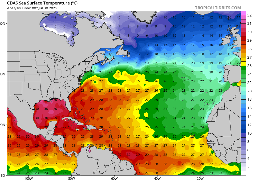
If number two mange to overcome the Saharan Air, then it has the potential to use the very high sea surface temperatures to start organizing and getting stronger. The sea surface temperature in Gulf of Mexico is reaching up to 30 C (86 F). The minimum temperature to get some kind of tropical development to start is 26 C (79 F).
Eastern Pacific Ocean
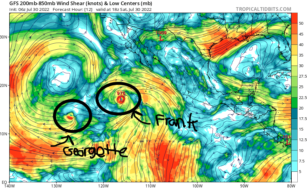
There are two tropical system is happening in the eastern Pacific Ocean. Hurricane Frank is so far doing better than Tropical storm Georgette. Hurricane Frank is moving to northwestern with a slight turn to the right to move up north in the next few days. Meanwhile tropical storm georgette is moving around in a circle and soon move to the Northeast after trying to organize itself better.
Hurricane Frank is starting to be surround by wind shear that will try to weaken Hurricane Frank, but it might be fast enough to get away from the wind shear. If it keeps moving to the northwest to encounter weaker wind shear. Tropical storm Georgette will be encountering stronger wind shear and will turn into more wind shear to weaken Tropical storm Georgette. Unless its path starting to change faster to the northeast, it can avoid the wind shear for little while.
For Hurricane Frank having a very high relative humidity to keep going and surviving from the strong wind shear. It going to be the opposite for tropical storm Georgette as it is getting surrounded by the dry air to try cut out any moisture to Tropical Storm Georgette from getting stronger.
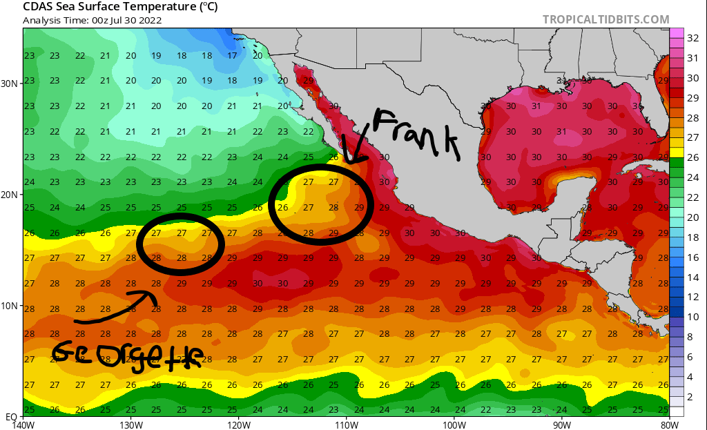
Both tropical systems will be barely above the minimums sea surface temperatures before traveling deeper into the Pacific Ocean. It will be very detrimental for Hurricane Frank as it is traveling further from the favorable sea surface temperatures as it will travel into 24C-26C (75 F – 78 F) sea surface temperatures. It seems like tropical storm Georgette will be stay around 27 C – 28 C (80 F -82 F) sea surface temperatures. It will survive bit longer as the dry air and strong wind shear will weaken tropical storm Georgette in the next few days.
