Happy Friday. I hope you had a great week. There is quite a lot of activity currently brewing in the Atlantic and Pacific oceans. In the Atlantic, invest 97L is currently situated over the eastern part of Cuba and is expected to track northwest as it strengthens. A tropical depression could be in the Gulf early next week, which could cause impacts on the Gulf Coast region of the U.S. Looking to the Pacific, Tropical Storm Carlotta has just been upgraded to a category 1 storm as of the 8 AM observation. This system is expected to remain a hurricane as it moves westwards. We are also continuing to monitor two other disturbances in the Pacific Basin that could form in the next few days. We have a lot to talk about in this briefing, so let’s get into it.
The Atlantic


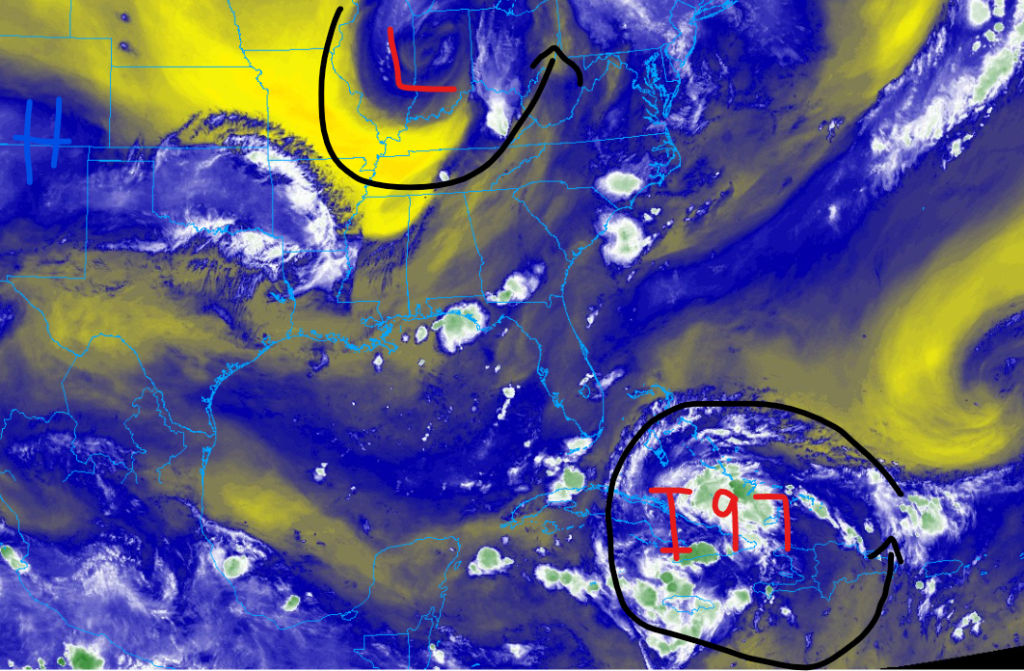
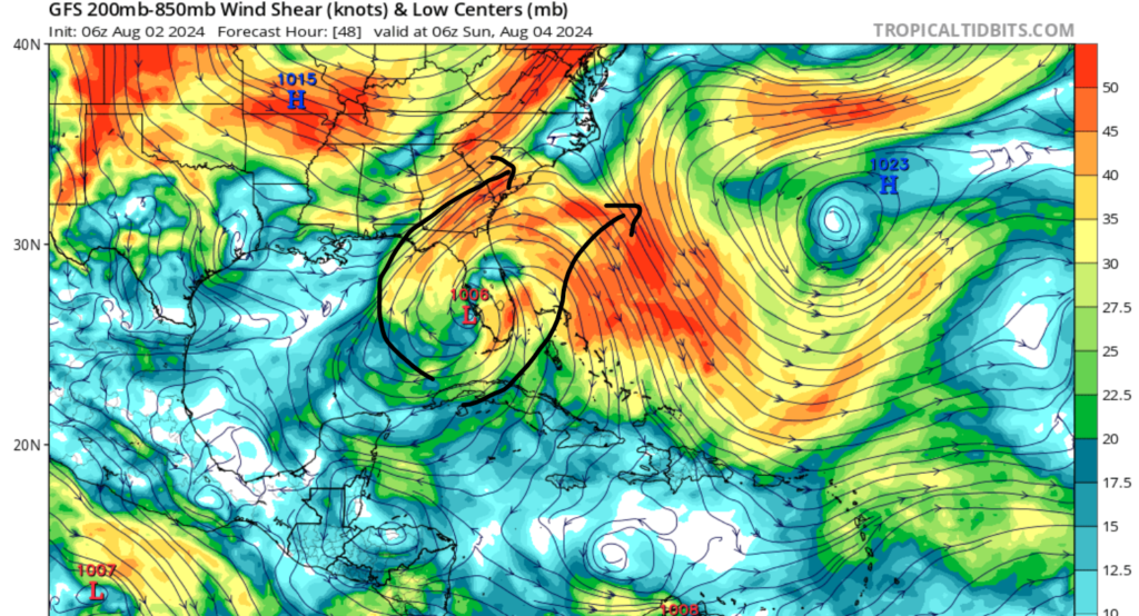
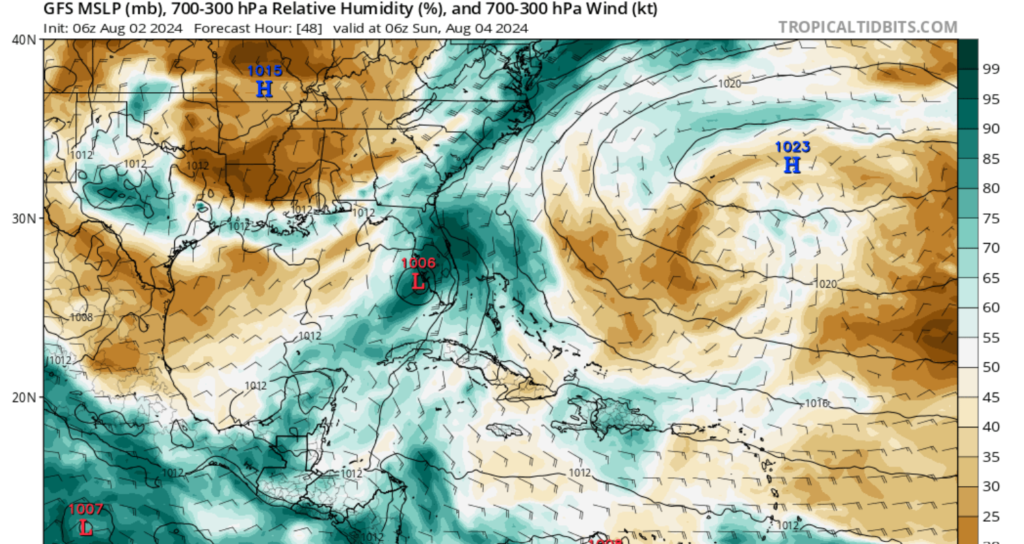
Looking to the Atlantic Basin, invest 97L is currently situated over the eastern part of Cuba and is mostly a large cluster of showers and thunderstoms. Continued organization and strengthening are expected over the next 24 hours as the system moves to the northwest and enters the Gulf of Mexico. As it enters the Gulf, a center of high pressure off the coast of Texas will limit the storm’s time in the Gulf, as This means that strengthening will be limited as it interacts with the Florida Peninsula to its east. This is good news, as all of the other ingredients needed for tropical development are there, such as lots of moisture, low windshear, and warm ocean temperatures in the Gulf, as shown in the images below.
What impacts are expected
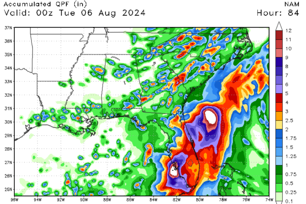
Although this system is still developing, we are expecting major impacts for parts of the Southeastern U.S., as most of Florida is under a state of emergency. The primary impact that this storm will cause is heavy rainfall for the Florida Peninsula. Tropical storm conditions are expected as early as Saturday evening for the Florida Keys. The highest winds are expected by Sunday evening for areas north of Tampa, Florida; however, winds are not expected to be above tropical storm force. Storm surge and coastal flooding are expected on the West Coast of Florida through this weekend. After moving through the Florida Peninsula, additional impacts are expected for the coasts of Georgia, south, and North Carolina through early next weekend. Although this storm is not expected to strengthen beyond a tropical storm, remember that even a tropical storm can cause significant impacts to life and property so please be prepared for heavy rainfall and gusty winds.
The Pacific Basin

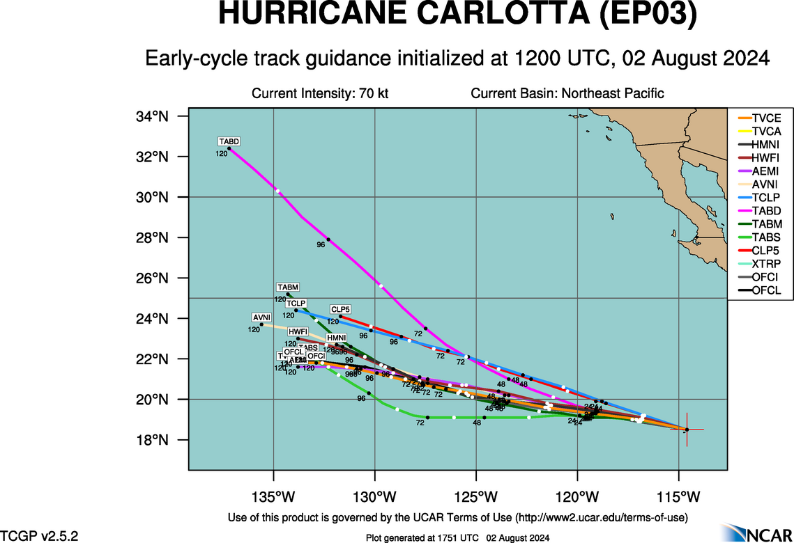
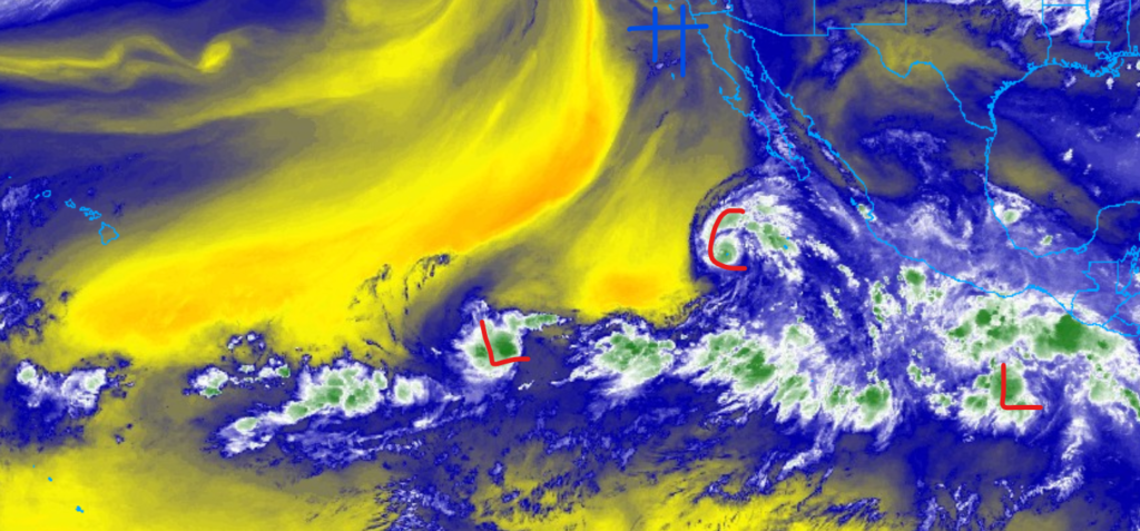
Looking west to the Pacific, multiple systems are expected to form or have already formed. Luckily, as of this writing, no landfall impacts are expected in the Pacific. Our named system (Hurricane Carlotta) is just been upgraded to a category 1 storm, with maximum sustained winds of 80 MPH. As of 8 AM PDT, the center of Carlotta is located at Lattitude 18.6 North, Longitude 115.2 West, and is moving west-northwest at 14 mph.
Looking at disturbance 1 is just a broad area of showers and thunderstorms; however, due to high wind shear, marginal organization is expected over the next few days. This center of low is expected to move across open waters and cause no impacts to land. I am keeping a much closer eye on disturbance 2, as it continues to show organization as it moves into the Pacific. Unlike disturbance 1, this other disturbance is showing more signs of convective development and could form into a tropical system in the next few days. Regardless if this system develops or not, it’s a great idea to keep a very close eye on it over the next couple of days.


