You are probably waking up to rain this morning. We have some loud thunderstorms drifting through parts of the area as you wake up and get moving. Nothing severe, but you’ll need an umbrella and the windsheilf wipers for certain.
We have quite the setup during the next few days. It starts with a quick-moving system advancing from Missouri to the Ohio Valley/Great Lakes region. and a robust upper jet streak with high-speed winds over Texas and up into Tennessee are creating favorable conditions for storms in Mississippi.
Don’t forget to download my weather app before the rain starts so you can monitor storms on the radar!
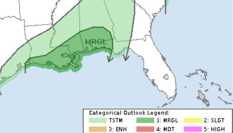
The Storm Prediction Center has outlined the area with a Marginal Risk for severe weather. But it isn’t a slam dunk. There are a lot of things helping the threat for a severe storm, but a few things limiting the threat, too.
Just as an aside — The cool thing about atmospheric physics is that when stuff happens up high, it can impact how things happen a bit closer to the surface. So strong winds up around 30,000ft from SW to NE pull in a southerly and southeasterly wind toward the surface. And pulling in air from that direciotn tends to be decently humid air. So anytime we get one of these “jet streaks” (not jet streams) we tend to see the potential for storms increase.
Anyway! The moist air is resulting in widespread showers and storms, expected to dwindle by mid-morning. And at the same time, a low-pressure system is taking shape over the Plains, instigating a northeastward movement of a warm front. This brings a potential for severe weather in areas situated east of I-55.
Model guidance is in a bit of a disagreement about how everything will shake out because a lot of the parameters that go into make storms and severe weather are pretty conditional. For example over here in Houston, yesterday we had an Enhanced Risk from the SPC, but barely had more than a few thunderstorms at all.
But that wasn’t terribly surprising given the conditional nature of the parameters.
For Southern MS/AL/LA, it looks like we will be playing the same game. Here is a look at some of the instability maps from the NAM computer weather model. The NAM shows two windows of opportunity where the instability in the lower-levels and the mid-levels will be high enough to support strong or severe storms. One window is late tonight and into tomorrow morning (9p to 3a) and then the other is tomorrow afternoon and evening (between 1p and 7p)
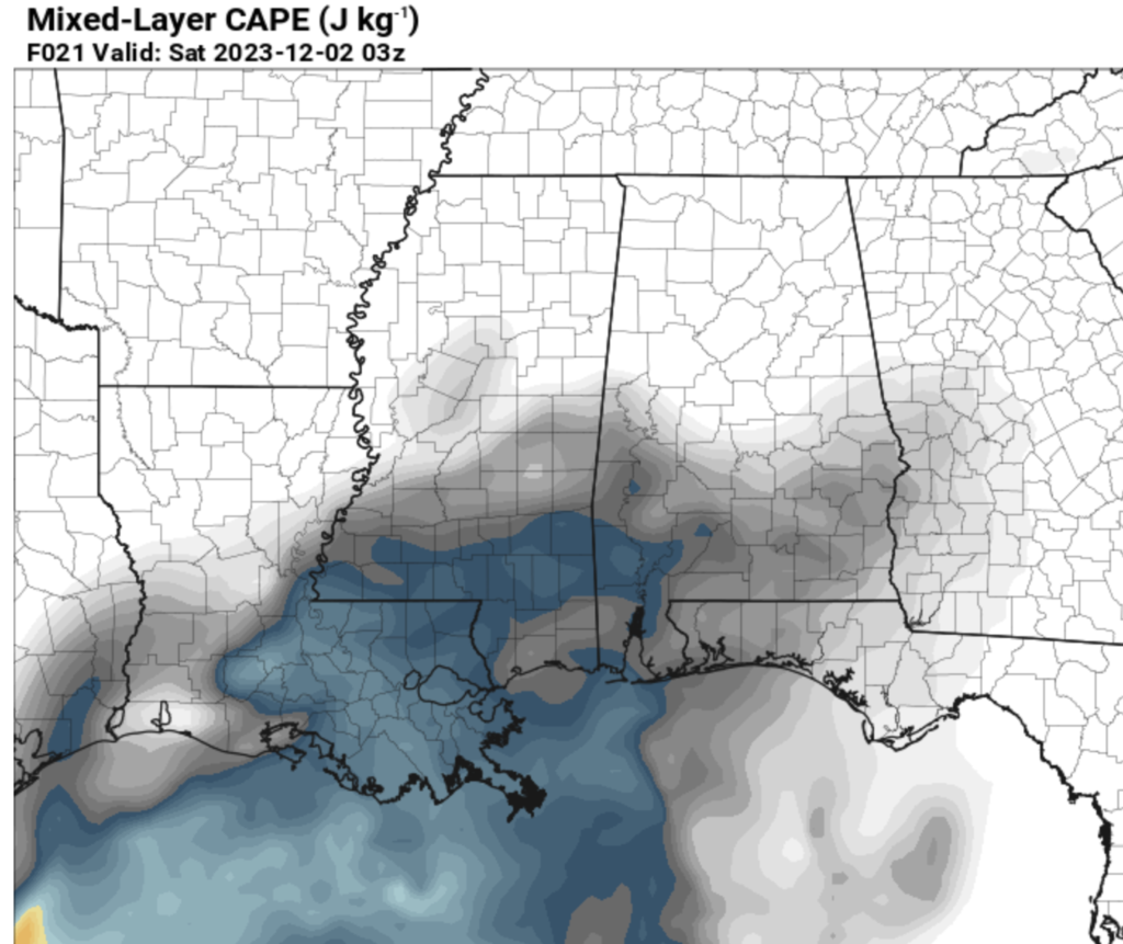
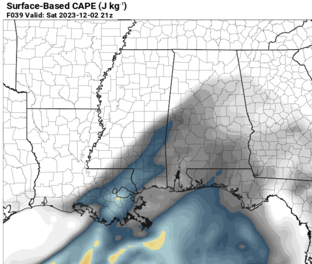
In this case those two windows do happen to line up with when there is a potential for rain. So I think those are our two windows for strong/severe storms tonight and tomorrow.
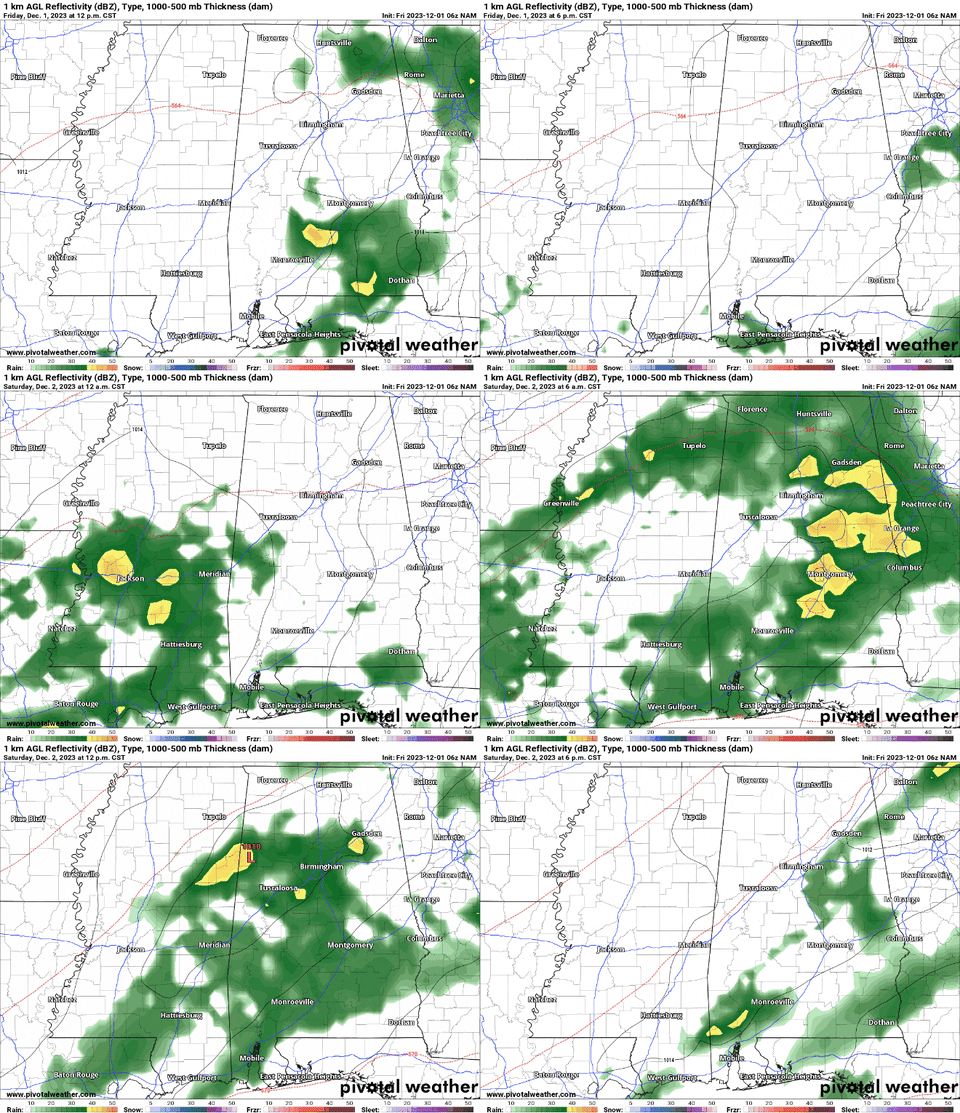
As we move into the night, southerly winds persist, and the likelihood of rain and storms increases post 10 PM. That is when the threat for severe weather will pick up. The good news is that we may not have the support for totally surface-based storms which would limit the tornado threat.
The HRRR model, which is a higher-resolution model, tends to think things will be less robust and drawn out over a longer period of time.
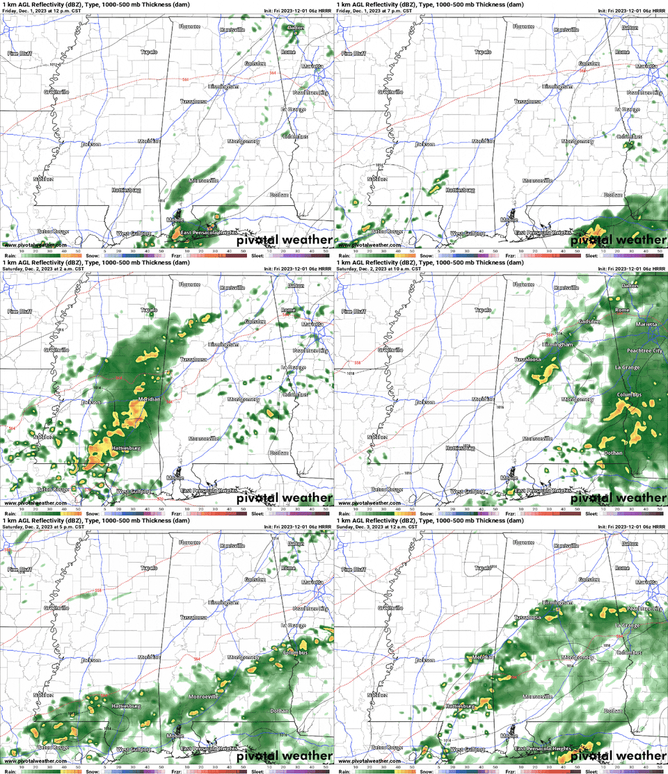
Which one is right? Neither. But they are good tools to help shake out the prospects for rain and storms.
I tend to think the timeline for storms and severe weather look like this:
Tonight between 11p and 4a — A quick round of rowdy storms that should remain below severe limits, with a few storms packing some heavy rain, gusty wind, and lightning
Tomorrow between 11a and 4p — A second round of storms with one or two storms turning severe if – BIG IF! – we see breaks in the clouds tomorrow and we get some extra daytime heating in spots. No breaks in the clouds, no real threat for severe weather.
Then we get back to off-and-on regular rain and thunder through the rest of the day and weekend. And looking at the rainfall estimates, I am surprised to see the higher-res guidance showing even more rain than some of the global models. The HRRR shows a stretch of 3″ to 5″ rainfall totals across the area over the next 48 hours.
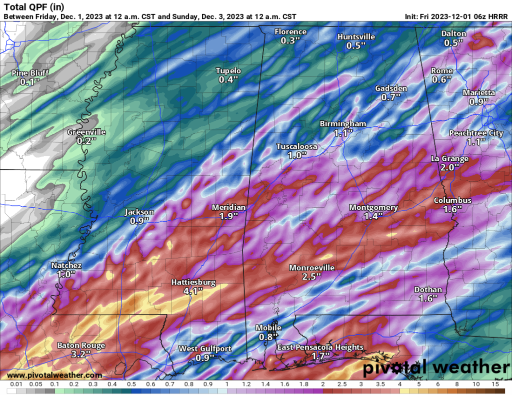
I don’t know that things will be that wet, but if they do shake out like that, we will take it! We could use the rain.
Then as we move into next week we shift back into a calmer weather pattern.
REGIONAL DAY TO DAY FORECAST
Friday: Mostly cloudy with storms possible. Highs in the mid 70s. South winds 10 to 15 mph with gusts up to 25 mph. Chance of rain 80 percent.
Friday Night: A chance of thunderstorms. Showers. Not as cool. Near steady temperature in the mid 60s. South winds 5 to 10 mph. Chance of rain 90 percent.
Saturday: A chance of thunderstorms. Showers. Highs in the lower 70s. South winds 10 to 15 mph. Chance of rain 90 percent.
Saturday Night: Cloudy. A chance of showers with a slight chance of thunderstorms in the evening, then showers likely with a chance of thunderstorms after midnight. Lows in the lower 60s. Southwest winds 5 to 10 mph. Chance of rain 60 percent.
Sunday: Cloudy. A chance of showers with a slight chance of thunderstorms in the morning, then a slight chance of showers in the afternoon. Highs around 70. Chance of rain 40 percent.
Sunday Night: Mostly cloudy. Cooler with lows in the lower 50s.
Monday: Partly sunny. Highs in the mid 60s.
Monday Night: Mostly cloudy. Lows in the lower 40s.
Tuesday: Partly sunny. Highs in the mid 60s.
Tuesday Night: Partly cloudy. Lows in the mid 40s.
Wednesday: Mostly sunny. Highs in the lower 60s.
Wednesday Night: Partly cloudy. Lows in the upper 30s.
Thursday: Mostly sunny. Highs in the lower 60s.

