Summer is currently in full swing here in the U.S., and it shows, with severe weather and hot temperatures expected from today through this weekend. Looking at the severe weather threat for today, areas of the central plains are under a slight risk of severe weather. This weekend, the severe weather threat will move to the east, affecting major metropolitan areas. Looking further south, excessive heat is expected to dominate the southern plains, parts of the Southeast, and the Centeral Valley of California. This heat could pose a danger to those who plan on spending time outside this weekend.
Severe weather moving east
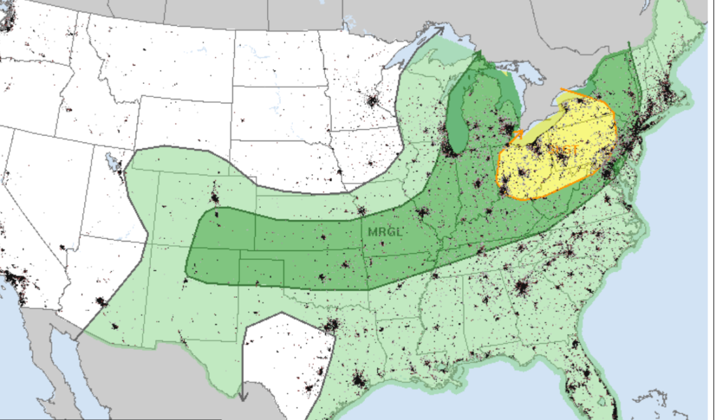
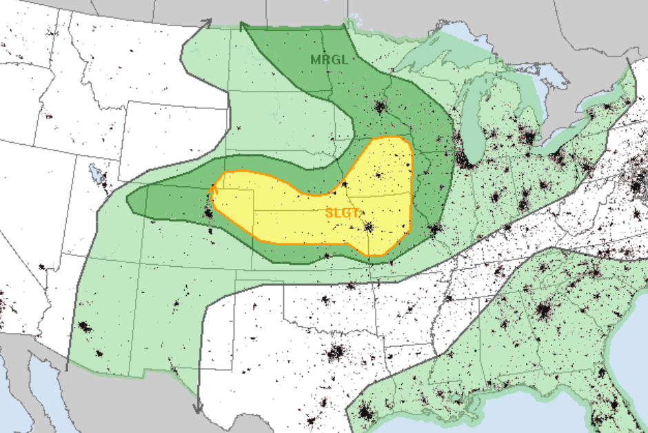
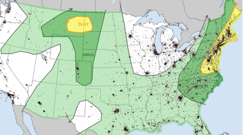
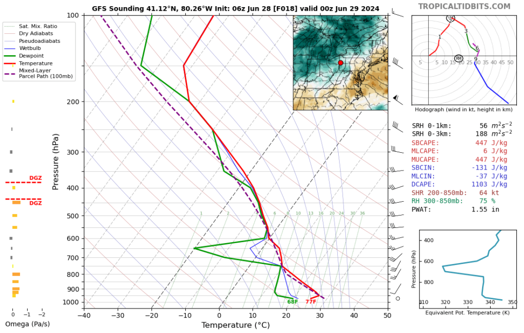
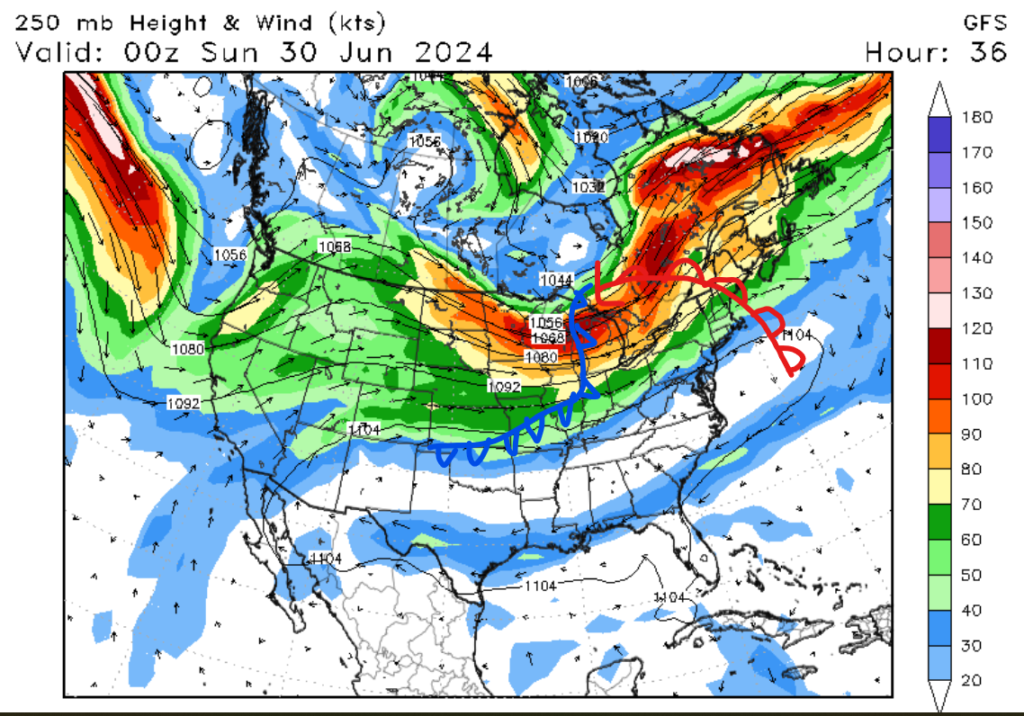
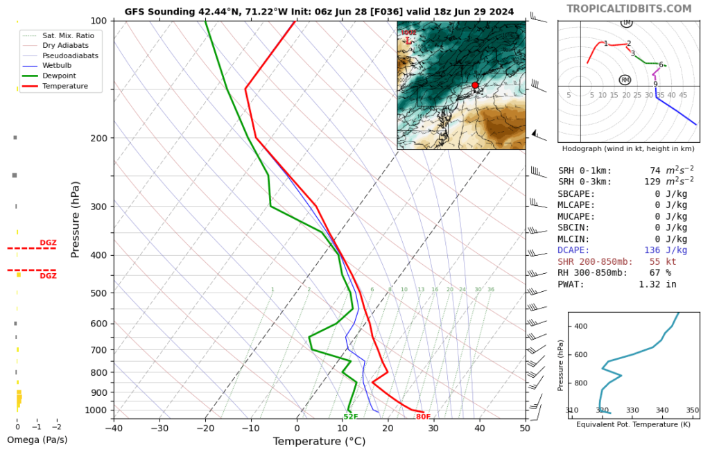
Looking at our severe weather threat for the next 3 days, we have a slight or 2 out of 5 risk of severe weather. Today’s severe weather threat encompasses the central plains, with high winds being the main threat. Areas around Kansas City, MO, are under the most significant threat of tornadoes today. Tomorrow and Sunday, the severe weather threat moves to the Northeast, with damaging winds, large hail, and isolated tornadoes possible. Major cities such as Pittsburg, D.C., Baltimore, Philadelphia, New York City, and Boston are in the risk zone. This severe weather threat is being caused by a positively tilted trough moving through Ontario and Quebec, Canada. The tilting of the trough will allow for steep slope rates in the area, causing the lift and instability needed for severe weather. The image below shows how the warm and cold fronts are tilting with the center of low pressure to the north.
More heat expected
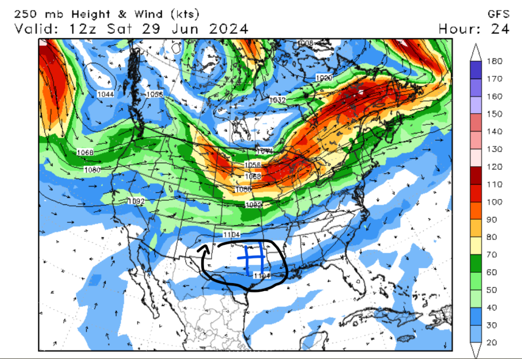
Switching gears here, areas further south will see quite the opposite of severe weather today and this weekend. Heat advisories and excessive heat warnings are posted for areas of the Southern Plains and parts of the Southeast. An excessive heat watch is in effect until July 6th for the Centeral Valley of California. This heat is being caused by an upper-level ridge setting up in the Centeral U.S. High temperatures are expected to rise to over 100 degrees Fehernight for parts of the Southern Plains, Southeast, and the Centeral Valley of California. Areas of the Southeast may see some scattered thunderstorms, which may provide some relief to this area. If you have any outdoor plans this weekend, please make sure to take proper heat-related precautions.
Looking into the future


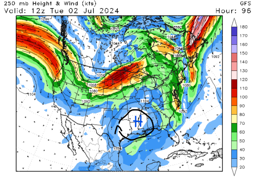
Looking into next week, the heat is expected to move into the Northwest and Southeastern U.S. The models are aggring that an area of cooler weather is expected in the center U.S. This is not good news for the western U.S., as dry and warm weather is often the precursor to wildfires. Areas of the southern plains that are currently baking should see some relief, but I expect temperatures to still be above average. Overall, most of the country should expect above-average temperatures through next week.


