The Storm Prediction Center has outlines part of the area with a Marginal Risk for severe weather on Wednesday. The timeline still looks like it will be between about 3p on Wednesday and about 3a on Thursday morning. That said, some of the latest model guidance has inched that up a few hours to look like more of a Wednesday afternoon and evening event, instead of lingering into the overnight hours for us.
The Marginal Risk area on the map from the SPC is pretty wide right now, leaving the door open to add a Slight Risk at some point in the middle. But that is just my estimate, no Slight Risk is in the works as of yet.
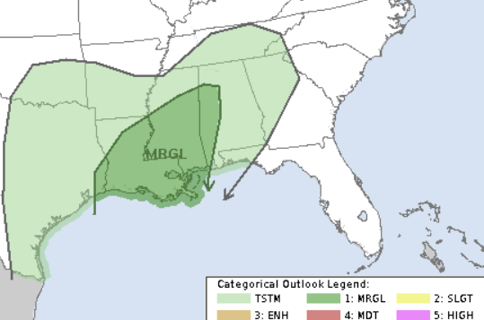
This is a “Level 1” risk on the scale that goes from 1-to-5 where “Level 5” is the highest risk for the most significant severe weather. So this doesn’t look like a huge event with severe storms all over th place, but will feaure the potential for a handful of severe storms and the threat for damaging wind, hail and tornadoes.
CIPS DATA
The CIPS Analogs continues to point for historical precedent for a severe weather risk. The map below shows the percent of times in the past where the atmosphere has looked like this on a given day and we have seen five (or more) severe weather reports.
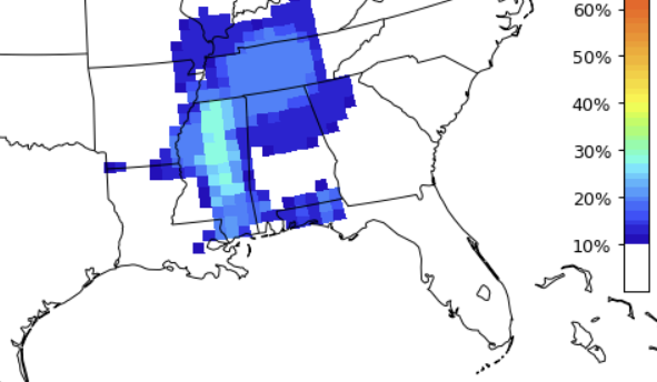
That is up above 1 out of every three times. A pretty reasonable shot. Below is the number of times we have seen a tornado. Again looking at a 1-in-3 shot, historically.
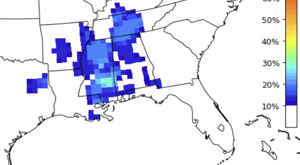
Thankfully, the risk for significant tornadoes or long-track tornadoes is lower.
You might be reading this, thinking, “Big deal. Who cares about the past?! I want to know what will happen on Wednesday!”
Fair enough! But I will note that weather is just like everything else, we can sometimes learn the most and make predictions from what has happened in the past. History can be a fantastic teacher in some cases. And for this particular case, I think it does a pretty good job, too.
But it isn’t always straightforward with weather. Especially down here!
In this case, the Top 15 most similar dates in history that look the most like the forecast for Wednesday show a pretty strong split between a number of severe storms across the area and a handful of tornadoes – or just a few severe storms here and there.
So we have to dig into the data to see where things are different on the margins that may – or may not – tip the scales one way or the other.
MODEL DATA
To dig a bit deeper into the model guidances, I think it is important to start with the difference between the CIPS data (based on the GFS model) and the forecast (a blend of the GFS an the ECMWF model data).
To the Skew-Ts!

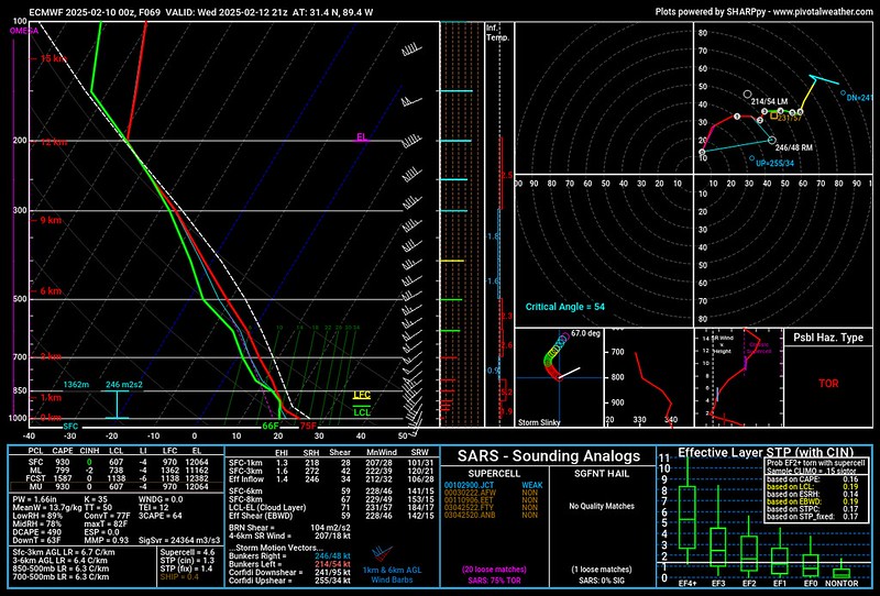
The difference between the two isn’t very glaring at all. They actually look pretty similar at face value. But because we are interested in what is happening on the margins, we need to look a bit deeper.
Looking at the severe weather parameters, both the CAPE and the Helicity are higher on the ECMWF data. Shear is the same. The DCAPE is higher on the ECMWF model data, too.
And the hodographs produce two different shapes. The GFS is more of a straight, diagonal line. And the ECMWF is a bit more curved.
All of that to say that the ECMWF is showing a more potent (albeit not spectacularly so) severe weather environment. And because the CIPS data is based only on the GFS it may be under-representing the severe weather threat.
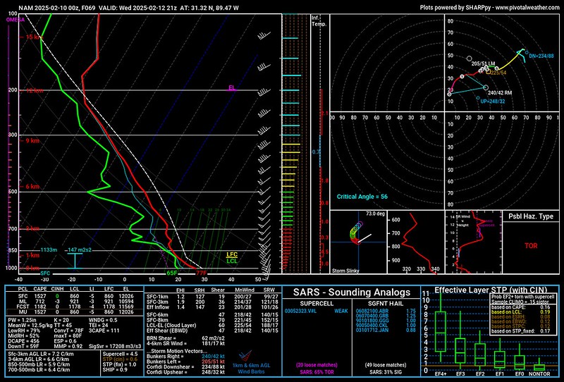
Want to complicate factors even more? The shorter-range NAM model shows an environment similar to the GFS, despite it (the NAM model) having a biased toward over-producing environments for severe weather!
So, hey, not an easy forecast. But that is pretty typical along the Gulf Coast in the Winter months. Rarely are the specifics of a severe weather threat a “slam dunk.”
But, hey, lets try to make heads or tails of this….
THE BOTTOM LINE
It looks like Wednesday will offer a shot for some severe weather. And I’m thinking the SPC will bump up the Risk from a Marginal Risk (level 1) to a Slight Risk (level 2) by the time we get there. That isn’t to indicate that i think things will be super bad, but I think the ceiling is a bit higher than just a Marginal Risk.
The timeline suggests that storms may begin for some as early as after lunch (to the west) and may not start until closer to dinner for others (to the east). Once storms do start in your area, you’ll have a shot for off-and-on storms for about 5-to-7 hours before things come to an end.
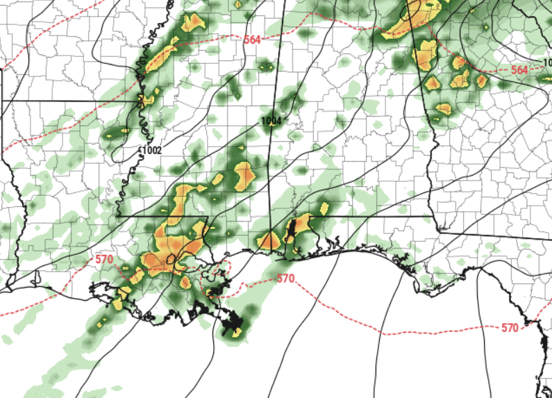
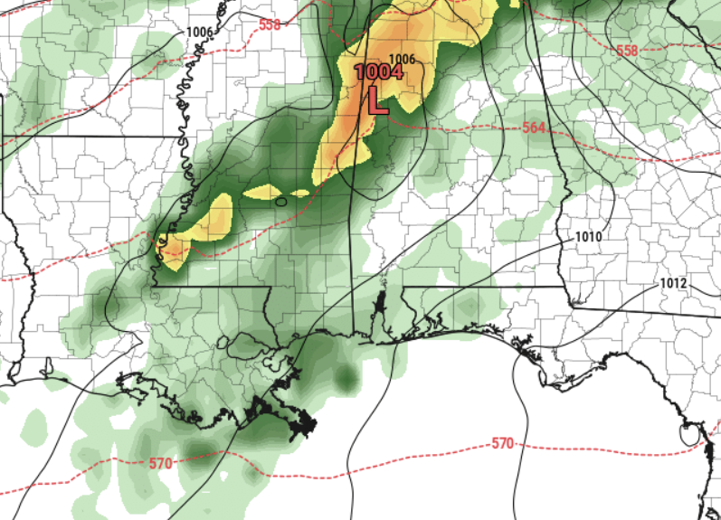
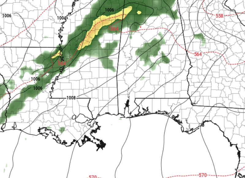
This time, it looks like storms will be scattered along the front and out ahead of the front, too. This may be a time where we don’t see a full stout squall line of storms. It will likely depend on how the day evolves.
What we will see is the isolated cells or the kinks in the line fostering the best environment for rotating updrafts and the strongest of the storms. That will include the risk for wind gusts up over 65mph, hail up to the size of half dollars and the potential for a tornado or two.
As the higher resolution model guidance continues to come in during the next 24 to 48 hours we will get a much better idea about the specifics, but for now this is the best we can do!
Keep tabs on the forecast and make sure that your plans on Wednesday include keeping an eye tot he sky.


Thank you! Saturday is proported to be worse than Wednesday?