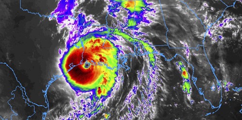
Hurricane Laura made landfall as a strong Category 4 Hurricane. It has sustained wind estimated by the NHC at 150mph at the time. The destruction was catastrophic, some places will never be the same.
Before Laura made it into the Gulf, though, this past Sunday, August 23rd, the International Space Station flew over then-Tropical Storm Laura as it was moving over Cuba.
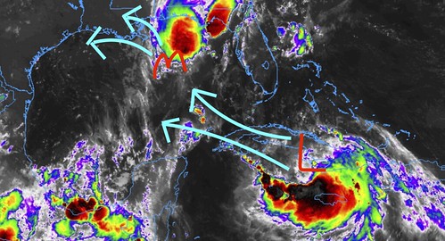
To give you an idea of what it looked like on satellite, this was one of the graphics I created at the time:
But this is what the astronauts on the International Space Station saw:
NASA released the video with the caption: “External cameras on the International Space Station captured views of Tropical Storm Laura from approximately 250 miles above. The station passed directly over the tropical system on Sunday, August 23 prior to the storm making landfall on Cuba. The National Hurricane Center is projecting Laura to strengthen into a hurricane once in the Gulf of Mexico with landfall expected on the Gulf coast later this week.”
Really interesting to see the storm from a different vantage point, for certain.


