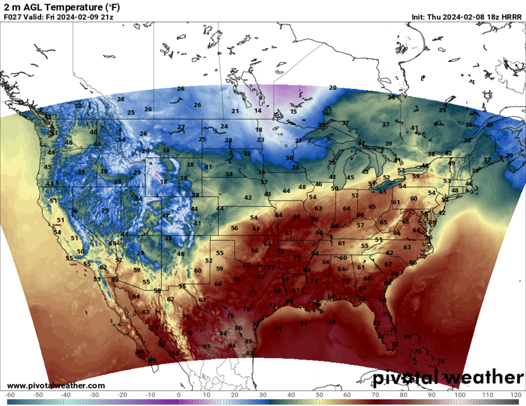
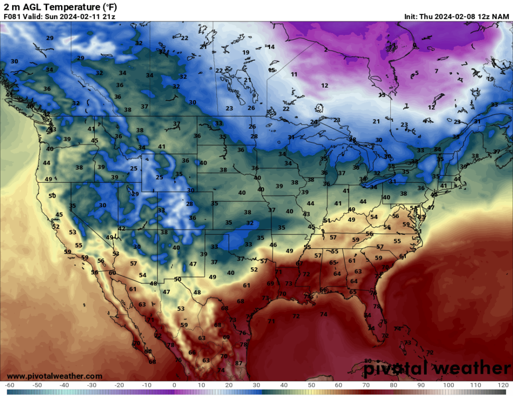
Heading into the weekend, temperatures will be fairly warm across the South. Highs in the southern states will hit the 60s and 70s in many areas, especially at the beginning of the weekend. As the weekend progresses, a cold front will advance southward, confining the pleasant temperatures to the Deep South by Sunday.


Despite the pleasant temperatures, the South will be rainy over the weekend. Moisture from the Gulf ahead of the cold front will result in on and off showers and thunderstorms throughout the region. The South will see most of the precipitation, but some of the Mid-Atlantic and Northeast states will see rain as well. Additionally, there is a chance of snow behind the cold front on Sunday in the Texas Panhandle and Oklahoma.
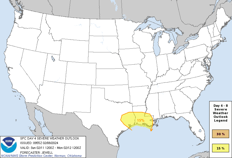
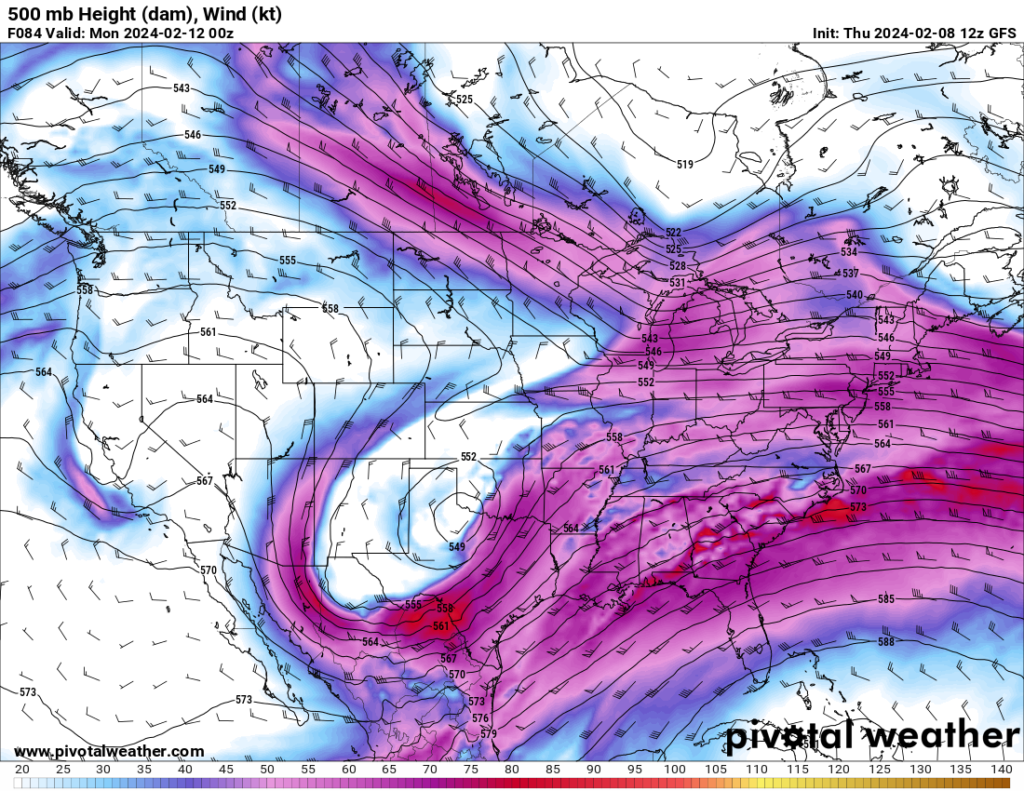
In addition to the precipitation, the SPC has a 15% severe risk for Day 4 (Sunday) in east Texas and southern Louisiana. A potent shortwave trough to the west of the region will provide ample lifting and shear ahead of it, and CAPE values may reach 1000 J/kg in some areas. If this holds, the threat for damaging winds and tornadoes will be present. The SPC notes that precipitation ahead of the system is uncertain, which forecasters will have to watch for, as precipitation ahead of the main system can stabilize the atmosphere and lower the severe threat. However, the fact that they already have a 15% risk issued on Day 4 should be reason enough for people in the area to pay attention to their forecast, especially considering it’s Super Bowl Sunday and many people will be out and about.


