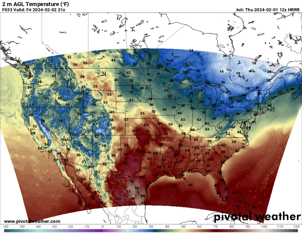
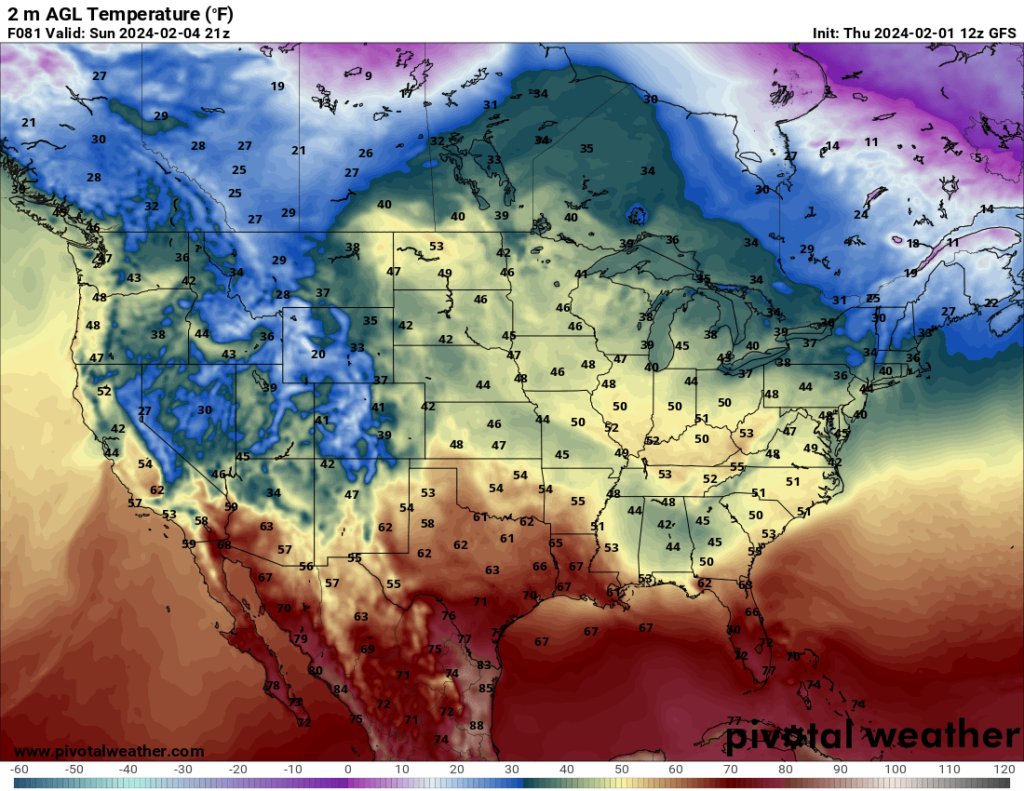
Looking to the weekend, the warmer temperatures across the southern Plains will spread into the Southeast, allowing for pleasant temperatures Friday across most of the southern states. Unfortunately, this will be short-lived, as cooler temperatures associated with a trough and rainy conditions will bring temperatures down by Sunday in the Southeast, leaving the mild temperatures mostly confined to Texas.
After a relatively quiet last few weeks, the potential for severe weather will increase over the weekend. On Friday, the SPC has a Slight Risk across part of southern Texas and a Marginal Risk throughout most of the central part of the state and part of Oklahoma. The main threat is hail, but all severe hazards are possible. The tornado risk is greatest in southern Texas near the Gulf Coast, although based on what I’ve looked at with the HRRR model, I think they may extend that risk a bit further west. Storm mode is expected to be fairly discrete, so I could realistically see a discrete supercell or two with tornado potential, although this threat would likely be confined to only a few storms. The greatest chance for severe weather as of now appears to be Friday evening after sunset, although that could still change.
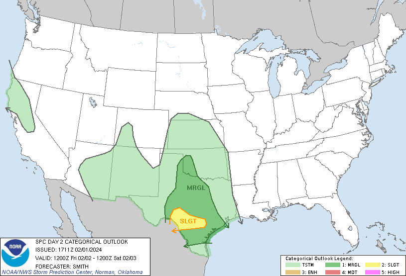
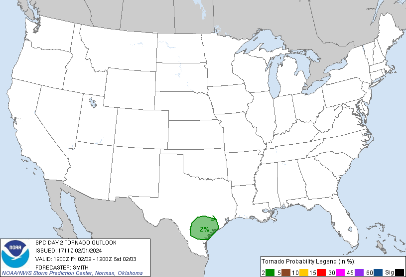
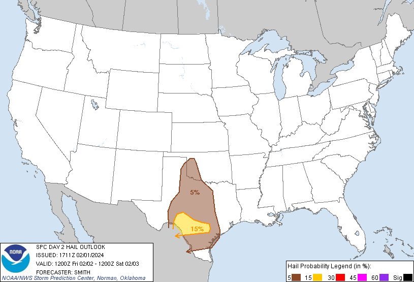
On Saturday, the SPC has a Marginal Risk for southeast Texas and the coastline of Louisiana. A marginal threat for damaging winds and perhaps an isolated tornado will be present Saturday morning, according to the SPC. This threat will occur with the remnants of Friday evening’s convection. The SPC also notes the possibility of storms developing later in the day in southeast Texas and possibly posing a hail threat, though this would depend on how soon the morning storms come through and whether the atmosphere has a chance to destabilize again.
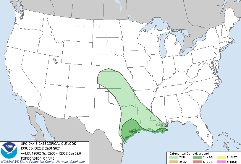
Rain will continue into the Southeast on Sunday. The SPC notes the possibility for severe weather in Florida on Sunday, though confidence is too low to issue any risk areas yet.
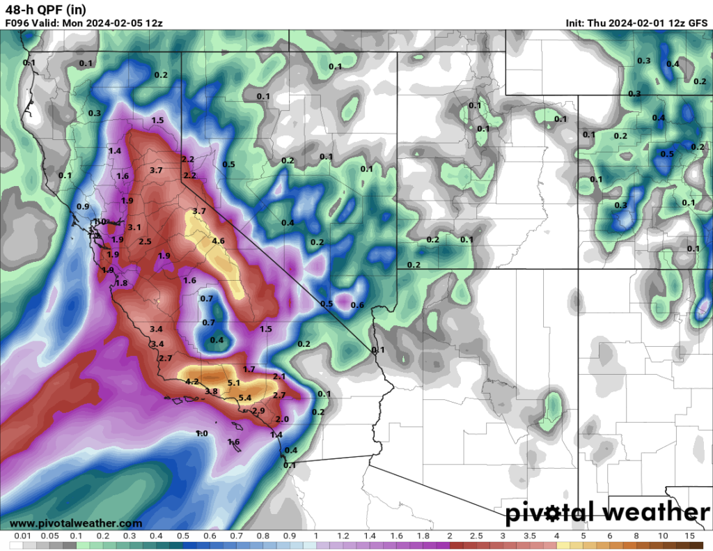
Another part of the country that will experience a lot of rain is California. Already experiencing heavy rain this week, another round of heavy rain is expected to enter the state by Sunday. The central part of the state is currently expected to get the most rain, with multiple areas expected to get over 2 inches, with locally heavier amounts possible.
