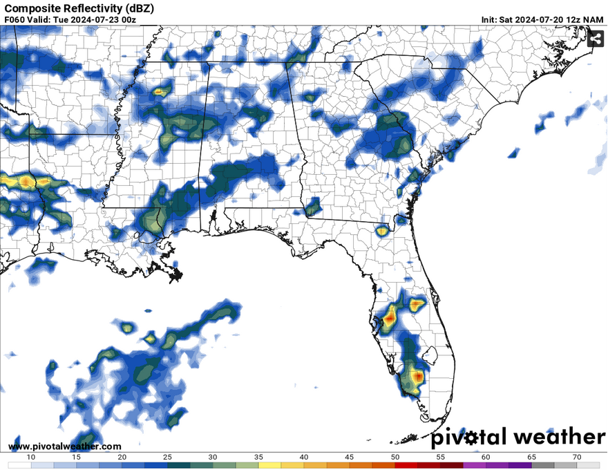
//Courtesy: Pivotal Weather
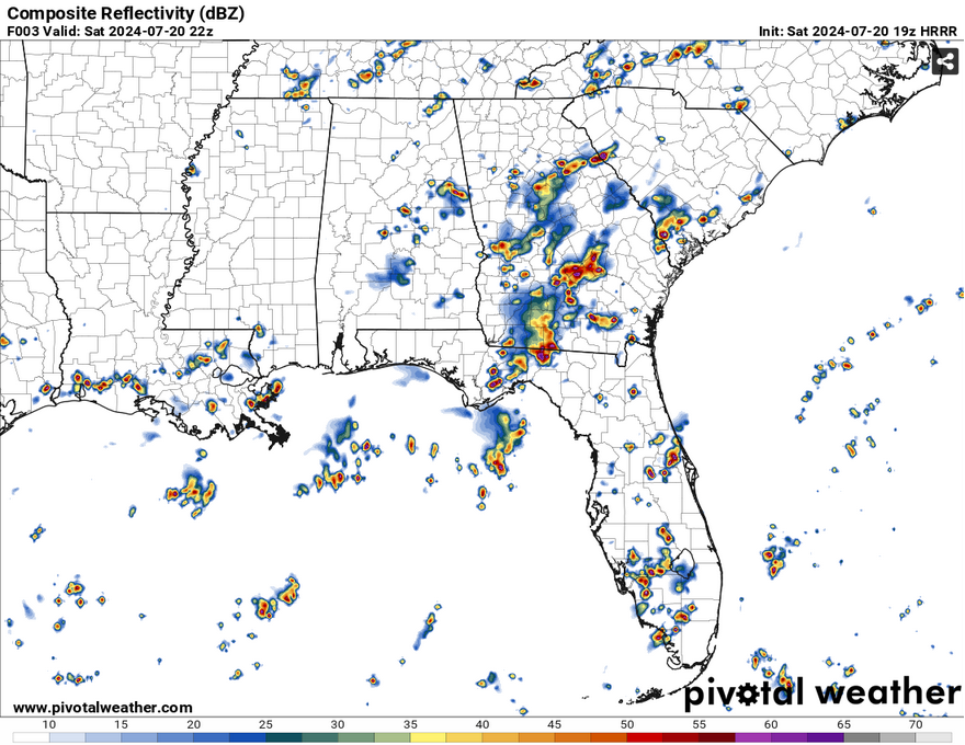
We’ve had some on and off rain all day today in the Pinebelt. For those wanting to be outside, the storms are dissipating as I’m writing this here blog. It’ll still be quite humid as the afternoon goes on with all the water on the ground, however. We’ll have temperatures in the mid-80s and slightly falling into the 70s overnight.
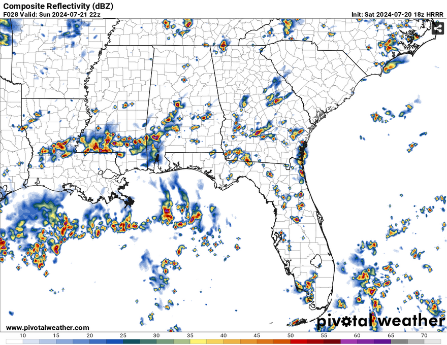
Tomorrow will be a similar story with an MCS forming from the moisture flow from the Gulf. It doesn’t look to be much of an organized system, rather one line clashing with another until they rain themselves out. Expect anything from a tenth to a half an inch for your average storm. This will take a few hours from the mid-afternoon to the evening, so keep an eye on the radar and have your umbrella with you when you go out tomorrow. Temperatures will reach the mid to upper 80s during the day before the rain moves in.
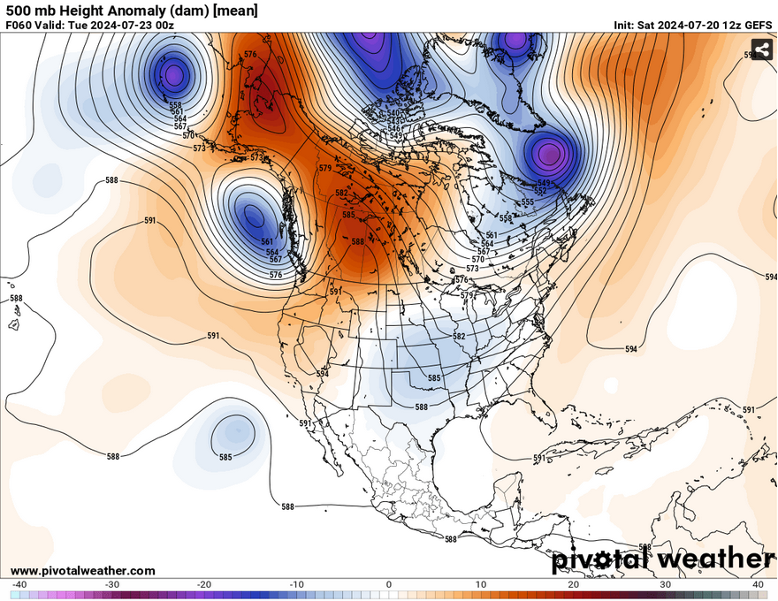
Just to give you all an idea of why this cold front is stalling out, we have to look into the upper levels. This ridge you see in the Atlantic (in shades of orange) spans a sizeable portion of the northern Atlantic Ocean. It’s keeping much of the low pressure systems to the north, while the meridional ridge in the southwest and northwestern Canada is contributing to the trough in our neck of the woods. Right now, the trough is stuck between the two until the Atlantic ridge begins to retreat in the next several days.
Anyways, let’s talk about Monday. We’ll see a similar setup to Sunday with some southwest flow bringing moisture to the southern and northern portions of Mississippi and Alabama. There may be a few instances of flash flooding depending on how much the storm is able to strengthen, however it will likely be some moderate to heavy rain until the storm rains itself out again. Temperatures will once again reach the mid to upper 80s before the rain arrives.
Select Data Set:

Regional Day-to-Day Forecast
This Afternoon – Showers and thunderstorms until the early evening. Mostly sunny, with a high near 90. Heat index values as high as 98. Southwest wind around 5 mph. Chance of precipitation is 60%. New rainfall amounts of less than a tenth of an inch, except higher amounts possible in thunderstorms.
Tonight – Showers and thunderstorms possible overnight. Mostly cloudy, with a low in the low 70s. Calm wind. Chance of precipitation 50%. New precipitation amounts of less than a tenth of an inch, except higher amounts possible in thunderstorms.
Sunday – Showers and thunderstorms possible in the afternoon. High in the upper 80s. Heat index values as high as 98. Calm wind becoming west southwest around 5 mph. Chance of precipitation is 80%. New rainfall amounts between a quarter and half of an inch possible.
Sunday Night – Showers likely and possibly a thunderstorm into the evening. Patchy fog after 1am. Otherwise, mostly cloudy, then gradually becoming mostly clear, with a low in the low 70s. Calm wind becoming south southwest around 5 mph. Chance of precipitation is 60%. New rainfall amounts of less than a tenth of an inch, except higher amounts possible in thunderstorms.
Monday – Showers and thunderstorms possible starting in the afternoon. Patchy fog before 10am. High in the upper 80s. Calm wind becoming southwest around 5 mph in the morning. Chance of precipitation is 90%. New rainfall amounts between a tenth and quarter of an inch, except higher amounts possible in thunderstorms.
Monday Night – A 40 percent chance of showers and thunderstorms into the overnight hours. Mostly cloudy, with a low in the mid 70s. Southwest wind around 5 mph.
Tuesday – Showers and possibly a thunderstorm. High in the upper 80s. Calm wind becoming south around 5 mph. Chance of precipitation is 90%.
Tuesday Night – A 40 percent chance of showers and thunderstorms. Mostly cloudy, with a low in the low 70s. Calm wind.
Wednesday – Showers and possibly a thunderstorm. High in the mid 80s. Calm wind becoming south southeast around 5 mph. Chance of precipitation is 90%.
Wednesday Night – A 40 percent chance of showers and thunderstorms. Mostly cloudy, with a low in the low 70s.
Thursday – Showers and possibly a thunderstorm. High in the upper 80s. Chance of precipitation is 80%.
Thursday Night – A 30 percent chance of showers and thunderstorms. Mostly cloudy, with a low in the low 70s.
Friday – Showers likely and possibly a thunderstorm. Mostly sunny, with a high in the low 90s. Chance of precipitation is 70%.
Friday Night – A 20 percent chance of showers and thunderstorms. Partly cloudy, with a low in the low 70s.
Saturday – Showers and thunderstorms likely. Mostly sunny, with a high in the low 90s.


