Not the sexiest title in the world, is it? It may not get as many clicks as “MAJOR HURRICANE EYES GULF STATE” or “CATEGORY FIVE STORM EXPECTED IN NEW ORLEANS” or “ERMIGHERD!! ITS KERMIN THIS WEYR!!!”
You know, stuff like this…

But that isn’t what this post is about. This is about an objective look – in plain English – at the storm and what you need to know about it. Because we are all on pins and needles after Harvey, the last thing we need is hyperbole. So here is a #nofilter look at everything Irma. Borrowing a line from United States Secretary of Defense Donald Rumsfeld, we are going to look at the known knowns. The known unknowns. And the unknown unknowns.
The known knowns
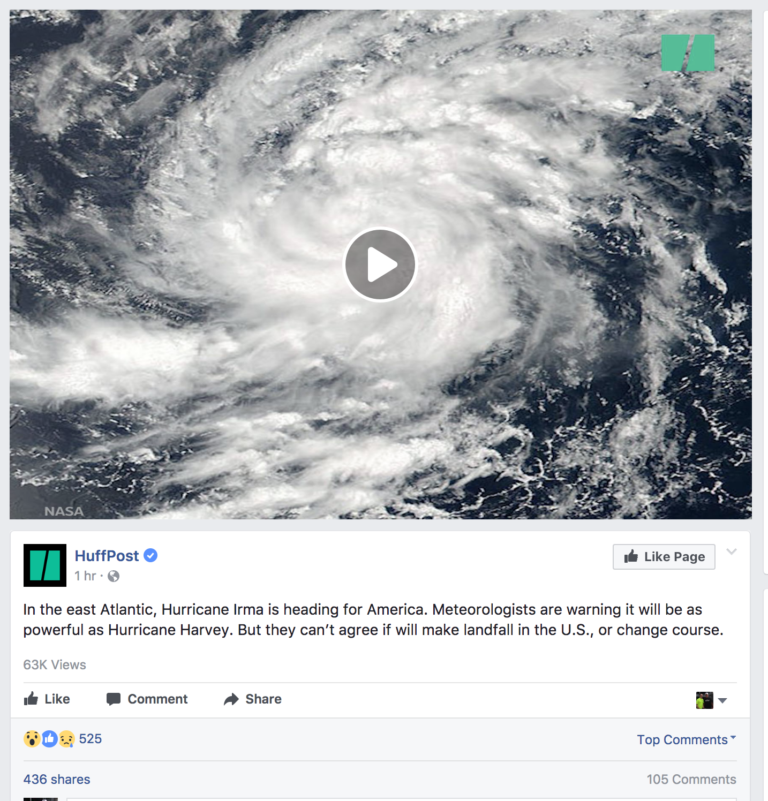
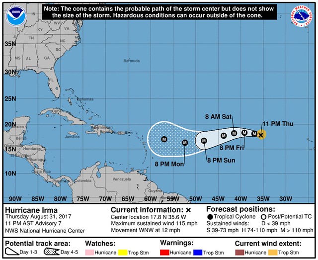
Hurricane Irma is a Major Hurricane in the open Atlantic. It is centered at 17.8N 35.6W. That is 775 miles west of the Cabo Verde Islands. The wind speeds are 110mph. Wind gusts are estimated at 140mph.

A turn toward the west is expected on Friday, followed by a turn toward the west-southwest on Saturday.
We know that it is a compact storm.

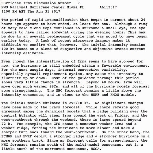
As stated by the National Hurricane Center, the threat for continued rapid intensification has ended for now:
“The period of rapid intensification that began in earnest about 24 hours ago appears to have ended, at least for now. Although a ring of very cold cloud tops continues to surround a small eye, the eye appears to have filled somewhat during the evening hours. This may be due to an eyewall replacement cycle that was noted to have begun earlier today. ”

The sea surface temperatures are warm in the open Atlantic. Currently temps are sitting in the Top 3 warmest during last 20 years trailing only 1998 and 2005. The atmospheric environment ahead of the storm is sufficient for sustaining or the continued strengthening of Irma.
The unknown knowns
We know that we don’t know what is going to happen with Irma beyond five days. That goes for the forecast track, the intensity of the storm, and who will be affected. We know that we don’t know because there are some big factors that go into Irma’s path that we can’t know yet:
1. Placement of ridge of High Pressure in the Atlantic
2. Atmospheric shear values in the Caribbean
3. Placement of the trough in the eastern 2/3 of the US
4. Influence of Typhoon Sanvu on the jet stream
Because of that, there are, like, a thousand possibilities.
00z euro v 12z ensemble tracks, more landfalling members now, though still sample that escapes pic.twitter.com/waHjBo6mwv
— Joe Bastardi (@BigJoeBastardi) August 31, 2017
U.S. weather models have finished for tonight (00z)
Spaghetti from GEFS shows intense Hurricane #Irma but no firm conclusion on U.S. threat pic.twitter.com/8gy151YoQP— Ryan Maue (@RyanMaue) September 1, 2017
There are other differences between the American (GFS) and European (ECMWF) models, that aren’t probable outcomes, too. When the models show things that aren’t probable, meteorologists don’t know which outcome for Irma is most close to the truth.
The unknown unknowns
Because it is the atmosphere, there are going to be things that are going to happen that we cannot foresee at this time. That is why it is important to be prepared for all possible outcomes. Live along the East Coast? Or along the Gulf Coast? Check your Hurricane Preparedness Kit. Don’t have one? Buy one! There is no need to do much else yet. Check your plan, make sure your kit is ready to go and wait for the meteorological world to figure out what will happen with Irma.
Being prepared today means when it is time to act, you’ll be ready to go!
The bottom line
We know it is going in a westerly direction. We know it is moving toward the United States. But we are still trying to figure out if it will ever get here. And if it does get to the USA, where it will be when it does. What we do know is that it is too far out to tell for certain. Anyone who suggests otherwise, is lying.

